1.3 km away
Via Alpina: Queyras Massif to the Ubaye Valley
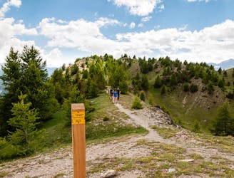
5-day hike along the Via Alpina in the French and Italian Alps.
Difficult Hiking
- Distance
- 75 km
- Ascent
- 5.7 km
- Descent
- 4.9 km
Long easy walk, in a nice mountain country side setting
Hiking Difficult

This is a popular hiking route which is generally considered to be difficult. It's remote, it features low exposure and is typically done between March and November. From a low point of 884 m to the maximum altitude of 1.6 km, the route covers 16 km, 812 vertical metres of ascent and 812 vertical metres of descent.
There is no technical difficulty but it is a long walk. It is nice to do between winter and spring when you want to avoid the snow.
Difficult
Hiking trails where obstacles such as rocks or roots are prevalent. Some obstacles can require care to step over or around. At times, the trail can be worn and eroded. The grade of the trail is generally quite steep, and can often lead to strenuous hiking.

The path is on completely flat land and potential injury is limited to falling over.

Away from help but easily accessed.
1.3 km away
5-day hike along the Via Alpina in the French and Italian Alps.
Difficult Hiking

3 routes · Hiking