Tarrine Directissime
Grenoble
Les 7 Laux
Comment se faire chier à rentrer à Theys depuis Pincerie
Freeride Skiing Easy
- Distance
- 8.7 km
- Ascent
- 118 m
- Descent
- 1.2 km
- Low Point
- 782 m
- High Point
- 1.9 km
- Gradient
- 35˚
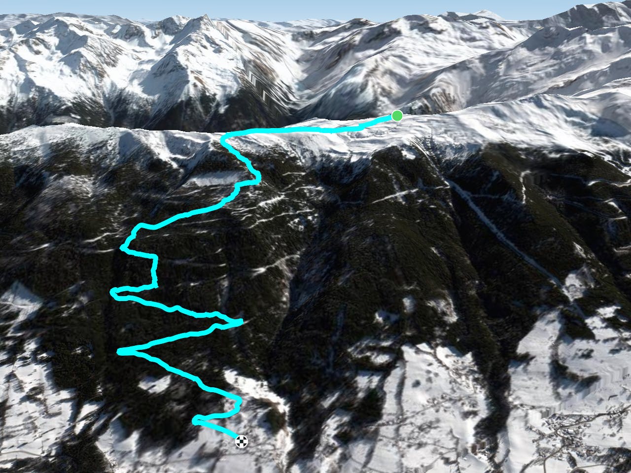
This is a popular freeride skiing route which is generally considered to be easy. It's not remote, it features low exposure (e1) and is typically done between January and February. From a low point of 782 m to the maximum altitude of 1.9 km, the route covers 8.7 km, 118 vertical metres of ascent and 1222 vertical metres of descent. It's graded 3.2 and Labande grade 2. You'll need skins to complete it safely.
Description
Run sympa dans les sapins sous le Cul du Pet. Puis emmerdements maximal dans les arcosses puis dans les sapins. Enfin final sur goudron peu enneigé
Difficulty
Easy
Wide gentle slopes at around 20 degrees or less.
Low Exposure (E1)

Exposure is limited to that of the slope itself. Getting hurt is still likely if the slope is steep and/or the snow is hard.
Remoteness
Close to help in case of emergency.
Best time to visit
Features
- Bowl
- Trees
Equipment required
- Skins