The Megavalanche
Alpe d'Huez
One of the most iconic downhills in the world.
Mountain Biking Extreme
- Distance
- 22 km
- Ascent
- 177 m
- Descent
- 2.7 km
- Duration
- 1-2 hrs
- Low Point
- 722 m
- High Point
- 3.3 km
- Gradient
- 16˚

The Megavalanche is an iconic, insane, annual MTB downhill marathon event which takes place high in the French Alps. It is the longest and craziest downhill race in the world, and is famed for starting on the glaciated summit of Pic Blanc at an impressive 3,330m altitude. The route descends to the lush meadows of the valley bottom at Allemont (720m), after some 2,600m dropped along 30km.
- •
- •
- •
- •
- •
- •
Description
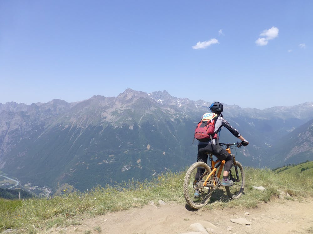
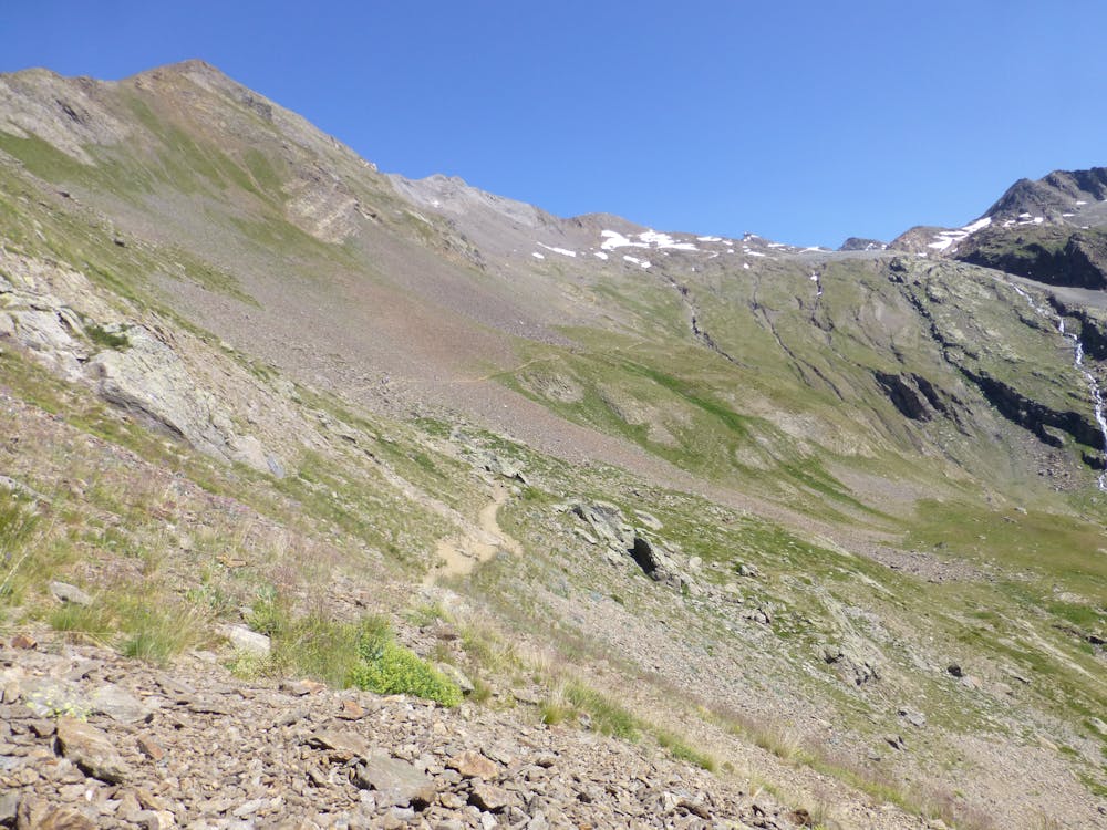
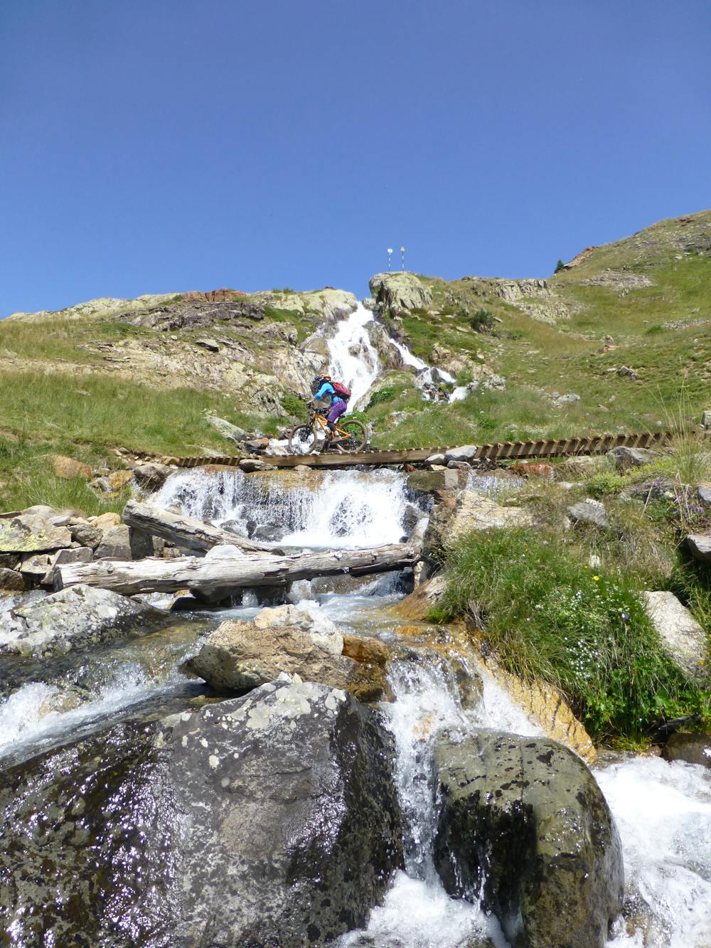
The grueling route is natural singletrack virtually all the way and the views are as breathtakingly-spectacular as you'd expect for this incredible high alpine area, with views over much of the surrounding Alps summits.
This trail is not suitable for a beginner rider due to the technical skills required, nor the weak-willed or those with vertigo. It offers a real challenge and extreme thrill for any competent and experienced rider.
There is plenty of parking close to the DMC gondola station in Alpe d’Huez town where the uplift takes all the pain out of riding to the top (not that you could if you wanted to).
Once at the top be prepared for it to be chilly even on the hottest summer day, and get ready to start the downhill experience! Protective equipment is strongly recommended as the consequence can be high if mistakes are made.
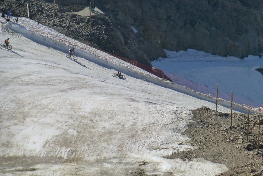
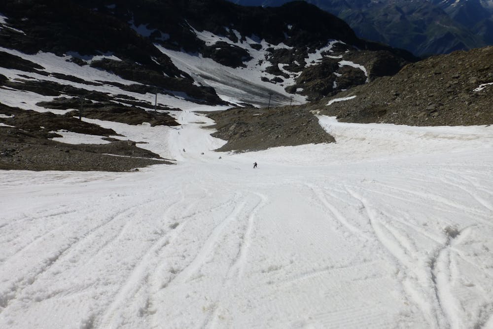
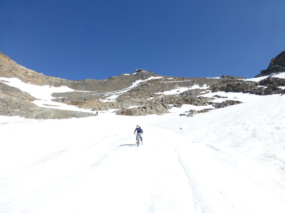
The start will be on snow—the amount will depend on the conditions at the time. It is quite rideable—perhaps with a bit of "tripoding" (riding with a leg down) or skiing on your feet beside your bike and steering it. The start is initially steep but does become less steep within 1-2km. The terrain under the snow, should there be little snow, is large scree rock which is more surfed through than ridden. The snow finishes and gives way to ice for a short period when the gradient is less steep. The route then dries up completely, leaving the trail to descend over scree and natural rock. Some of this section is quite technical, due to the steep descending over large, natural, stepped rock. Caution should be taken here as the trail is beside a steep, high drop with significant exposure of high consequence.
Eventually, the terrain becomes a bit easier and flowier, with some bike park-style berms and faster speeds as the trail traverses the Alpe d’Huez resort. A sneaky sharp climb is thrown in before dropping down through a dense forest for the descent to Allemont. The descent winds through numerous switchbacks, most of which are tight and steep.
To return to Alpe d’Huez and the parking there is a public bus available. During the summer, there is a free shuttle. If you can't catch the shuttle, you'll need to ride up out of the valley on the road to Oz-en-Oisans lift.
Note: this route can only be ridden when the summer lifts are open and when mountain conditions allow. It is forbidden to ride during the winter.
Difficulty
Extreme
Very steep, difficult, narrow singletrack with widely variable and unpredictable trail conditions. Unavoidable obstacles could be 15in/38cm tall or greater, and unavoidable obstacles with serious consequences are likely to be present. Obstacles could include big rocks, difficult root sections, drops, jumps, sharp switchbacks, and more. Ideal for expert-level riders.
Extreme Exposure

Some trail sections are extremely exposed where falling will almost certainly result in serious injury or death.
Remoteness

Away from help but easily accessed.
Best time to visit
Features
- Flow
- Technical
- Drops
- Roots
- Rock Rolls
- Rock Slabs
- Rock Gardens
- Wooden Feature