Haize 2.12 pic d'Anie
Orgue de Camplong et vue sur la vallée de Lescun
Hiking Difficult
- Distance
- 15 km
- Ascent
- 1.2 km
- Descent
- 1.2 km
- Duration
- 4-5 hrs
- Low Point
- 1.4 km
- High Point
- 2.5 km
- Gradient
- 19˚

This is a popular hiking route which is generally considered to be difficult. It's remote, it features high exposure and is typically done between April and September. From a low point of 1.4 km to the maximum altitude of 2.5 km, the route covers 15 km, 1191 vertical metres of ascent and 1191 vertical metres of descent.
Description
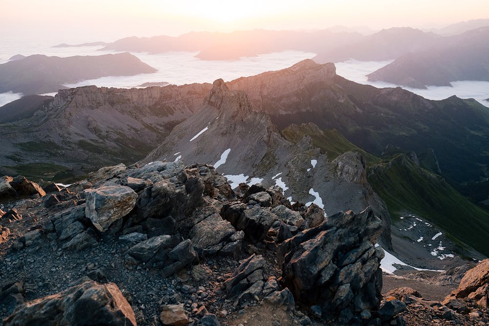
Le pic d’Anie est l’un des pics les plus emblématiques du Béarn, avec son profil pyramidal on le repère facilement depuis les cimes environnantes. Depuis Lescun les paysages sont riches de diversités.
à retrouver dans Haize vol.2 www.haize.fr
Difficulty
Difficult
Hiking trails where obstacles such as rocks or roots are prevalent. Some obstacles can require care to step over or around. At times, the trail can be worn and eroded. The grade of the trail is generally quite steep, and can often lead to strenuous hiking.
High Exposure

Some trail sections have exposed ledges or steep ascents/descents where falling could cause serious injury.
Remoteness

Away from help but easily accessed.
Best time to visit
Features
- Alpine
- Wildlife
- Picturesque
- Summit Hike
- Wild flowers
- Water features
- Forestry or heavy vegetation