12 m away
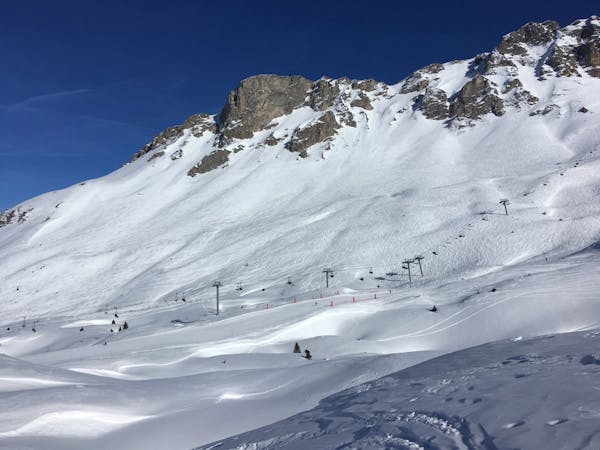
Dou des Lanches lift line

A La Tania classic enjoyed by holiday makers and three valleys veterans one and all
Difficult Freeride Skiing
- Distance
- 777 m
- Ascent
- 0 m
- Descent
- 347 m
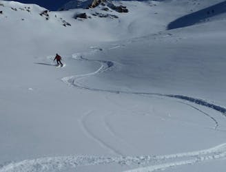
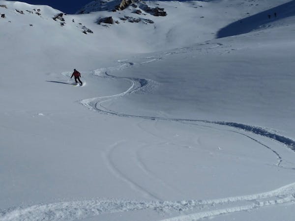
An easily accessed powder field with lots of drops, trees and open fields of powder
Freeride Skiing Difficult

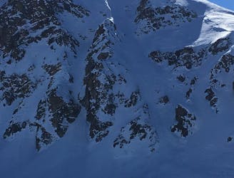
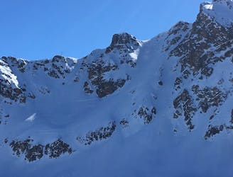
As you get off the Dou des Lanches chair turn right immediately and go back on yourself between Le Roc restaurant and the liftie hut. Rather than heading back down under the lift veer left (there will often be tracks already there) about 30 degrees and head over a small rise and keep to the left of the hut. As you pass the hut you'll follow along the ridge of the Dou des Lanches face. The further you go the less tracked it will be but there are four faces separated by three spines that you can ride down. The spines are all difficult and should be taken slowly first time till you get to know them and the two furthest faces also require sensible navigation. The top section is about 150 vertical metres and out of sight of the chair lift but as you come out from between the spines there is an open powder field that shallows out from which you can head right towards the Dou des Lanches black run and chair. Cut right fairly early after you come out into the open field to avoid the cordoned-off grouse hibernation area which is almost always untracked but skiing it is strictly forbidden.
The closer to the chair lift you are, the more cliff drops you'll find and as you begin to traverse further the more trees there are. Once you get to know the different faces you'll be able to link several cliff drops, wide open turns and tight tree sections all in the same run down. There is so much fun to be had here and when the conditions are right you can spend a whole day lapping the Dou des Lanches chair and still find fresh lines at last lifts!
Difficult
Serious gradient of 30-38 degrees where a real risk of slipping exists.

As well as the slope itself, there are some obstacles (such as rock outcrops) which could aggravate injury.
Away from help but easily accessed.
12 m away
A La Tania classic enjoyed by holiday makers and three valleys veterans one and all
Difficult Freeride Skiing
37 m away

Steep and deep open face with a couple of couloirs, some beautiful drops and beautiful turns to be had
Difficult Freeride Skiing
289 m away
What you see is what you get - a classic couloir!
Difficult Freeride Skiing
331 m away
Host to freeride competitions in the early 2000s - a short walk with an almost certain guarantee of cold snow!
Difficult Freeride Skiing
1.9 km away

If you want to add some tight trees and enjoyable drops to your run from La Tania to Courchevel 1850 head for the Coqs trees
Moderate Freeride Skiing
2.4 km away

A transfer that starts at Heathrow terminal 5 and sends you flying
Moderate Freeride Skiing
2.4 km away

Nice little couloir that's less tracked than the Grand Couloir
Severe Freeride Skiing
3 km away

Most fun mogul run in Courchevel
Difficult Freeride Skiing
3.3 km away
A surprisingly long descent on the edge of the Tuéda nature reserve.
Moderate Freeride Skiing
3.4 km away

A Courchevel classic enjoyed by locals and holiday makers all season long
Moderate Freeride Skiing
12 routes · Freeride Skiing
12 routes · Freeride Skiing