Piste de montée permanente des Rhodos
Galibier Thabor
Ideal intermediate route to progress. The little bonus: the possibility to relax and also to change in the high altitude restaurant at the top of the hill.
Resort Ski Touring Moderate
- Distance
- 3.6 km
- Ascent
- 518 m
- Descent
- 5 m
- Duration
- 2-3 hrs
- Low Point
- 1.4 km
- High Point
- 1.9 km
- Gradient
- 18˚
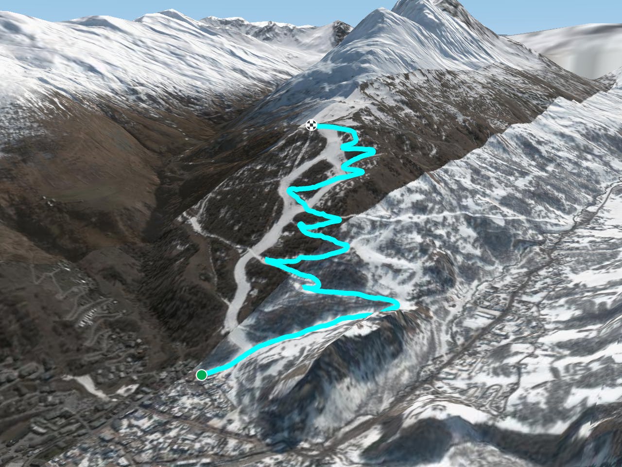
This is a popular resort ski touring route which is generally considered to be moderate. It's an unknown remoteness, it features unknown exposure and is typically done in an unknown time of year. From a low point of 1.4 km to the maximum altitude of 1.9 km, the route covers 3.6 km, 518 vertical metres of ascent and 5 vertical metres of descent.
Description
Ascent into the forest, with an overhanging view of Valloire, then the Verneys Valley and the Galibier.<br/><br/>For more information: <a href="https://skitouring.decathlon.fr" target="blank">skitouring.decathlon.fr</a>
Difficulty
Moderate