FATMAP by Strava

Foglietta North Face

Sainte Foy

Tarentaise

La Thuile & La Rosière

One of the classic north faces of the Haute Tarentaise

Ski Touring Severe

Distance
9 km
Ascent
182 m
Descent
1.8 km
Duration
2-3 hrs
Low Point
1.2 km
High Point
2.9 km
Gradient
47˚
Foglietta North Face Map

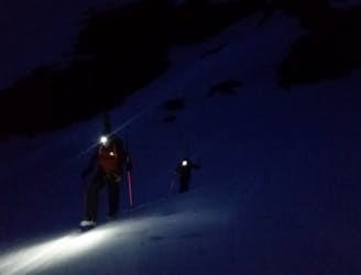
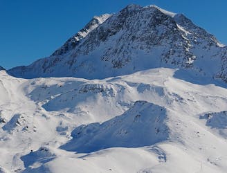
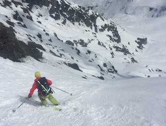
From the top of the Aiguille chair, hike or skin 45 minutes up the ridge to your left to the highest point. The huge north face reveals itself only once you reach the top. The face is often guarded by huge cornices which dictate a variety of different entry points. The upper pitch is wide, steep, and can be prone to huge avalanches, so be extra sure of snow conditions before you set off. It is this same breadth, altitude and northerly aspect though that means the snow can still be cold, powdery and untracked many days after a storm. The whole descent offers 1500m vertical of skiing in an away-from it all backcountry environment.

Description

The first pitch gradually flattens before plunging down a choice of two further steep pitches either side of a rocky outcrop before a long gentle cruise out through a small village made up of cute summer alpine chalets. Take the small bridge which crosses the Mercuel stream and continue down a track on its right bank until you reach the road. In winter the road is normally covered in snow and can be skied back to the hamlet of La Masure. Leave a car at La Masure or book a taxi back to Sainte Foy, or stop for lunch at the superb Chez Merie in the neighbouring hamlet of Le Miroir. A free bus back to the resort also runs- check timings.

Difficulty

Severe

Steep skiing at 38-45 degrees. This requires very good technique and the risk of falling has serious consequences.

Medium Exposure (E2)

2 out of 4

As well as the slope itself, there are some obstacles (such as rock outcrops) which could aggravate injury.

Remoteness

3 out of 4

Little chance of being seen or helped in case of an accident.

Best time to visit

between January and April

Features

  • Cliffs

Equipment required

  • Skins

Similar routes nearby

Guidebooks in this area