4.1 km away
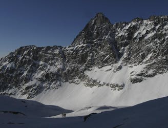
Tsanteleina South Couloir
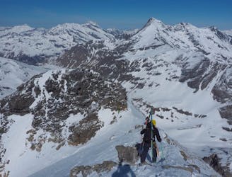
Taking in the classic peak of Tsanteleina, this line should be on the bucket list for all keen ski tourers in the region.
Severe Ski Touring
- Distance
- 9.7 km
- Ascent
- 1.6 km
- Descent
- 1.6 km
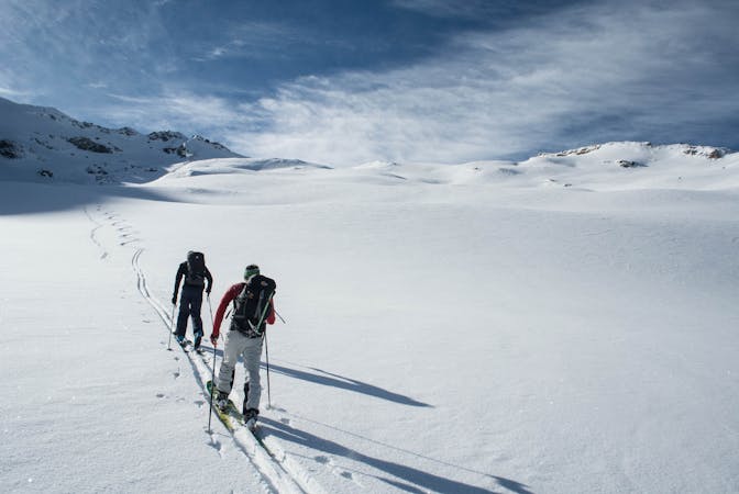
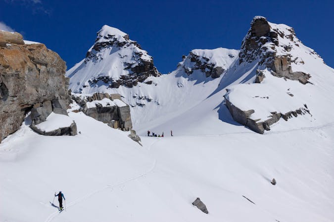
Fantastic skiing on a perfectly positioned glacier, a great full-on day covering a huge variety of terrain.
Ski Touring Severe

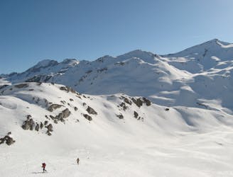
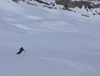
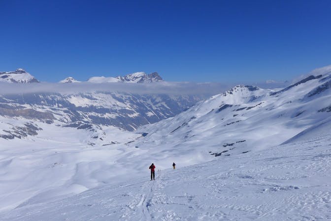
This ski tour begins on the summer road which leads out of Le Fornet. Start to ascend this road in a north east direction for a short distance, before breaking off and joining the summer path that leads up to the Réserve Naturelle de la Bailletaz. Once in the nature reserve (the terrain flattens out when you arrive), head in a north east direction and ascend up the Glacier de Court dessus - you should start to get a view of the south face of the Tsanteleina from here.
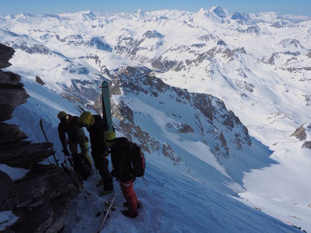
Once at the foot of the south couloir, take your skis/board off and bootpack straight up the couloir (crampons and walking axe advised). A fantastic ridge awaits you at the top of the couloir, with brilliant views of the north face of Tsanteleina and down into neighbouring Italy. Ascend the ridge in a westerly direction to stand on the 3,601m summit of Tsanteleina.
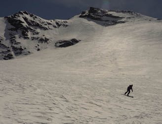
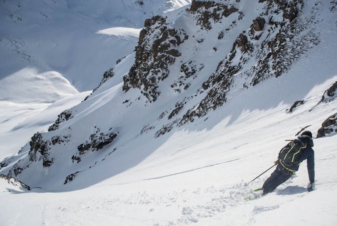
The summit is frequently wind scoured and rocky, so it's usually best to walk back down the ridge you ascended before putting your skis on at the top of the south couloir. Once at the top of the south couloir, keep walking in a westerly direction around the large rocky buttress in front of you. Once on the west side of this buttress, you can put your skis on and get ready for the awesome descent down the Glacier du Santel.
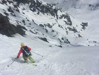
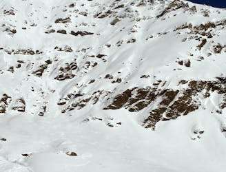
The top of the glacier starts fairly steep and quite exposed above a large rocky band below, so take your first few turns easy until you thread your way through the rocky band to put yourself on the glacier and a slightly more mellow gradient.
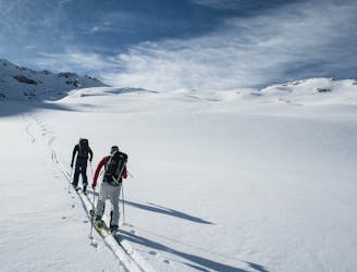
Head towards a short north facing ramp to get yourself off the glacier and heading down into the Réserve Naturelle de la Grande Sassiére. Keep skating, skiing and poling your way down this valley until your reach the finish point in Le Recluaz where you can either hitch or have left a car with which to drive home.
Severe
Steep skiing at 38-45 degrees. This requires very good technique and the risk of falling has serious consequences.

As well as the slope itself, there are some obstacles (such as rock outcrops) which could aggravate injury.

Little chance of being seen or helped in case of an accident.
4.1 km away
Taking in the classic peak of Tsanteleina, this line should be on the bucket list for all keen ski tourers in the region.
Severe Ski Touring
4.5 km away
This route is not visible from resort so it’s tough to check how the conditions are faring or how filled in the whole route is, but this is one incredible descent - take our word for it!
Extreme Ski Touring
5 km away
A great, long and mellow angled glaciated ski touring peak.
Moderate Ski Touring
5 km away
A classic ski touring peak on the Italian/French border
Moderate Ski Touring
6.6 km away
A great adventure! Take in the remote summit of the Grand Aiguille Rousse with a fantastic ski down the north face of this peak.
Severe Ski Touring
7.8 km away
An impressive south face on a stunning peak just a stone's throw from the Espace Killy
Extreme Ski Touring
8.1 km away
BIG day with an amazing north facing glacial ski from the top of Pointe de Méan Martin.
Severe Ski Touring
9.1 km away
A crucial link between two high huts, with some long high glacial sections and fabulous mountain scenery
Difficult Ski Touring
19 routes · Ski Touring
5 routes · Freeride Skiing · Ski Touring
3 routes · Ski Touring
6 routes · Ski Touring