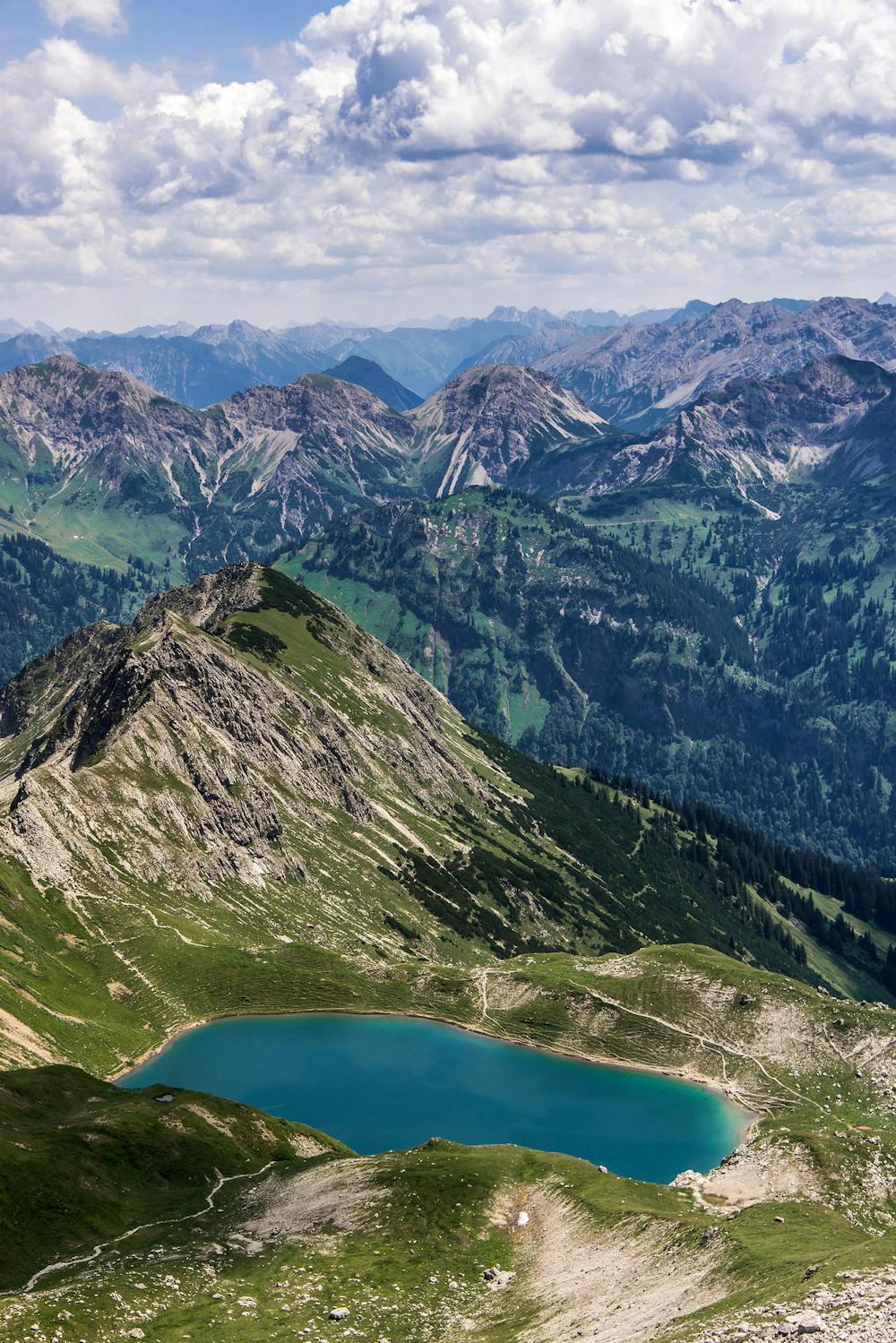
Engeratsgundsee
Nebelhorn
An easygoing hike with wonderful views of the Allgäu mountain range.
Hiking Moderate
- Distance
- 9.6 km
- Ascent
- 251 m
- Descent
- 1.1 km
- Duration
- 2-3 hrs
- Low Point
- 1.1 km
- High Point
- 2 km
- Gradient
- 16˚

Beginning at the Edmund-Probst-Haus which can be reached by taking the Nebelhornbahn to the Höfatsblick mountain station, head in the direction of Big Thumb (2280m). From the summit descend down through alpine forests, passing a series of smaller lakes until coming to the lovely Engeratsgund Lake. After you’ve enjoyed the lake continue on past alpine wildflower meadows, following a forest road to Gable House. Here you can take the bus back to Bad Hindelang.
Description
Difficulty
Moderate
Hiking along trails with some uneven terrain and small hills. Small rocks and roots may be present.
Medium Exposure

The trail contains some obstacles such as outcroppings and rock which could cause injury.
Remoteness
Away from help but easily accessed.
Best time to visit
Features
- Alpine
- Wildlife
- Picturesque
- Wild flowers