The Watzmann Ridge
Berchtesgaden
Full round tour of the Watzmann Ridge
Hiking Moderate
- Distance
- 23 km
- Ascent
- 2.4 km
- Descent
- 2.4 km
- Duration
- 1 day +
- Low Point
- 630 m
- High Point
- 2.7 km
- Gradient
- 36˚

Park in the town of Berchtesgaden, ideally in the southern side so you're closer to the start of the trail.
- •
- •
Description
If you plan to do the full hike in one day, start early! Alternatively, you can hike up to the Watzmannhaus which only takes a couple of hours, stay the night there and do the rest of the hike the next day.
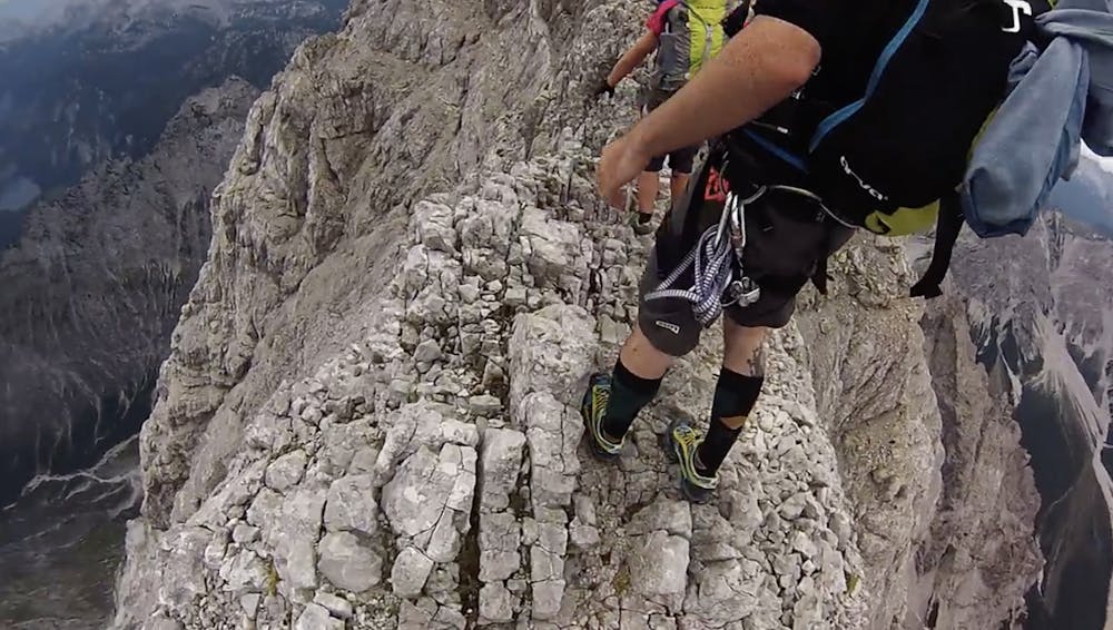
From the Watzmannhaus, follow the trail up to the start of the ridge line. It is well marked. Continue along the ridge until you reach the other side and then follow the steep descent down to the valley floor.
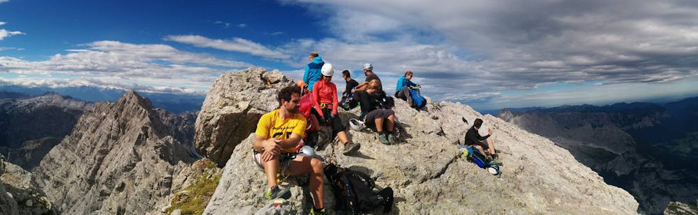
It is very exposed on the ridge and you will be spending a few hours walking the length of it, so via ferrata/klettersteig gear is recommended, with a helmet.
Once you descend on the North side, there is a hut on the valley floor - a very welcome break on a hot day.
Difficulty
Moderate
Hiking along trails with some uneven terrain and small hills. Small rocks and roots may be present.
High Exposure

Some trail sections have exposed ledges or steep ascents/descents where falling could cause serious injury.
Remoteness

Away from help but easily accessed.
Best time to visit
Features
- Alpine
- Picturesque
- Summit Hike
- Wild flowers
- Water features
- Forestry or heavy vegetation