8.1 km away
Elliott Key Campground Loop
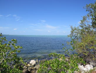
A path through the forest where you can find some small, secluded beaches on Elliott Key.
Easy Hiking
- Distance
- 1.9 km
- Ascent
- 3 m
- Descent
- 3 m
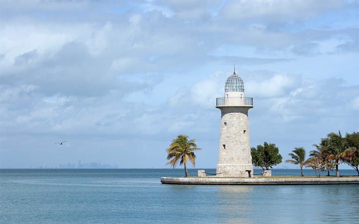
Short loop among palm trees and sunny forest on Boca Chita Key.
Hiking Easy

Boca Chita is the most-visited island in Biscayne National Park. It has a good-sized harbor and a grassy campground, as well as picnic areas, small sand beaches, and a stone lighthouse. To go for a walk on the island, you can follow this short trail loop. It’s a sandy path that starts in a grassy field with scattered palm trees, then goes into leafy hardwood forest. It more or less traces the south perimeter of the island, finding a few secluded beach areas between mangrove thickets. You might bring a camp chair and cooler to sit and enjoy the solitary views.

Easy
Walking along a well-kept trail that’s mostly flat. No obstacles are present.

The path is on completely flat land and potential injury is limited to falling over.

Away from help but easily accessed.
8.1 km away
A path through the forest where you can find some small, secluded beaches on Elliott Key.
Easy Hiking
8.1 km away
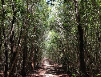
Southern portion of the Spite Highway Trail, beginning from the campground on Elliott Key.
Easy Hiking
8.1 km away

Northern portion of the Spite Highway Trail, beginning from the campground on Elliott Key.
Easy Hiking
6 routes · Hiking