Hengifoss Hiking Trail
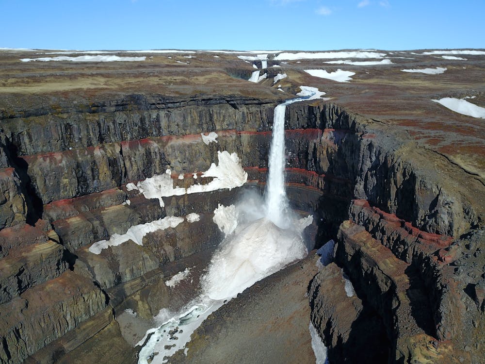
Hengifoss is 128 meters high waterfall
Hiking Easy
- Distance
- 4.8 km
- Ascent
- 355 m
- Descent
- 354 m
- Duration
- 1-2 hrs
- Low Point
- 29 m
- High Point
- 319 m
- Gradient
- 11˚

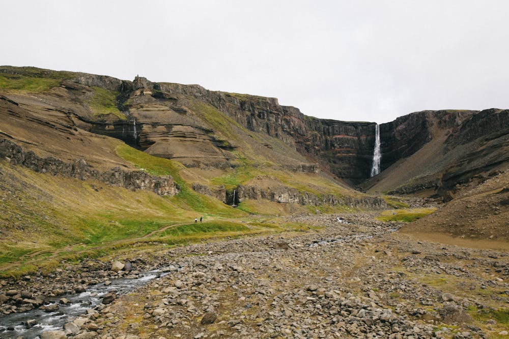
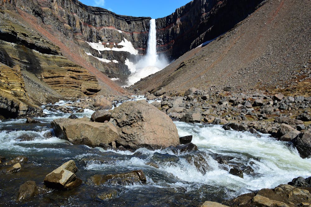
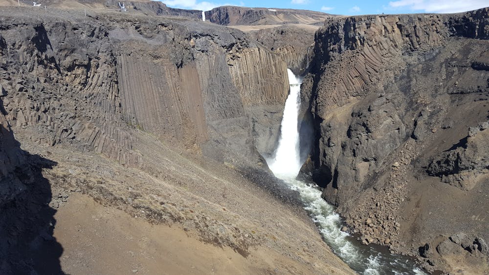
Apart from having recently been re-defined as Iceland's second-highest waterfall, the Hengifoss is particularly picturesque. The layers between numerous Tertiary lava strata yield a reddish color particularly salient in the cliffs around Hengifoss. Moreover, underway towards Hengifoss, the Litlanesfoss presents impressive stands of basalt columns on both sides of the gorge.
- •
- •
- •
- •
Description
Usually, the climb ends well below Hengifoss, at a point where it can easily be admired without crossing the river. However, if the flow is scarce - as is often the case in autumn - it is feasible to go closer and even enter a shallow cave behind the waterfall. There is an easy walking path from the highway to Hengifoss, it takes 40-60 minutes to walk from the parking lot to the waterfall.
Difficulty
Easy
Walking along a well-kept trail that’s mostly flat. No obstacles are present.
Medium Exposure

The trail contains some obstacles such as outcroppings and rock which could cause injury.
Remoteness
Away from help but easily accessed.
Best time to visit
Features
- Picturesque
- Dog friendly
- Water features
- Family friendly