S3 Trail - Skaftafell
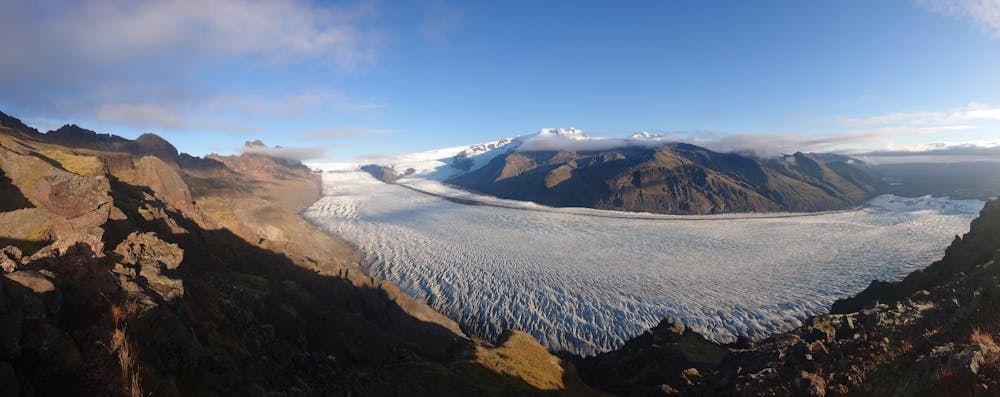
TThe Skaftafellsheiði traverse.
Hiking Moderate
- Distance
- 16 km
- Ascent
- 753 m
- Descent
- 754 m
- Duration
- 4-5 hrs
- Low Point
- 95 m
- High Point
- 726 m
- Gradient
- 10˚

This is a popular hiking route which is generally considered to be moderate. It's remote, it features low exposure and is typically done between June and October. From a low point of 95 m to the maximum altitude of 726 m, the route covers 16 km, 753 vertical metres of ascent and 754 vertical metres of descent.
Description
The trail that traverses all of Skaftafellsheiði, with views of Skaftafellsjökull glacier, Morsárdalur valley, Skeiðarárjökull glacier, and Skeiðarársandur outwash plain. Possible to stop by Svartifoss waterfall on the way. Duration: 5-7 hrs.
Difficulty
Moderate
Hiking along trails with some uneven terrain and small hills. Small rocks and roots may be present.
Low Exposure

The path is on completely flat land and potential injury is limited to falling over.
Remoteness

Away from help but easily accessed.
Best time to visit
Features
- Alpine
- Wildlife
- Picturesque
- Wild flowers