Waterfall Circle
Five waterfalls and one canyon
Hiking Moderate
- Distance
- 7.6 km
- Ascent
- 308 m
- Descent
- 309 m
- Duration
- 2-3 hrs
- Low Point
- 412 m
- High Point
- 584 m
- Gradient
- 7˚

At Laugarfell there’s an amazing hike called the Waterfall Circle. It’s about 8 km long and starts at the parking lot of Laugarfell.
- •
- •
- •
- •
- •
- •
- •
- •
- •
Description
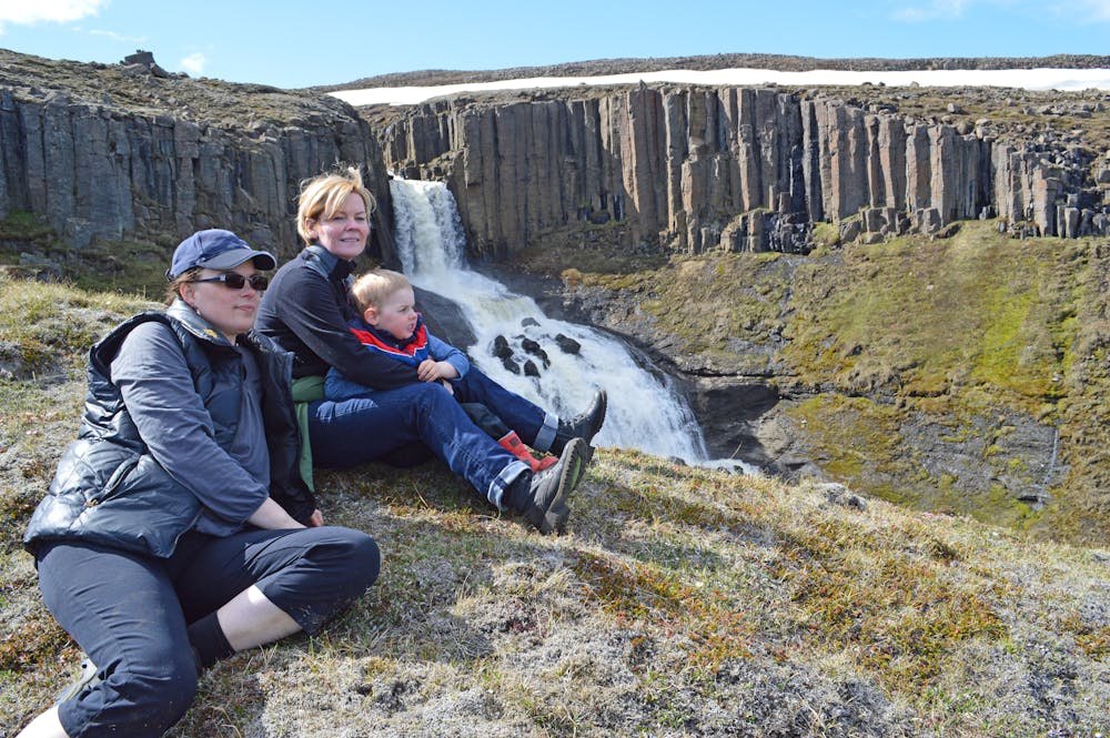
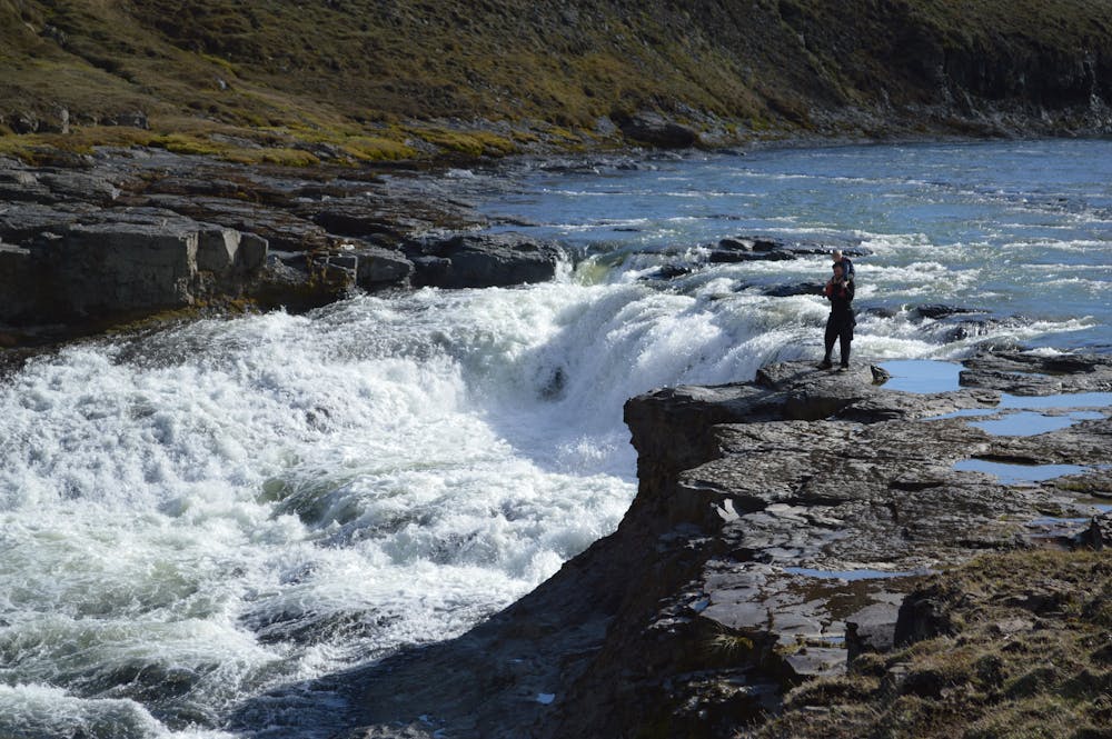
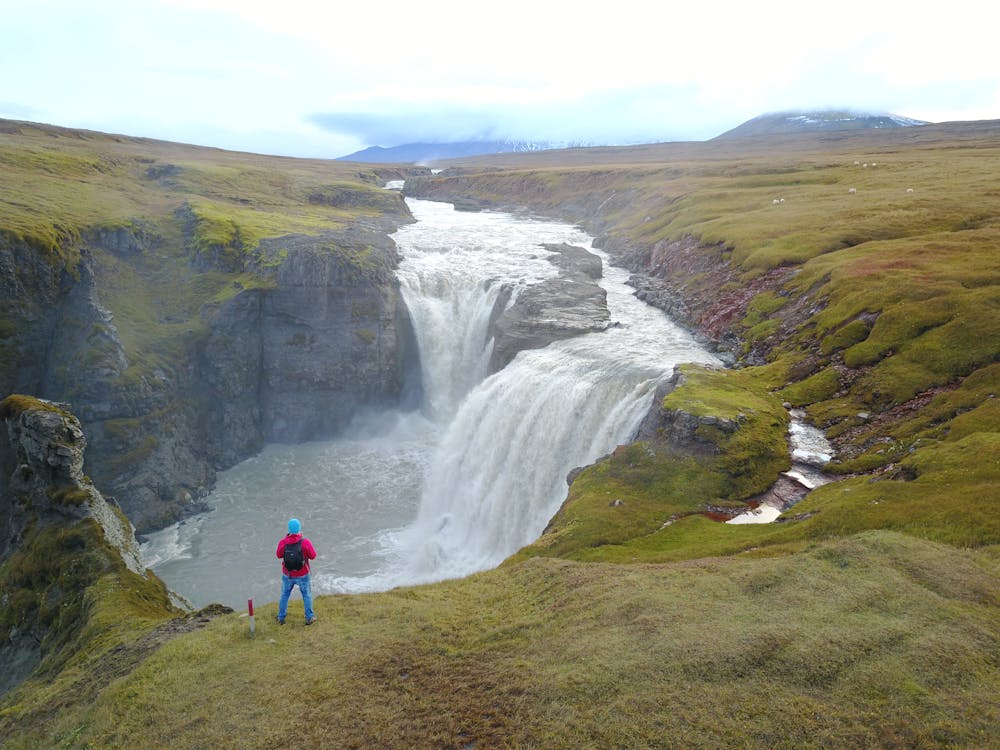
You’ll see a wooden panel with a sign on it, showing where the trail begins. There you’ll find a sink to fill up your water bottles, if you wish to. On the sign a red arrow shows you a ladder going over the fence. Once you’re past it, you’ll start seeing red wooden sticks showing you the way. Follow them along the Laugará (the river), where you’ll walk past some spectacular waterfalls (among them Stuðlafoss, a basalt column waterfall).
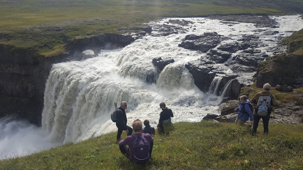
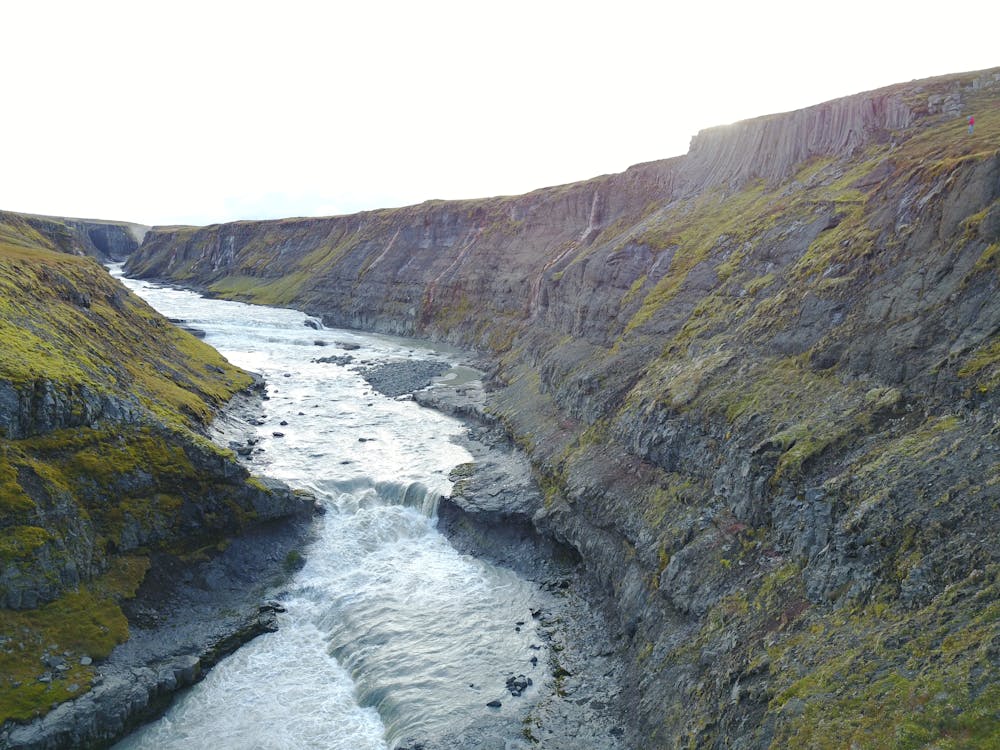
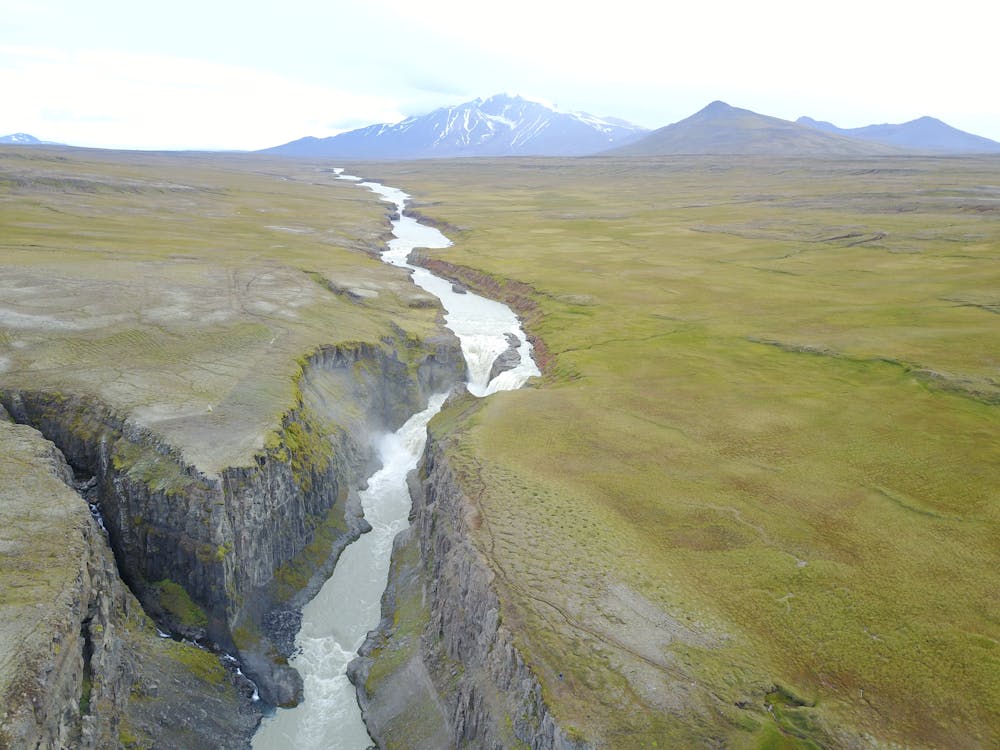
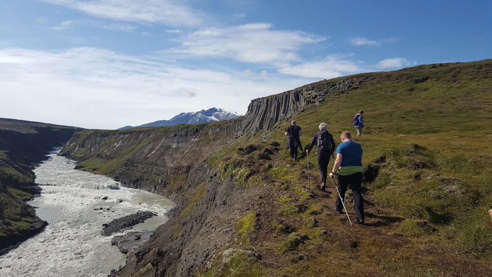
Once you reach the waterfall called FAXI, where the Jökulsá á Fljótsdal meets the Laugará, there’s a magnificent viewpoint. You’ll have to turn right here and follow the red sticks along the canyon. You can cross the bridge on left over the Laugará to have a nice view over Faxi, but you’ll notice that the colour of the sticks there changes to green. This path leads to the Wilderness centre and it’s 16 km long. So, come back over the bridge and follow the red sticks again along the canyon. There are some boardwalks in this section.
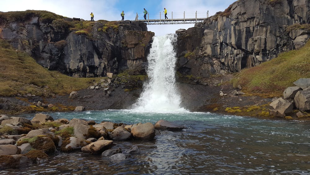
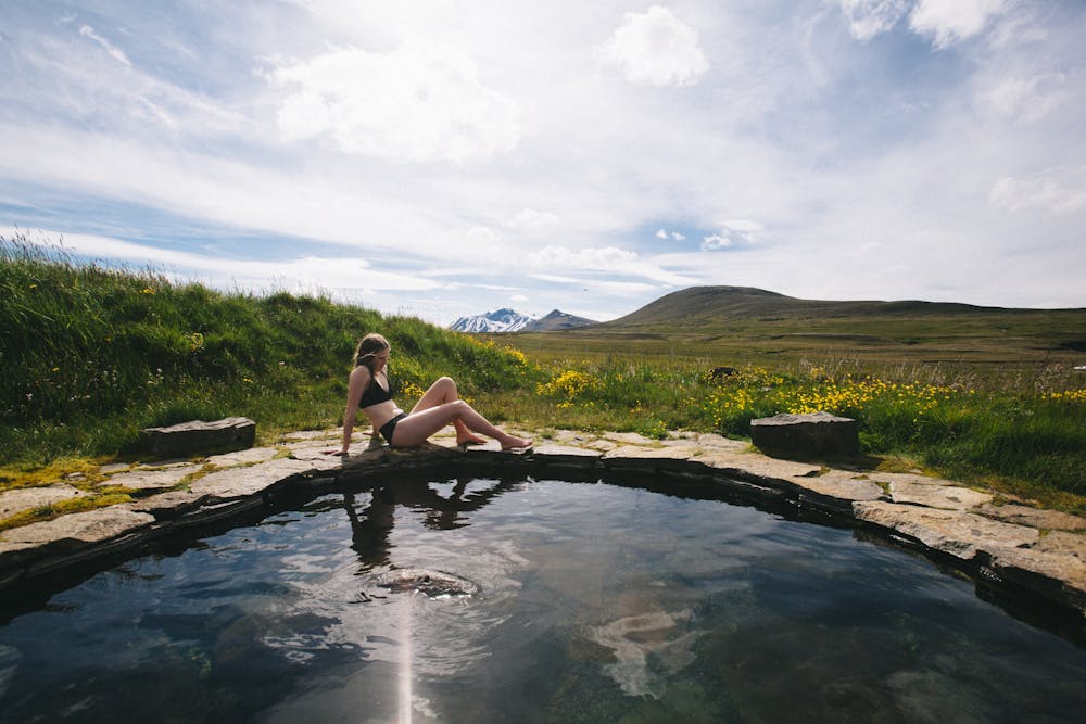
When you reach Kirkjufoss, you’ll have a perfect view over Snaefell on a clear day. The path takes you now up the hill and back to Laugarfell. You can end your walk at the hot springs at Laugarfell. Ask the staff there for information.
Difficulty
Moderate
Hiking along trails with some uneven terrain and small hills. Small rocks and roots may be present.
Medium Exposure

The trail contains some obstacles such as outcroppings and rock which could cause injury.
Remoteness
Away from help but easily accessed.
Best time to visit
Features
- Picturesque
- Dog friendly
- Family friendly