1 routes · Hiking
Yousmarg to Sunset peak and descend from Zaznar Mughal road
Hiking Severe

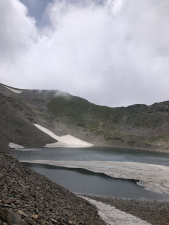
Sunset Peak, so named because it is the last of the tops to catch the rays of the setting sun.It is the second highest summit of Pir Panjal range encompassing Kashmir valley. This peak has a saddle-back, and has been several times ascended by Dr Arthur Neve, Dr Ernest Neve and various friends. The ascent, which is not difficult, lies for the last three hours up a snow slope, which gradually increases in steepness and culminates in a rocky arete, the southern face of which, and of the peak itself, drops as a sheer precipice for some hundreds of feet. On the summit pieces of smooth rock with vitreous fracture can be found, showing bubbles and other traces of igneous action.


Severe
Hiking challenging trails where simple scrambling, with the occasional use of the hands, is a distinct possibility. The trails are often filled with all manner of obstacles both small and large, and the hills are very steep. Obstacles and challenges are often unexpected and can be unpredictable.

The trail contains some obstacles such as outcroppings and rock which could cause injury.
Away from help but easily accessed.
1 routes · Hiking