176 m away
Tacconet

Easy freeride
Moderate Freeride Skiing
- Distance
- 1.1 km
- Ascent
- 0 m
- Descent
- 329 m
A nice tour through a beautiful village
Freeride Skiing Easy

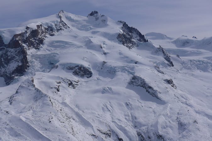
This is a popular freeride skiing route which is generally considered to be easy. It's remote, it features low exposure (e1) and is typically done between December and March. From a low point of 1.6 km to the maximum altitude of 2.4 km, the route covers 1.9 km, 23 vertical metres of ascent and 804 vertical metres of descent. It's graded 2.2 and Labande grade 2.
It's an easy line that runs through open slopes at the beginning then woods. It needs a good snow base. This line also passes by the village of Soussun (hence the name of this run). The line will finish 500m circa below Frachey.
Easy
Wide gentle slopes at around 20 degrees or less.

Exposure is limited to that of the slope itself. Getting hurt is still likely if the slope is steep and/or the snow is hard.

Away from help but easily accessed.
176 m away
Easy freeride
Moderate Freeride Skiing
596 m away

A fun couloir
Difficult Freeride Skiing
893 m away

Have fun in this natural pipe!
Moderate Freeride Skiing
912 m away

Good north exposed woods
Moderate Freeride Skiing
1.6 km away

A quite isolated line
Moderate Freeride Skiing
1.8 km away

Escape the crowds and discover the backcountry - no hiking required!
Moderate Freeride Skiing
1.8 km away

An easy freeride line
Moderate Freeride Skiing
1.9 km away

For free riders who wants to start pushing themselves
Difficult Freeride Skiing
1.9 km away

An easy freeride slope
Easy Freeride Skiing
2.4 km away

A great freeride warm-up run, fast and fun with a quick traverse at the beginning.
Moderate Freeride Skiing
12 routes · Freeride Skiing