4.2 km away
Tete De La Tronche
One of the best backcountry MTB rides in the area.
Severe Mountain Biking
- Distance
- 29 km
- Ascent
- 1.8 km
- Descent
- 2.2 km
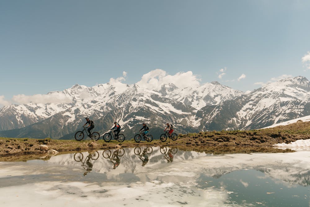
September 2022, we took Norrona loyal guests to ride a part of the Tour du Mont Blanc
Also in Haute-Savoie, France
Mountain Biking Difficult

This is a popular mountain biking route which is generally considered to be difficult. It's remote, it features medium exposure and is typically done between July and October. From a low point of 989 m to the maximum altitude of 2.5 km, the route covers 83 km, 4216 vertical metres of ascent and 4693 vertical metres of descent.
We like this part of the Tour du Mont Blanc where you find the lowest trails. It's easy to get there from Chamonix by crossing the Mont Blanc tunnel
Difficult
Mostly stable trail tread with some variability featuring larger and more unavoidable obstacles that may include, but not be limited to: bigger stones, roots, steps, and narrow curves. Compared to lower intermediate, technical difficulty is more advanced and grades of slopes are steeper. Ideal for upper intermediate riders.

The trail contains some obstacles such as outcroppings and rock which could cause injury.
Away from help but easily accessed.
4.2 km away
One of the best backcountry MTB rides in the area.
Severe Mountain Biking