4 km away
Cima Vallelunga and Monte Sibilla Loop
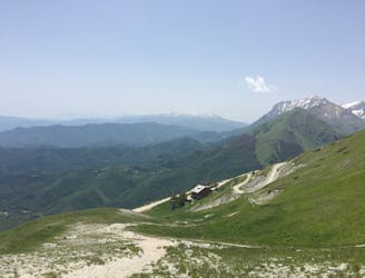
A magnificent high alpine ridge line hike to two incredible vantage points.
Moderate Hiking
- Distance
- 14 km
- Ascent
- 766 m
- Descent
- 766 m
A gorgeous, yet moderately-strenuous, climb to the magical, mysterious, and only natural lake in Le Marche.
Hiking Difficult

This stunning hike in the Monti Sibillini National Park runs from the small village of Foce to the remote, barren, yet totally majestic Lago di Pilato (Pilates Lake). This is the only natural lake in the region.
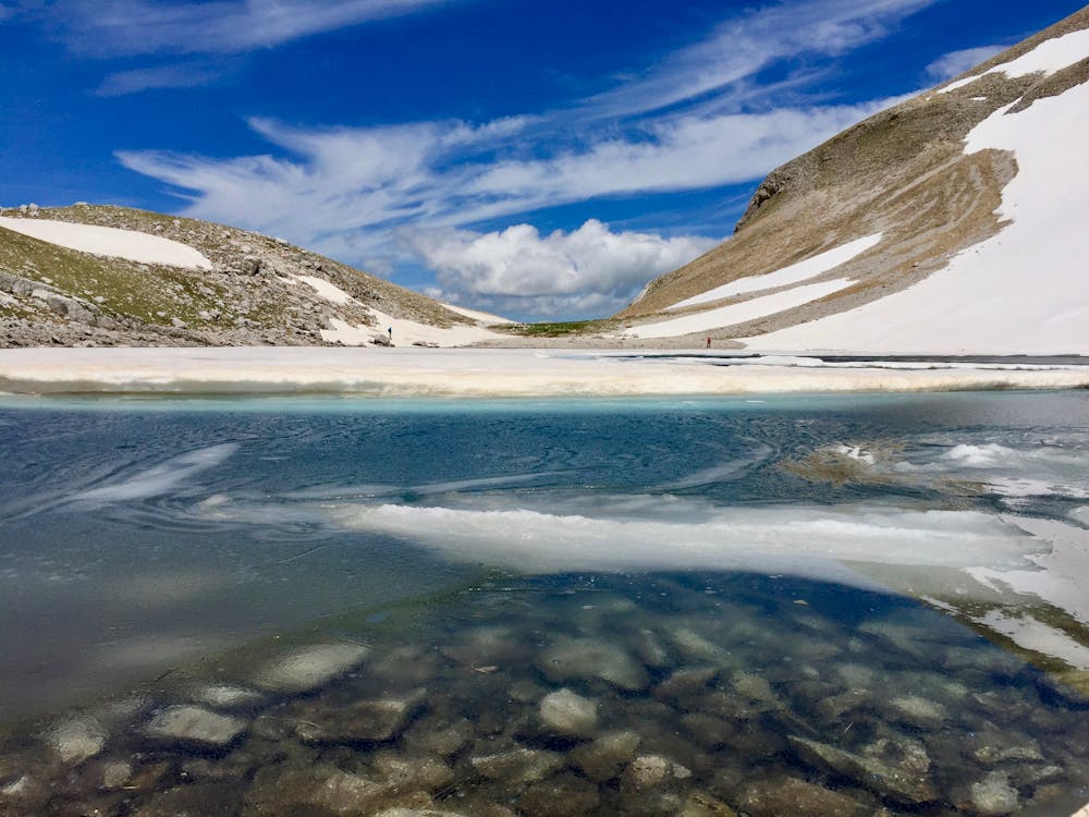
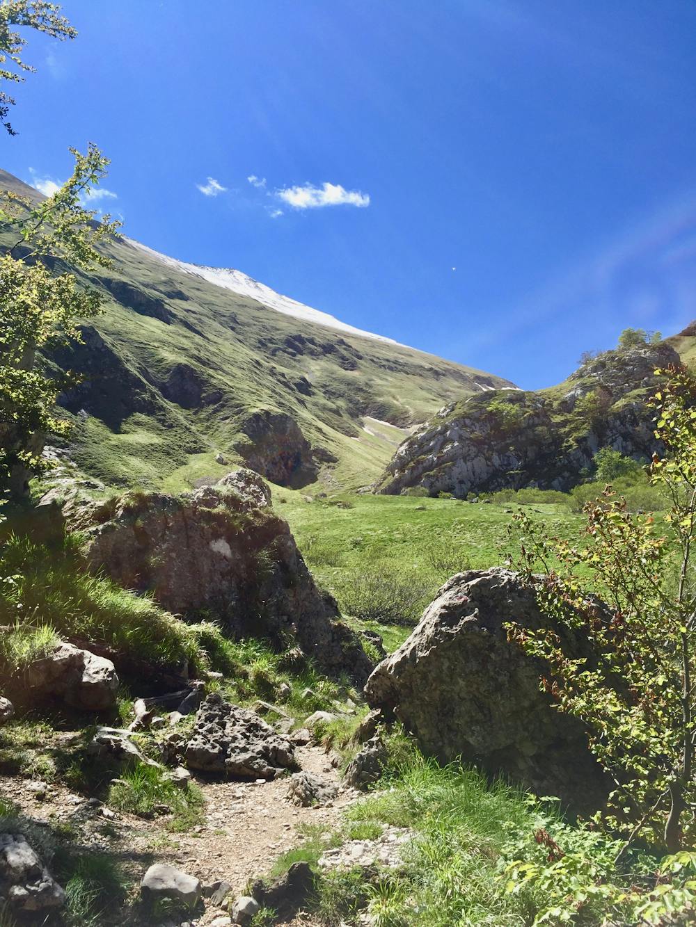
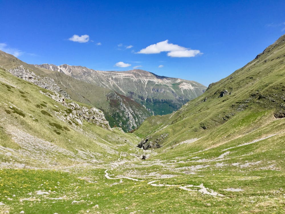
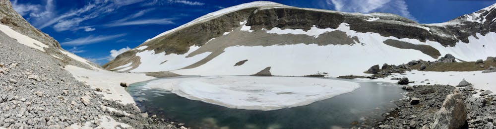
Lago di Pilato is an alpine glacial lake located in a narrow glacial valley beneath Monte Vettore (Mount Vector) summit. The mountain is a view for most of this route once you are up above the treeline. The valley is reported to date back to the superior Pleistocene era.
The lake takes its name from the legend of Pontius Pilate being killed here and buried under the lake bed as punishment for his portrayal of Jesus.
The lake is also the endemic home to the Chirocephalus marchesonii, a freshwater shrimp. This is the only place in the world where this species of fairy shrimp is found. Please be respectful of this matter.
This out-and-back route is enjoyable the whole way, in both directions, as the view is completely different on the return. Although the destination of the lake is your ultimate goal and reward here, the journey to and from is spectacular and a moderately strenuous challenge.
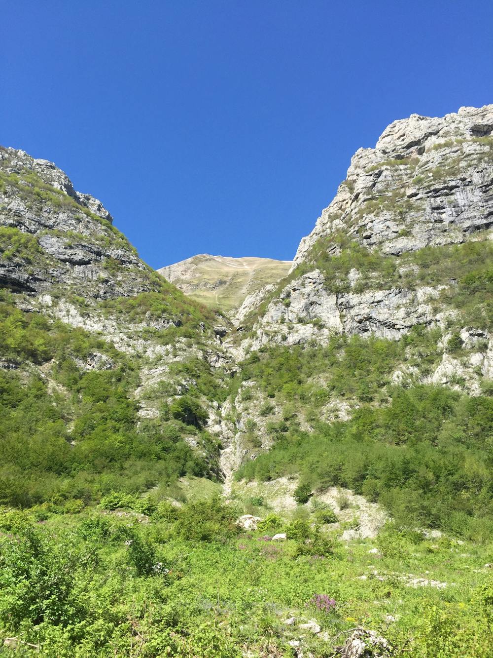
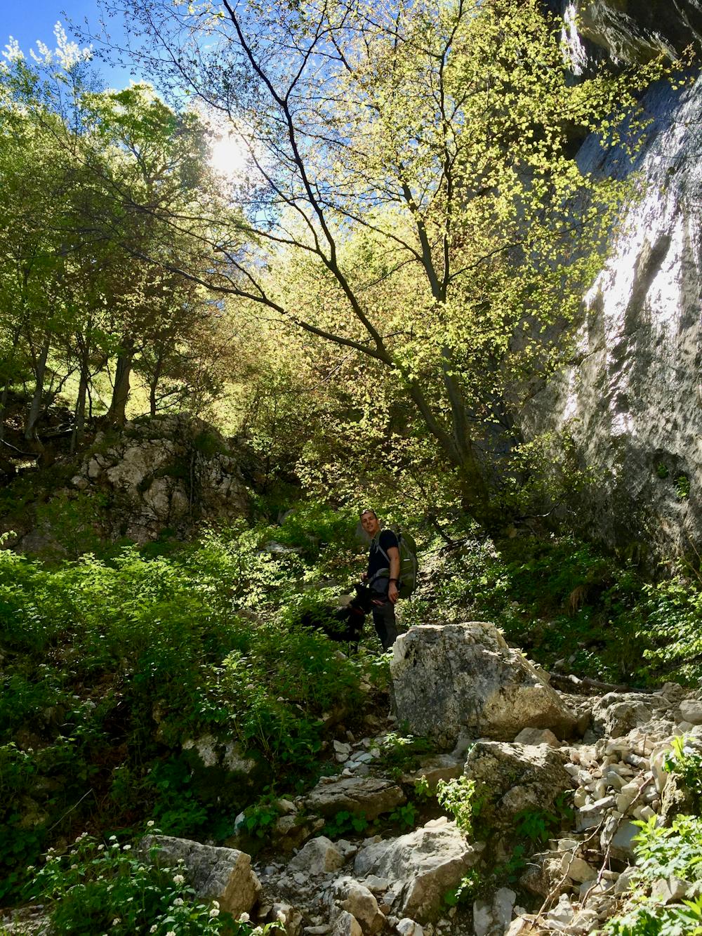
Initially, the trail is easy going on a fairly flat ground, with a gentle gradient close to a small stream (usually dry in the summer months) with a bit of rough, unevenness to the path. After of few kilometers you reach the forest where the trail becomes very steep and arduous for a while. The trail zigzags its way up the corner of a rocky gully and is at times loose underfoot and can be subject to erosion. There isn't any scrambling required, but care should be taken for sure-footedness.
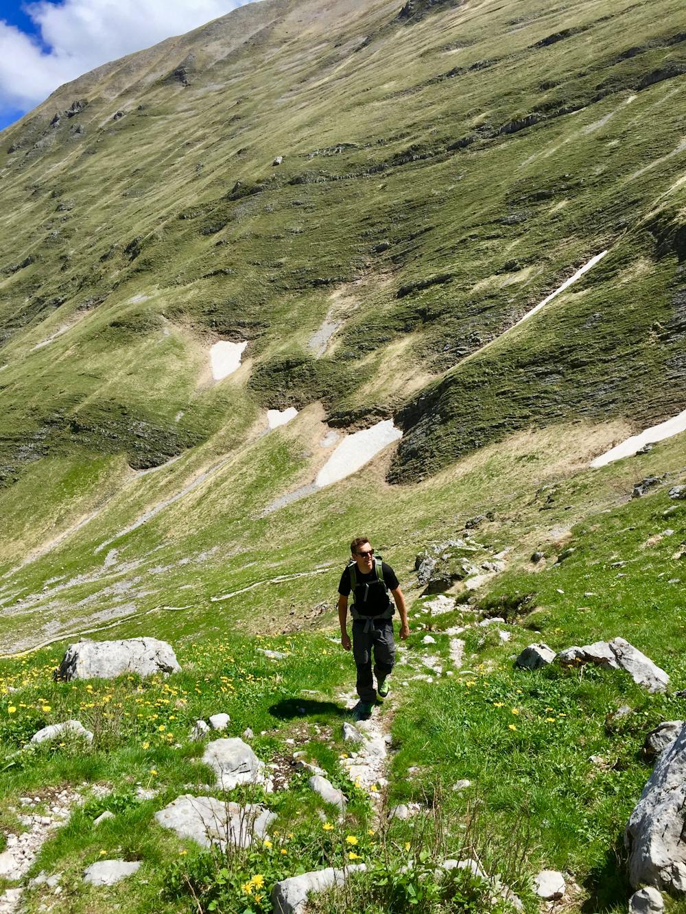
Soon the looseness disappears and firmer terrain takes over, but with large boulders and steep zigzags. You may require to use your hands to negotiate the trail here. It doesn't last for very long, and you will soon be above the tree line and presented with a magnificent view towards the upper valley.
The trail from here to the lake steadily winds its way up the valley along smooth but uneven terrain, with small boulders to climb over. You are rewarded with the view of the lake with its crystal clear waters at the very end of the trail.
Depending on the amount of snow, it may be possible to walk around the perimeter of the lake. This is a perfect place to sit for lunch, soak up the ambiance and admire the lunar-like location before reversing the route for the return.
You can also link in the route to the summit of Monte Vettore from the lake for an extended hike.
This route is dog-friendly but due to being in the National Par,k they must be kept on a leash and must NOT disturb the shrimp.
Difficult
Hiking trails where obstacles such as rocks or roots are prevalent. Some obstacles can require care to step over or around. At times, the trail can be worn and eroded. The grade of the trail is generally quite steep, and can often lead to strenuous hiking.

The trail contains some obstacles such as outcroppings and rock which could cause injury.

In the high mountains or remote conditions, all individuals must be completely autonomous in every situation.
4 km away
A magnificent high alpine ridge line hike to two incredible vantage points.
Moderate Hiking