7 m away
Cima Vallelunga and Monte Sibilla Loop
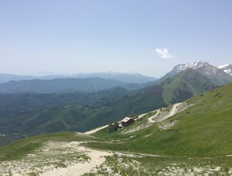
A magnificent high alpine ridge line hike to two incredible vantage points.
Moderate Hiking
- Distance
- 14 km
- Ascent
- 766 m
- Descent
- 766 m
Via invernale dal Rifugio Sibilla al M.Sibilla.
Also in Fermo, Italy
Hiking Easy
![[WIN] M. Sibilla da Rifugio Sibilla Map](https://fatmap-adventure-screenshots.imgix.net/routes/131960-blank.png?auto=compress%2Cformat)
This is a popular hiking route which is generally considered to be easy. It's not remote, it features medium exposure and is typically done between December and March. From a low point of 1.5 km to the maximum altitude of 2.2 km, the route covers 4.1 km, 627 vertical metres of ascent and 14 vertical metres of descent.
Panorami mozzafiato nell'escursione più affascinante dei M. Sibillini.
Easy
Walking along a well-kept trail that’s mostly flat. No obstacles are present.

The trail contains some obstacles such as outcroppings and rock which could cause injury.

Close to help in case of emergency.
7 m away
A magnificent high alpine ridge line hike to two incredible vantage points.
Moderate Hiking
4 km away
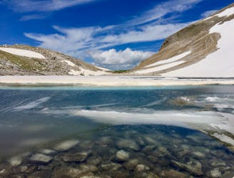
A gorgeous, yet moderately-strenuous, climb to the magical, mysterious, and only natural lake in Le Marche.
Difficult Hiking