633 m away
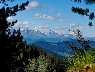
Alta Via Dolomiti 1

The classic route of the 10 Alta Via Dolomiti high altitude trails.
Moderate Hiking
- Distance
- 112 km
- Ascent
- 6.7 km
- Descent
- 7.8 km
ALTA VIA 1 SEPT. 4th STAGE 1
Hiking Difficult

This is a popular hiking route which is generally considered to be difficult. It's remote, it features low exposure and is typically done between July and September. From a low point of 1.5 km to the maximum altitude of 2.4 km, the route covers 12 km, 910 vertical metres of ascent and 451 vertical metres of descent.
ALTA VIA 1 DOLOMITES STAGE 1
Difficult
Hiking trails where obstacles such as rocks or roots are prevalent. Some obstacles can require care to step over or around. At times, the trail can be worn and eroded. The grade of the trail is generally quite steep, and can often lead to strenuous hiking.

The path is on completely flat land and potential injury is limited to falling over.

Away from help but easily accessed.
633 m away
The classic route of the 10 Alta Via Dolomiti high altitude trails.
Moderate Hiking
8.3 km away
A challenging 100km high altitude hike across the eastern Dolomites.
Difficult Hiking

10 routes · Hiking