8.1 km away
Passo Forca Rossa
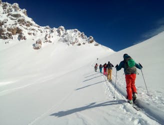
A linear cruise through some typically beautiful Dolomites valleys.
Easy Ski Touring
- Distance
- 15 km
- Ascent
- 739 m
- Descent
- 1.4 km
bellissimo ambiente, salita per il canale non estrema
Ski Touring Difficult

This is a popular ski touring route which is generally considered to be difficult. It's remote, it features medium exposure (e2) and is typically done between February and April. From a low point of 1.4 km to the maximum altitude of 2.6 km, the route covers 20 km, 1589 vertical metres of ascent and 1602 vertical metres of descent. It's graded 2.3 and Labande grade 2. You'll need skins and crampons to complete it safely.
bellissimo ambiente fuori dalle rotte più battute
Difficult
Serious gradient of 30-38 degrees where a real risk of slipping exists.

As well as the slope itself, there are some obstacles (such as rock outcrops) which could aggravate injury.
Away from help but easily accessed.
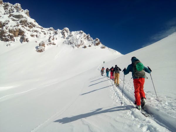
8.1 km away
A linear cruise through some typically beautiful Dolomites valleys.
Easy Ski Touring
3 routes · Ski Touring