6.3 km away
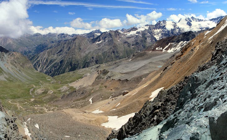
Western Transalp: Susa to Usseglio

The first leg of the incredible 6-day crossing of the Western Alps.
Difficult Mountain Biking
- Distance
- 30 km
- Ascent
- 2.2 km
- Descent
- 1.4 km
collegamento Novalesa Venaus
Mountain Biking Moderate

This is a popular mountain biking route which is generally considered to be moderate. It's not remote, it features medium exposure and is typically done all year round. From a low point of 567 m to the maximum altitude of 817 m, the route covers 5.7 km, 14 vertical metres of ascent and 264 vertical metres of descent.

E' il collegamento in sigle track tra Venaus e Novalesa, si può percorrere in entrambe le direzioni
Moderate
Mostly stable trail tread with some variability, with unavoidable obstacles 8in/20cm tall or less. Other obstacles such as rock gullies and steep sections may exist. Ideal for lower intermediate riders.

The trail contains some obstacles such as outcroppings and rock which could cause injury.

Close to help in case of emergency.
6.3 km away
The first leg of the incredible 6-day crossing of the Western Alps.
Difficult Mountain Biking
6 routes · Mountain Biking