6.4 km away
Mount Fuji Fujinomiya Route
The second most popular route on the mountain which enjoys all the sunshine going
Difficult Hiking
- Distance
- 9.8 km
- Ascent
- 1.4 km
- Descent
- 1.4 km
This route faces directly into the sunrises for which Fuji is famous and as such is the most popular route to the summit.
Hiking Difficult

Starting from the Fuji Subaru Line 5th Station (which can be reached by car or public transport from the centre of Tokyo) this is the route by which most ascents of Fuji are made.
The Station itself is at 2300 metres and has an excellent view of the Fuji Five Lakes area as well as Fujiyoshida City and Lake Yamanaka. On a practical level there are also plenty of shops where you can stock up on provisions or buy any gear you might be lacking before you head up the mountain.
Once en route there are 20 or so mountain huts where you can choose to stay or get hold of some refreshments but if you need gear, pick it up at the 5th Station or you might not be able to get hold of it higher on the mountain.
Suitably equipped and stocked up, get hiking!
The initial section of the ascent is shared with the descent but about 50 minutes after you set off, the ascent route branches off to the right and from this junction onwards you are on a loop and don't travel the same bit of trail twice until you get back to this point.
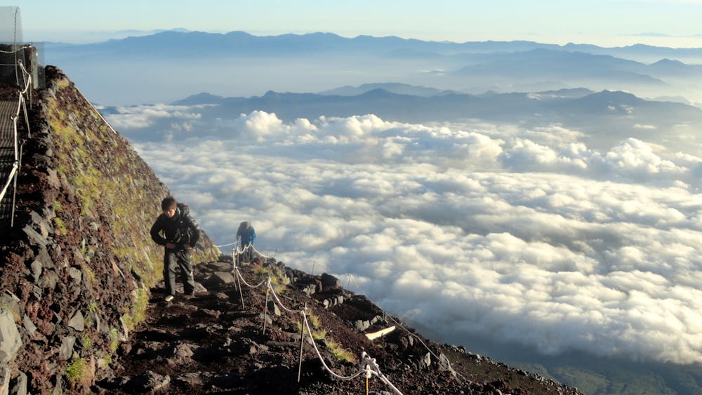
The path from here is not always that solid and can be muddy so watch your footing and concentrate on gaining some height and earning your summit view. As you climb the views get better and better and the trail quality improves too.
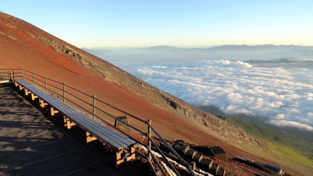
Mount Fuji is famous for the incredible sunrises from its summit so of the many mountain huts en route, pick one that is close enough that you can get to the summit before first light. Which one you pick will depend on how acclimatised you are and how fit you're feeling but whichever one you go for, get up in the early hours and head for the top!
One of the great things about the Yoshida route is that if you get your timings wrong and haven't made the summit by daybreak, you will still see the sunrise to the east.
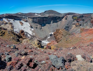
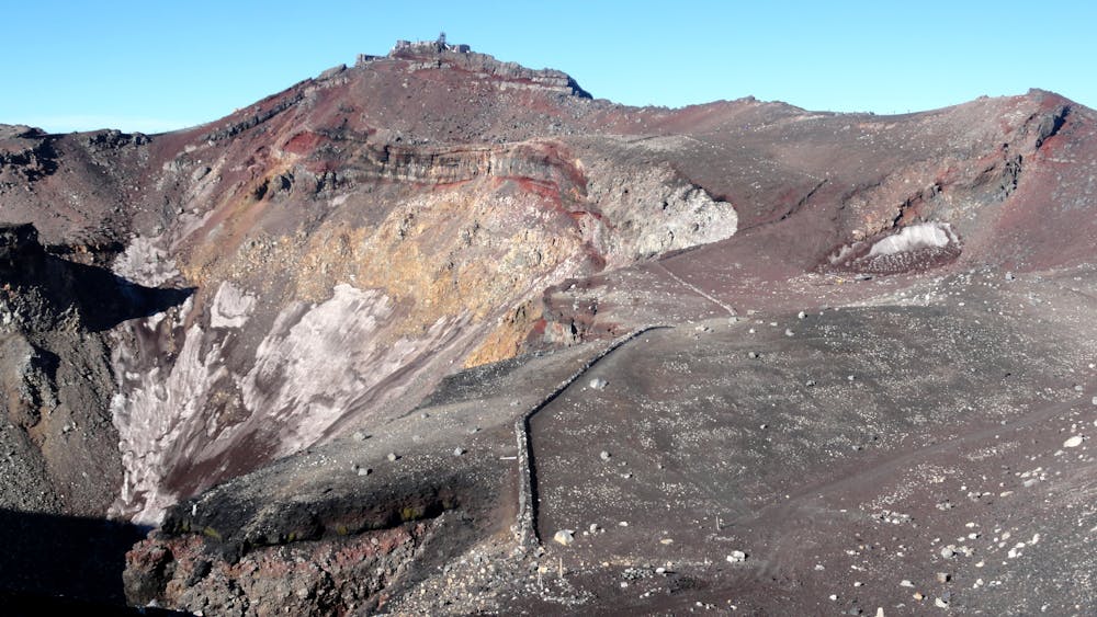
Once you reach the summit crater, follow it around to the Mount Fuji Weather station, the highest point of the mountain. Get settled in and prepare for one of the best sunrises you'll ever see!
There is even a post box on the summit so if you're not panting too hard from the altitude and exertion and can hold your hand steady, write a postcard and send it from the top!
Once the sun is high in the sky and you've taken plenty of photos, carry on around the crater to reach the descent route. There are no mountain huts on the way down but there are a couple of emergency shelters.
Descend all the way back down to the 5th Station and take a bus down to civilisation, where sushi, ramen and beer await!
Difficult
Hiking trails where obstacles such as rocks or roots are prevalent. Some obstacles can require care to step over or around. At times, the trail can be worn and eroded. The grade of the trail is generally quite steep, and can often lead to strenuous hiking.

The trail contains some obstacles such as outcroppings and rock which could cause injury.
Away from help but easily accessed.
6.4 km away
The second most popular route on the mountain which enjoys all the sunshine going
Difficult Hiking