Nevado de Toluca - Walkaround
One way crossing of Toluca
Hiking Moderate
- Distance
- 13 km
- Ascent
- 1.1 km
- Descent
- 737 m
- Duration
- 4-5 hrs
- Low Point
- 3.7 km
- High Point
- 4.6 km
- Gradient
- 24˚

This is a popular hiking route which is generally considered to be moderate. It's remote, it features medium exposure and is typically done between November and February. From a low point of 3.7 km to the maximum altitude of 4.6 km, the route covers 13 km, 1071 vertical metres of ascent and 737 vertical metres of descent.

- •
- •
- •
- •
- •
Description
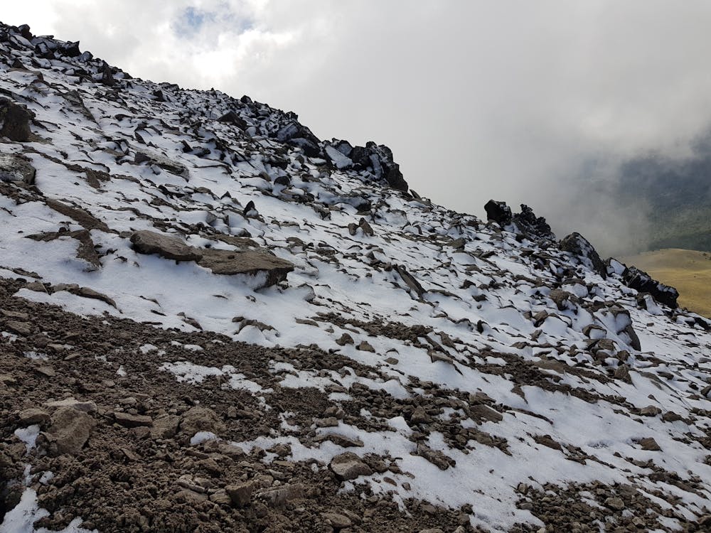
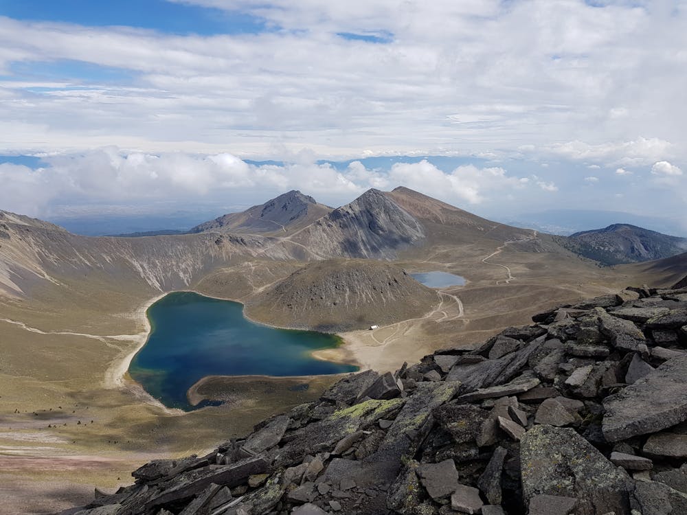
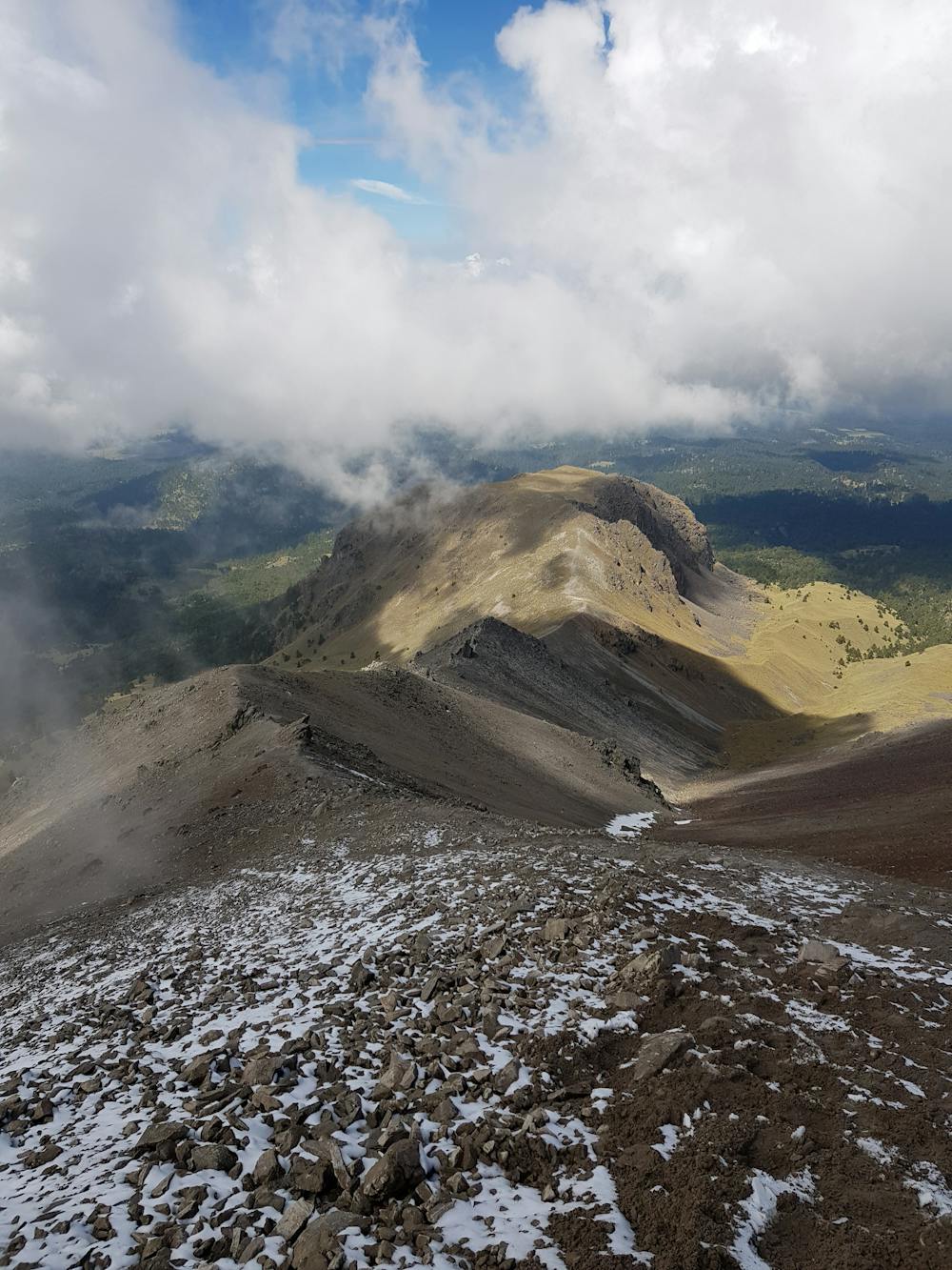
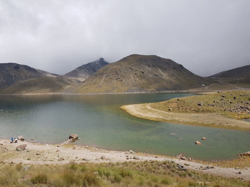
Forest, snowy peaks, rocky landscapes and a wide view.
Difficulty
Moderate
Hiking along trails with some uneven terrain and small hills. Small rocks and roots may be present.
Medium Exposure

The trail contains some obstacles such as outcroppings and rock which could cause injury.
Remoteness
Away from help but easily accessed.
Best time to visit
Features
- Wildlife
- Picturesque
- Summit Hike
- Dog friendly
- Wild flowers
- Forestry or heavy vegetation