12 m away
Mt. Abel, North Couloir
A fantastic half day and accessible ski mountaineering loop
Severe Ski Touring
- Distance
- 1.6 km
- Ascent
- 254 m
- Descent
- 257 m
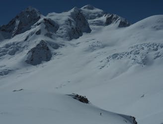
One of the more stunning summits within the Tasman Glacier Area
Ski Touring Difficult

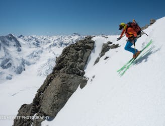
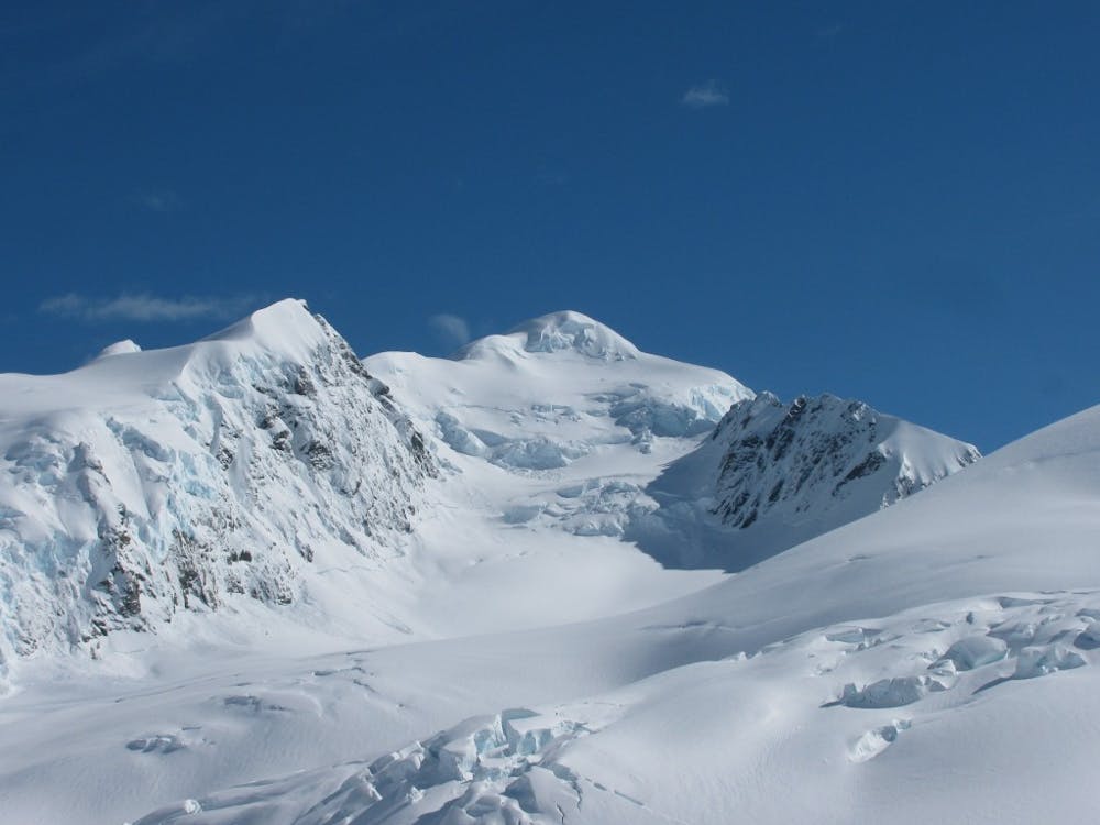
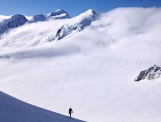
Staying on the Tasman Glacier on a clear day you can’t help but stare across the valley at Ellie De Beaumont. It dominates the skyline as you look towards the west with it being one of the many starting points of the Glacier. While this ski tour can be easily done it needs to be approached with a bit of respect. Navigating up to the summit you will need to pass by numerous crevasses so make sure to bring a rope and the skills to use it. The actually skiing/ climbing season for this summit is relatively short and it must have a healthy snowpack to make the crevasses passable. But if the stars align this is a great and long ski tour which in our experience was powder snow from top to bottom.
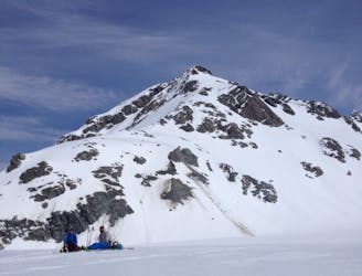
To start off it should be said that the best way to approach the Tasman Glacier is via ski plane or by helicopter. I was once told that hiking up the moraine will destroy your gear and if you think of it that way then paying for a flight is actually cheaper. Once on the upper Tasman Glacier you have the choice between the Tasman Saddle Hut or the Kelman Hut, we always chose the Kelman for its views as well as being supplied with gas cookers but people like to call this the fridge on the ridge, long story short it can get really cold.
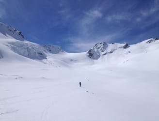
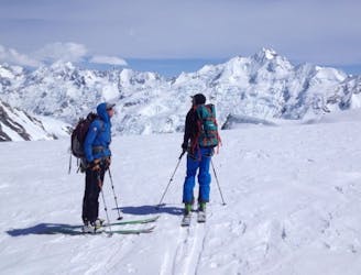
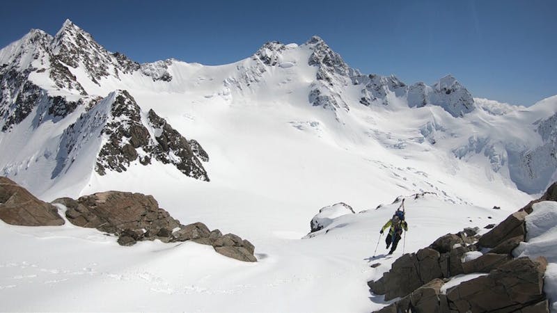
Leaving from the Kelman Hut start skiing towards the Tasman Saddle Hut and after around 200 meters it is time to switch over to skinning. Once you’ve put skins on you need to do a long traverse to the West heading under Hochstetter Dome before arriving on the lower lobe of the Anna Glacier. By now you will need to study your ascent route as it is directly in front of you and only getting closer with every step.
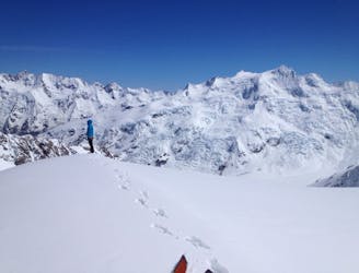
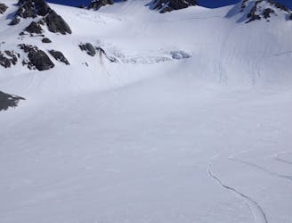
Once you arrive to the base of Ellie De Beaumont head towards the lookers left side wrapping around the lower crevasses before making a hard right to get into the next technical section. The rest of this route is the make or break of the trip as you need to have sufficient snow to find a route trough but heading near the rocks there is a break in the crevasses. Once on top of the next roller make your way once again a bit to the lookers left before finding yet again another route through. After this final glacial crux you need to head directly towards the Southwest ridge to climb the last 150 meters to the top. This ridge is an airy climb as to your right it drops down to the West Coast but with a few well placed steps you will arrive at the summit.
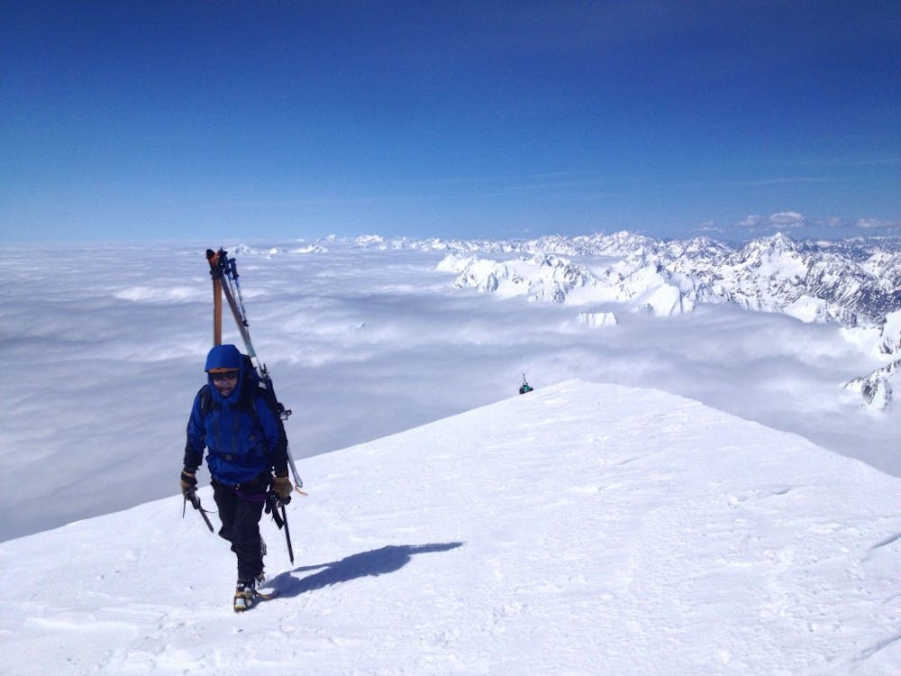
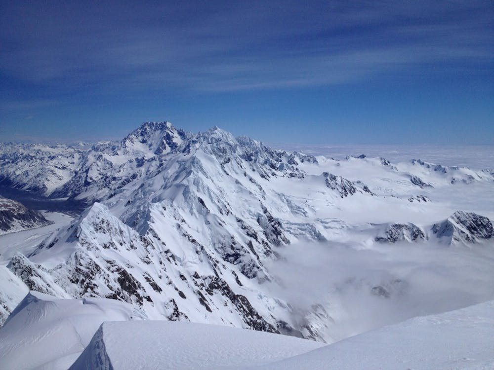
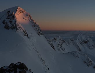
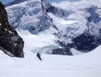
Standing on top you have one of the best views around in all directions. Standing at 3109 meters this is a great view to look around the Southern Alps and South towards Mount Cook. Once all is said and done you need to be cautious about descending back down the way you came up. While riding down you have two options. Either 1 you could ride down to your traverse track and take it back to the hut or 2 you can ride a bit more vert until the Tasman Glacier Bends and climb back up to the Kelman Hut. Both of these options should be based on how much energy you have or how much daylight is left.
For more pictures and the full story check out this link https://www.whereiskylemiller.com/new-zealand/tasman-glacier-ellie-de-beaumont/
Difficult
Serious gradient of 30-38 degrees where a real risk of slipping exists.

As well as the slope itself, there are some obstacles (such as rock outcrops) which could aggravate injury.
Away from help but easily accessed.
12 m away
A fantastic half day and accessible ski mountaineering loop
Severe Ski Touring
17 m away
A great afternoon run on the Tasman Glacier
Easy Ski Touring
22 m away
A great ski tour explore the more remote areas near the Tasman Glacier
Moderate Ski Touring
23 m away
Exploring the seldom visited corners of Mount Cook National Park
Moderate Ski Touring
29 m away
One of the more sustained routes within the Tasman Glacier area
Difficult Ski Touring
30 m away
A nice steep face transitioning from the Tasman to Murchison Glacier
Moderate Ski Touring
30 m away
A stunning traverse through Mount Cook and West Coast National Parks
Difficult Ski Touring
31 m away
A technical but great loop within the Murchison Glacier area
Difficult Ski Touring
33 m away
A nice line within the reach of the Kelman Hut
Difficult Ski Touring
34 m away
A great and non-technical ski tour on the Tasman Glacier
Moderate Ski Touring
17 routes · Ski Touring