6.4 km away
Xenicus Peak
Another great ski tour off the Routeburn Track
Difficult Ski Touring
- Distance
- 9.3 km
- Ascent
- 878 m
- Descent
- 878 m
A scenic ski tour from the Routeburn Hut
Ski Touring Moderate

The Routeburn area is well known within the hiking community and is filled to the brim during the summer months, but the winter time is a different story. The area is known as one of the great walks for a good reason as the views and the surrounded terrain are stunning to say the least. While this area isn’t filled to the brim like the Mount Cook area that doesn’t mean that there isn’t good skiing there. This ski tour is a semi short but sweet run that utilizes the main hiking trail and turns one of the highlights of the summer months into a few good turns.
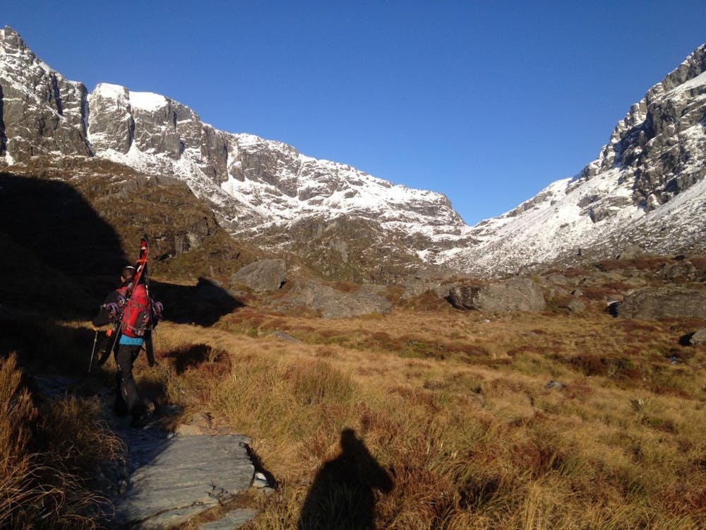
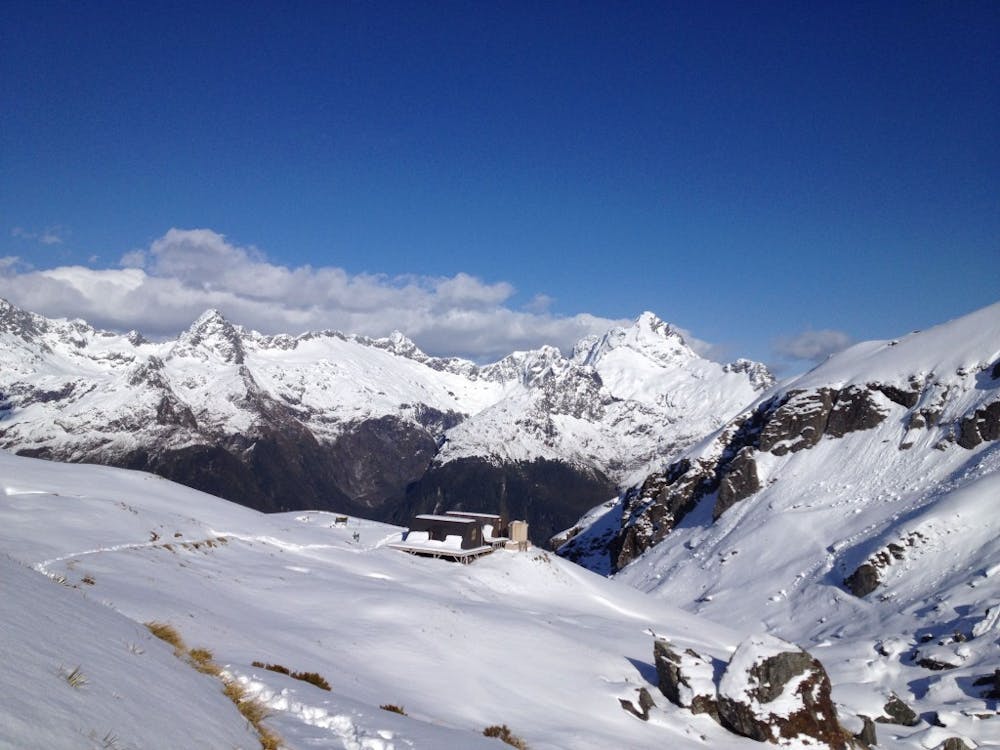
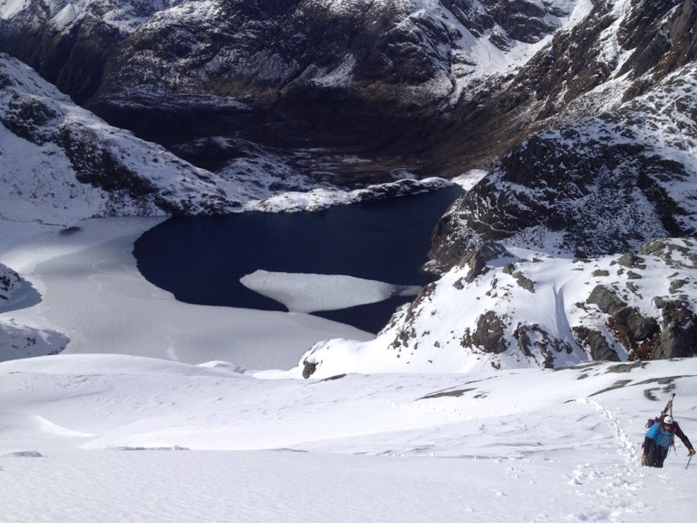
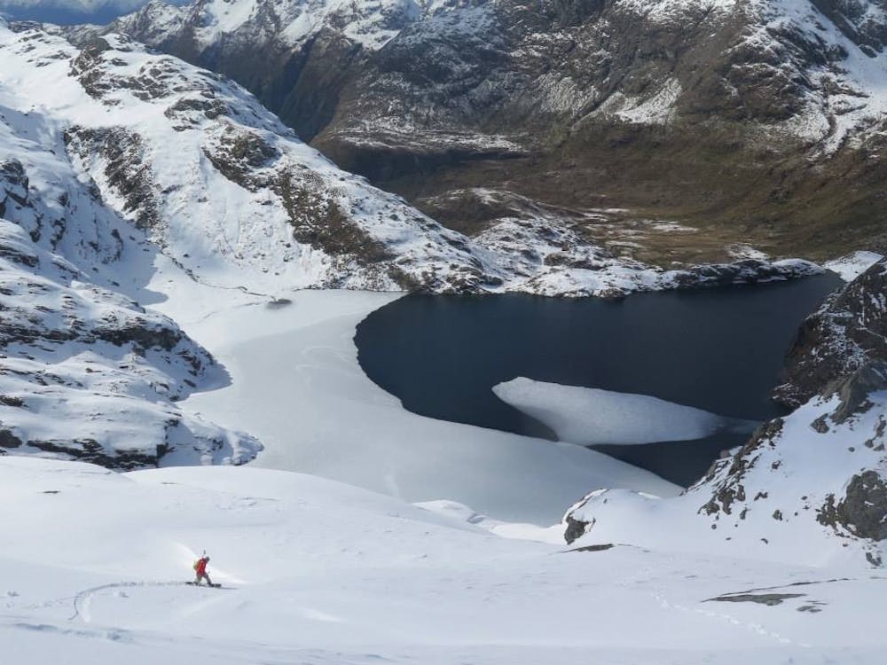
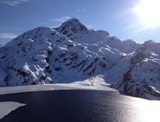
Leaving on the Routeburn Track from the Eastern Side follow the great walk and wide open trail as if it was the height of the summer season. Before long you will arrive at the Routeburn Falls hut where you can leave your overnight gear at the shelter and go out for an afternoon tour. Heading up into the alpine you will soon find yourself near the shoreline of Lake Harris as you head out to Harris Saddle and what should be a snow covered shelter.
From Harris Saddle make your way north following what should be the summer trail which starts semi steep but mellows out quickly.Traversing northwest on the terrain you will soon be just below Conical Hill were you will do the final steps up its Southeast slope before arriving on the summit. From here you have a great view of Fjordland and the high alpine terrain of the Routeburn Track. Knowing that the hut isn’t that far away take your time to make the most out of the views before descending on the route you had just climbed. Once back at Harris Saddle it is time to put your gear on the backpack and make your way back to the Routeburn Falls Hut.
For more pictures and the full story check out this link https://www.whereiskylemiller.com/new-zealand/routeburn-track/
Moderate
Slopes become slightly steeper at around 25-30 degrees.

As well as the slope itself, there are some obstacles (such as rock outcrops) which could aggravate injury.
Away from help but easily accessed.
6.4 km away
Another great ski tour off the Routeburn Track
Difficult Ski Touring