10 routes · Hiking
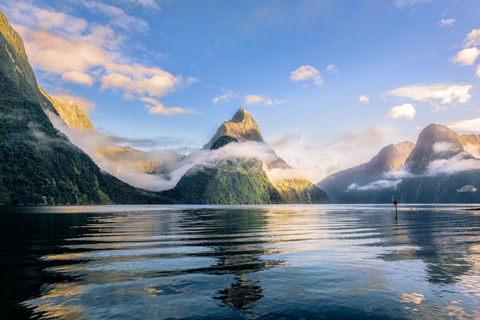
A 60 kilometre loop which passes through some of New Zealand's most impressive scenery (and that's saying something) close to the small town of Te Anau in the Fjordland region of the South Island.
Hiking Moderate
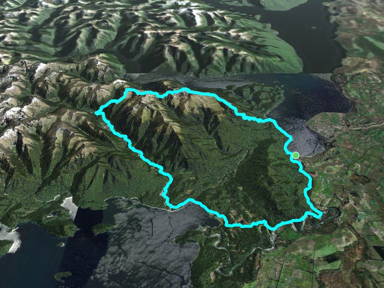
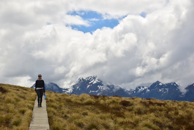
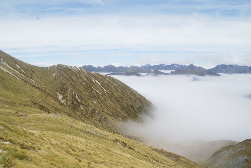
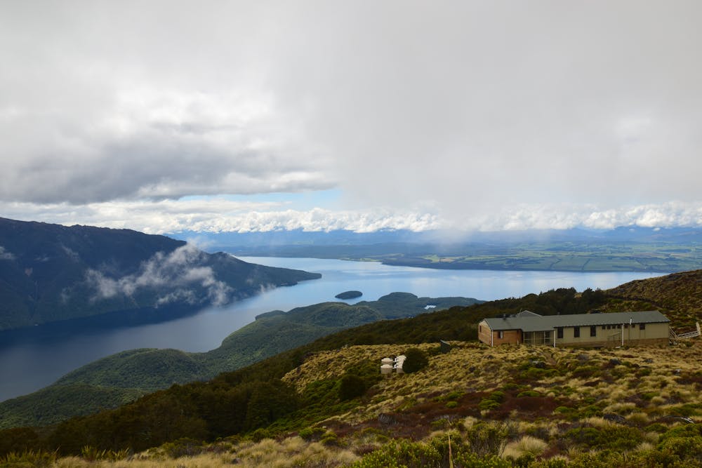
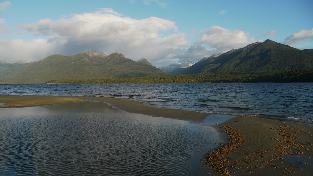
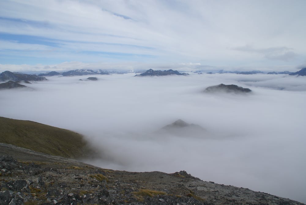
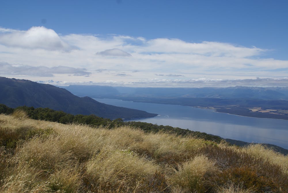
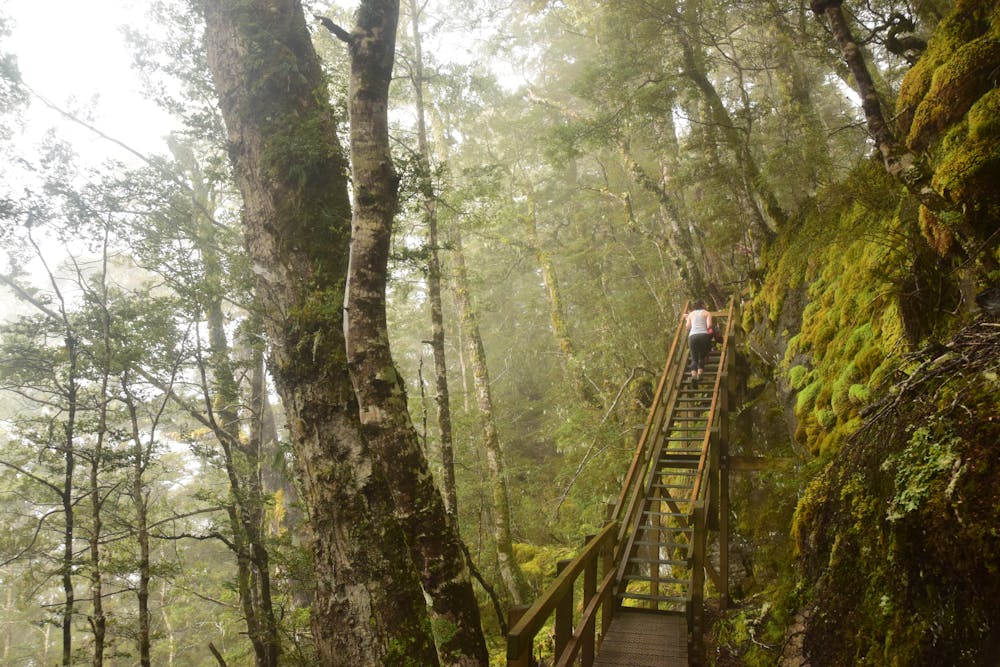
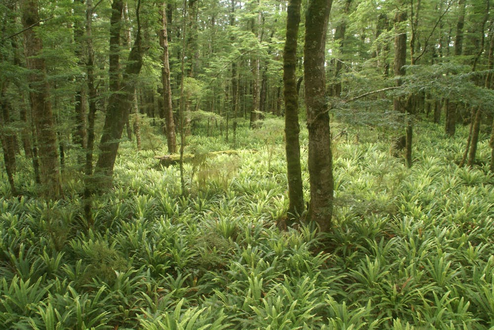
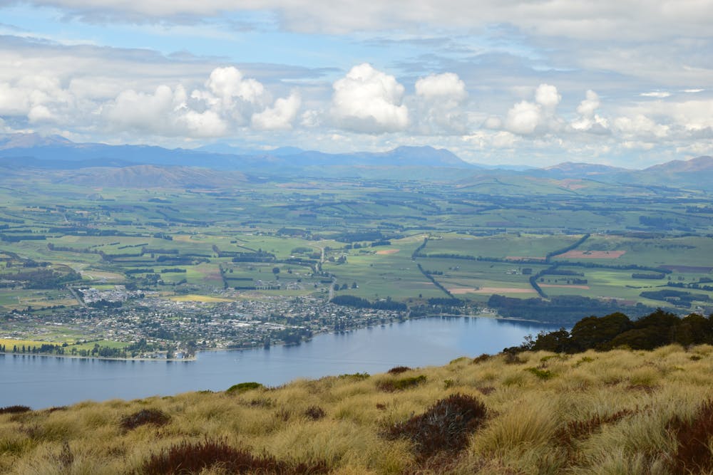
A circular hike, the Kepler Track is one of the jewels in New Zealand's impressive hiking crown. As the trail makes its way through Fjordland it encounters a staggering diversity of landscapes, from lake shores, gorges, forests, wetlands to high mountains. The path is excellent throughout which means that you can complete the hike in 3 -4 not-too-tough days. The New Zealand Department of Conservation (DOC) has 3 manned huts on the route, and 2 campsites. The huts cost NZ$65 per night and have running (cold) water, beds, cooking and toilet facilities and heating, but they are not catered and you will need to carry your own food. The campsites, which are NZ$20 per night, have running water and cooking shelters, but no cooking facilities. Whichever option you choose, these facilities are generally open from late October until late April and you will need to book in advance because the track is popular. The hike starts at Lake Te Anau Control Gates and leads gently along the forested shoreline of the lake (which is Australasia's largest body of fresh water), to Brod Bay and then a tough climb to above the tree line, at which point the Luxmore Hut is 45 minutes away. From the hut, climb to a ridge line just below Mount Luxmore and follow this, enjoying the view of the Murchison Mountains all the way, to the Iris Burn Hut. From the hut the trail crosses a saddle then goes through a gorge and some beautiful forests before emerging at the Moturau Hut, on the shore of Lake Manapouri. From here a simple but beautiful walk on a good wooden walkway leads through wetlands back to the road.

Moderate
Hiking along trails with some uneven terrain and small hills. Small rocks and roots may be present.

The path is on completely flat land and potential injury is limited to falling over.

Little chance of being seen or helped in case of an accident.
10 routes · Hiking
9 routes · Hiking