37 m away
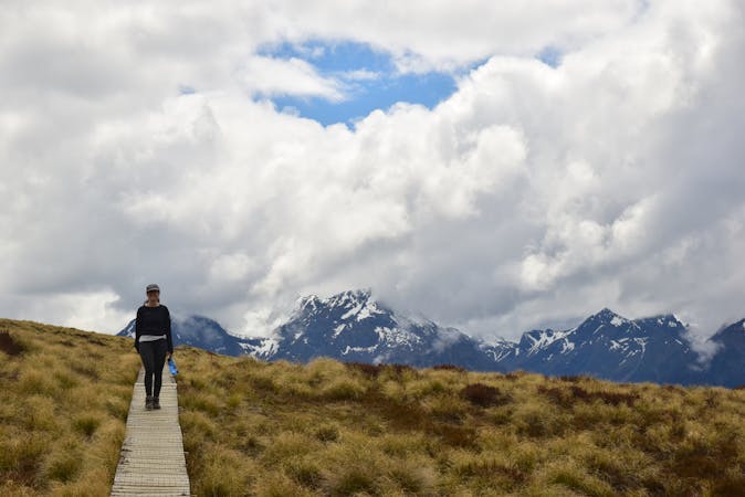
Routeburn Track
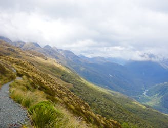
Possibly the most famous hike in The Long of the White Cloud, this is New Zealand at its very finest.
Moderate Hiking
- Distance
- 32 km
- Ascent
- 1.7 km
- Descent
- 1.7 km
Routeburn Track to górski szlak łączący dwa wyjątkowe parki Narodowe, Fiordland i Mount Aspiring.
Also in Otago, New Zealand
Hiking Difficult

Routeburn Track to górski szlak łączący dwa wyjątkowe parki Narodowe, Fiordland i Mount Aspiring. Porośnięte mchem i paprociami lasy, szumiące wodospady, strumienie i górskie stawy, ostre szczyty i strome przepaści - oto widoki, jakich możesz spodziewać się na tym naprawdę niesamowitym szlaku.
WIĘCEJ NA https://bezsygnalu.pl/routeburn/
Difficult
Hiking trails where obstacles such as rocks or roots are prevalent. Some obstacles can require care to step over or around. At times, the trail can be worn and eroded. The grade of the trail is generally quite steep, and can often lead to strenuous hiking.

Some trail sections have exposed ledges or steep ascents/descents where falling could cause serious injury.

Away from help but easily accessed.
37 m away
Possibly the most famous hike in The Long of the White Cloud, this is New Zealand at its very finest.
Moderate Hiking
10 routes · Hiking
9 routes · Hiking