6 m away
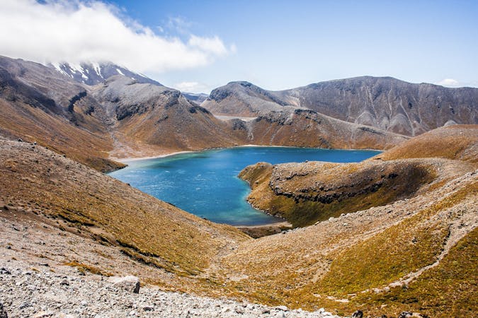
Tongariro Alpine Crossing
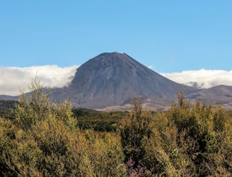
Traverse active volcanoes in New Zealand's oldest national park.
Difficult Hiking
- Distance
- 20 km
- Ascent
- 808 m
- Descent
- 1.2 km
NZs best one day walk....
Also in Manawatu-Wanganui, New Zealand
Hiking Difficult

This is a popular hiking route which is generally considered to be difficult. It's remote, it features medium exposure and is typically done between September and May. From a low point of 757 m to the maximum altitude of 1.8 km, the route covers 20 km, 813 vertical metres of ascent and 1180 vertical metres of descent.
20ks of alpine walking which includes awesome volcanic landscape and features along with beautiful podocarp forest at the end.
Difficult
Hiking trails where obstacles such as rocks or roots are prevalent. Some obstacles can require care to step over or around. At times, the trail can be worn and eroded. The grade of the trail is generally quite steep, and can often lead to strenuous hiking.

The trail contains some obstacles such as outcroppings and rock which could cause injury.
Away from help but easily accessed.
6 m away
Traverse active volcanoes in New Zealand's oldest national park.
Difficult Hiking
19 m away
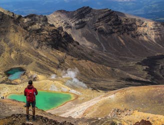
The world's best day hike? The Tongariro Alpine Crossing is certainly one of them. Boasting picture-perfect surrounds, it is a must-do for anyone on the North Island.
Moderate Hiking
5 routes · Hiking
9 routes · Hiking