220 m away
Dronningkrona - glacier route
Stunning scenery with ocean view and glacier travel
Difficult Ski Touring
- Distance
- 19 km
- Ascent
- 1.9 km
- Descent
- 1.9 km
An epic alpine traverse with several S/SW facing couloirs to descend
Ski Touring Difficult

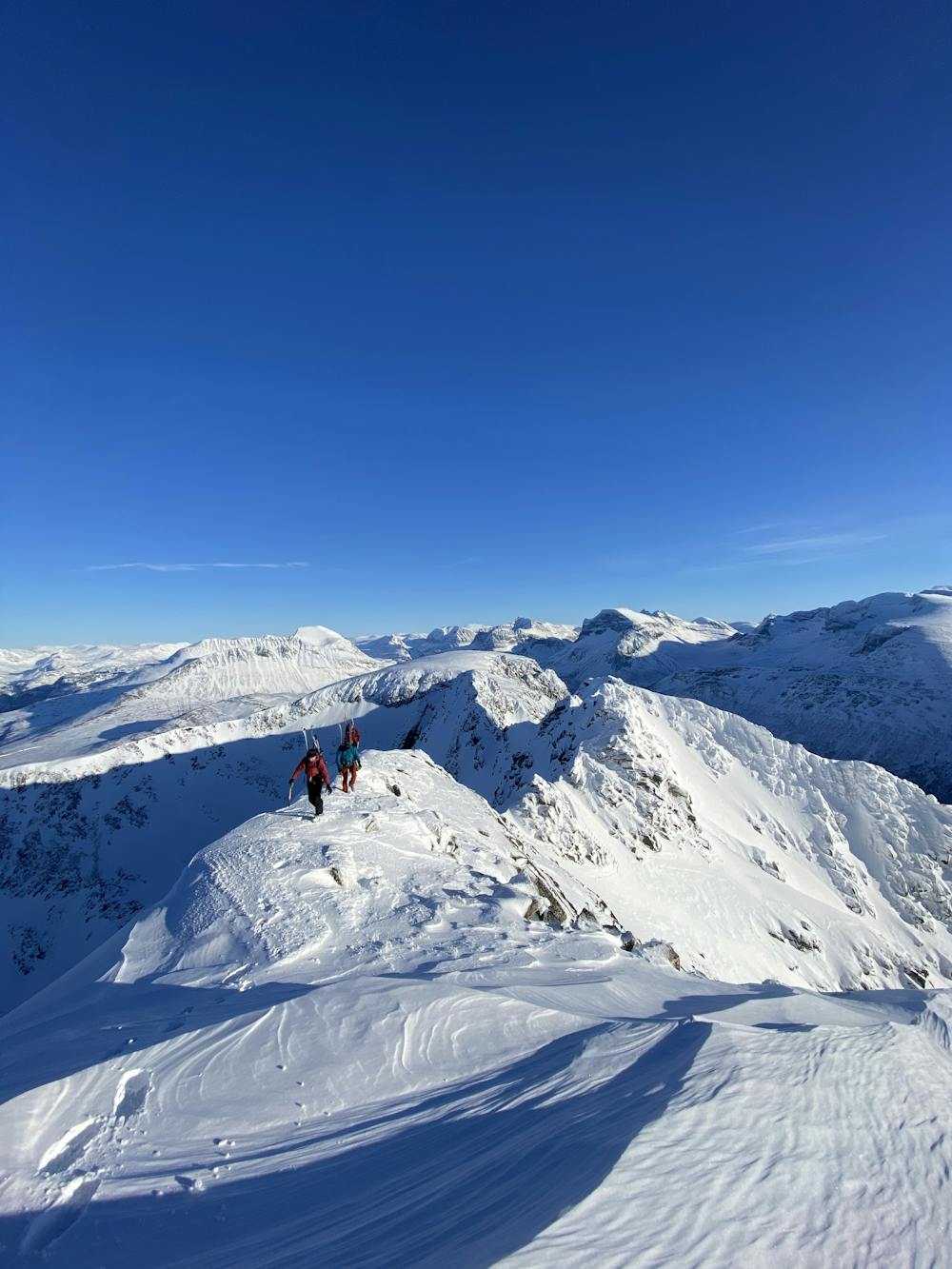
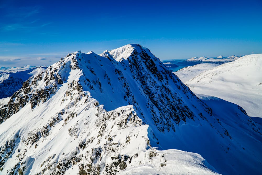
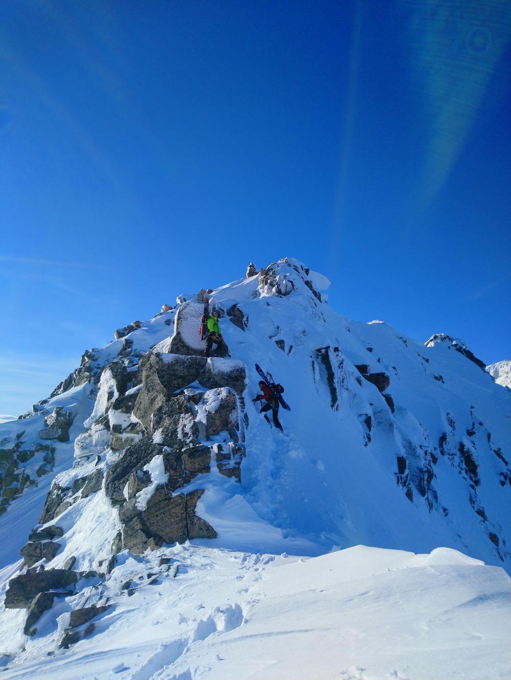
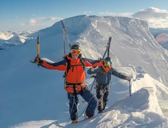
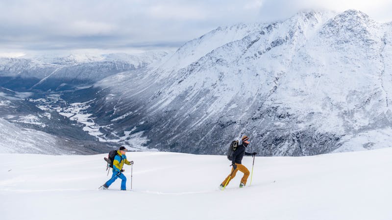
This is a classic traverse taking you along a narrow arete in the Innerdalen valley. As the ridge narrows it offers moderate exposure along with phenomenal views of the surrounding peaks including Snøfjellet, Innerdalstårnet and Kongskrona. This trip is recommended for anyone looking to put some technical alpine skills to use and have a variety of steep skiing down narrow south /southwest facing couloirs. This trip can easily take a full day with a larger group (3+) due to its technical nature and likely rappels.
The trip starts from the Innerdalen parking area. Begin walking west along the road before you can start skinning up towards the east ridge of Viromkjerringa. The approach to the ridge has many boulders so the route finding can be difficult and frustrating. There is a powerline you can also follow up with a slightly more cleared area, but still with a lot of boulders to navigate around.
Once on top of the ridge, continue west until you reach the summit. The ridge traverse requires moderate scrambling, and it is necessary to use ice axe and crampons. There is also a section that often requires a rappel (~7m) to navigate across. This rappel may require building your anchor, since the existing anchor can be difficult to find or may not be in a condition worth using. It's a good idea to bring a long cord or sling and a few nuts, hexes or gear that you would be willing to leave. While this traverse can be completed without a rappel when snow conditions are more favorable, which allow for an exposed, yet manageable downclimb, a rappel is the safest option.
From the top of the ridge, you have several southwest-facing couloirs you can choose to ski down or continue further west and ski the more popular west-facing couloir towards Børsetkjerringa. Whichever way you decide to ski down, you can then traverse across towards the ski resort and ski down well-groomed trails into the sunset.
It is recommended to set up a shuttle with a second car at the ski resort parking lot as it is fairly easy to traverse into the ski resort and avoid having to bushwhack to the main road.
Difficult
Serious gradient of 30-38 degrees where a real risk of slipping exists.

In case of a fall, death is highly likely.

Away from help but easily accessed.
220 m away
Stunning scenery with ocean view and glacier travel
Difficult Ski Touring
264 m away
The 'Mont-Blanc of north-western Norway' offers glacier adventure and great skiing.
Difficult Ski Touring
8 routes · Ski Touring