2 km away
Justadtinden Summit Trail
A stunning Lofoten hike with a bit of an easy scramble.
Difficult Hiking
- Distance
- 13 km
- Ascent
- 803 m
- Descent
- 803 m
Easy half-day Lofoten ridge hike with fabulous summit Views!
Hiking Moderate

Norway is famed throughout the world for being one of the most dramatic and breathtaking places on the planet! As a result, it's a haven for adventurous explorers.
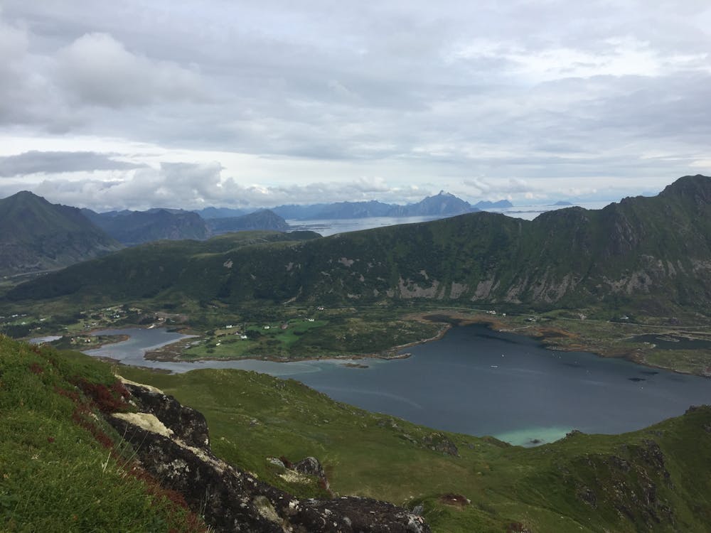
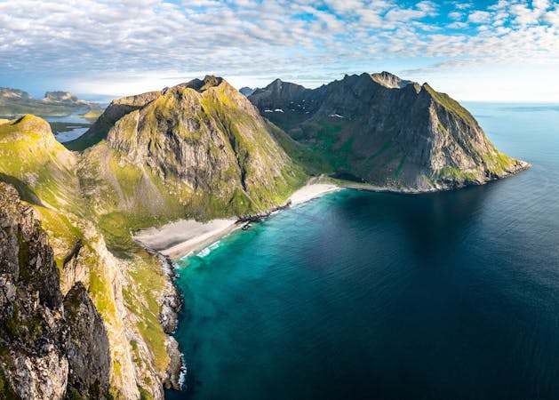
The Lofoten Islands, some would argue, offer the most spectacular of the drama and scenery with hundreds of rugged, foreboding mountains soaring out of the sea, looming high over deep, majestic fjords and with smaller bubble-like islands interspersed.
The Lofoten archipelago on the western coast of Norway is within the Arctic Circle, making it a destination with a restricted period for exploration. All of this makes for a very special, memorable, and challenging place to hike.
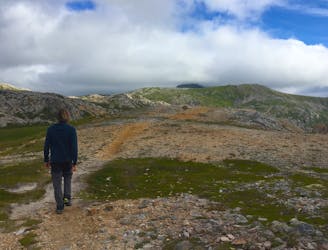
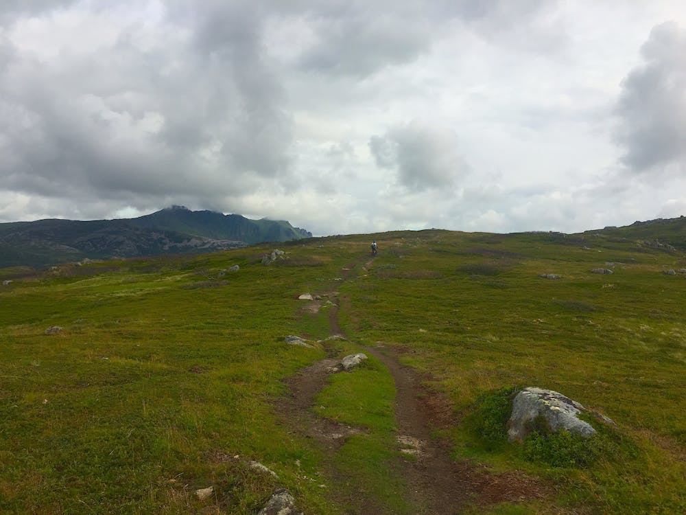
The steep landscape of this stunning area offers plenty of hiking opportunities, and this trail delivers everything you'd expect from this region. It's an easy hike available to all with a low to average level of fitness.
This route is an out and back and is mostly all easy going, except for one very short section that is steeper than the rest. It still does require any scrambling and occurs within the first couple of kilometers. Apart from that, the route to the highest point of Finngluntan has a steady, easy gradient.
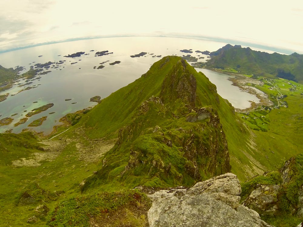
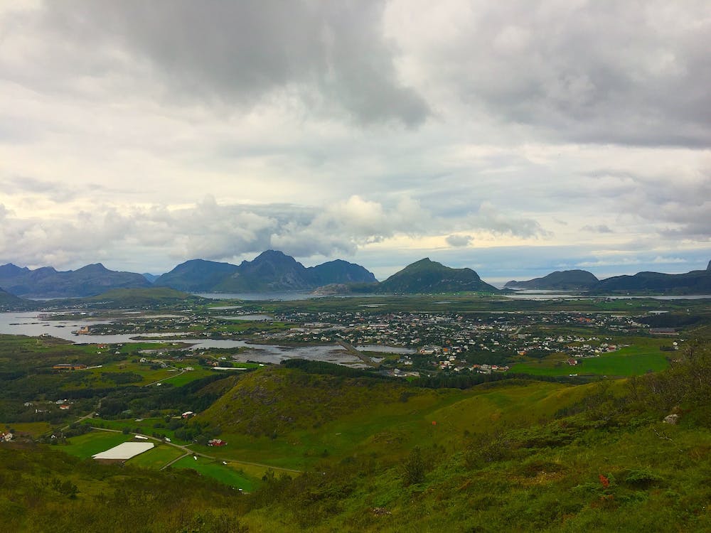
The only part of the route that has some exposure is at Finngluntan. The rest of the route enjoys height but with little to cause anxiety. The panoramic views from this point are incredible, looking over toward neighbouring mountains and ridges, down to fjord and sea ingresses, with small villages dotted around and out to the Arctic Ocean.
To return, follow the same route down. The scenery is enjoyed from a different and stunning viewpoint.
Moderate
Hiking along trails with some uneven terrain and small hills. Small rocks and roots may be present.

Some trail sections are extremely exposed where falling will almost certainly result in serious injury or death.

Close to help in case of emergency.
2 km away
A stunning Lofoten hike with a bit of an easy scramble.
Difficult Hiking
2 routes · Hiking