4.9 km away
Vagakallen South Couloir
A hidden gem on an impressive rocky peak.
Severe Ski Touring
- Distance
- 6.2 km
- Ascent
- 639 m
- Descent
- 639 m
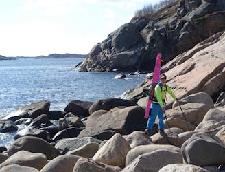
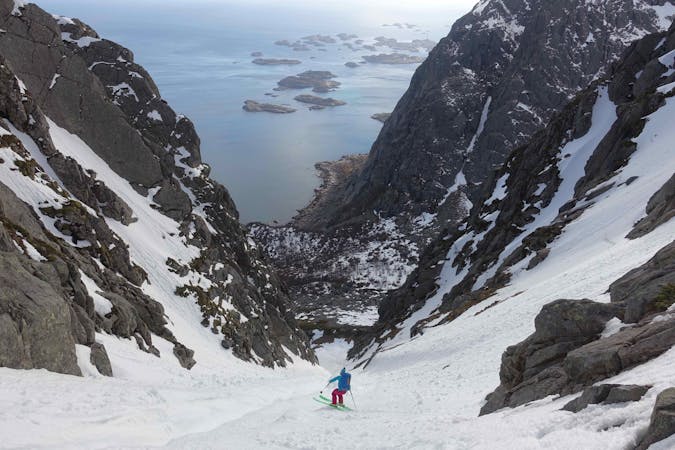
Boot packing straight up from the sea with zero approach from the parking and 500 vertical meters of steep skiing from the iconic Presten mountain.
Ski Touring Severe

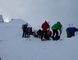
The Presten couloir is an eye-gripping line that cuts the surrounding steep rock walls in two by its snowy white stripe that is easily seen from the road. The Presten mountain itself is impossible to miss with its huge granite slabs almost shooting up from the sea. On its west side is a skiable couloir, not the longest with about 500 vertical meters of elevation but fun and interesting skiing for a quick tour. There are several parking options alongside the road towards Henningsvær and under Presten itself. It makes sense to start boot packing straight up from the car. For days with bad visibility the couloir offers reference and can be a good objective, but always assess the snow safety first as it is a natural path for avalanches.
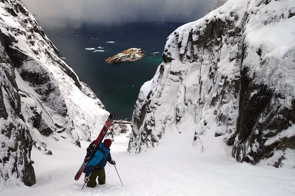
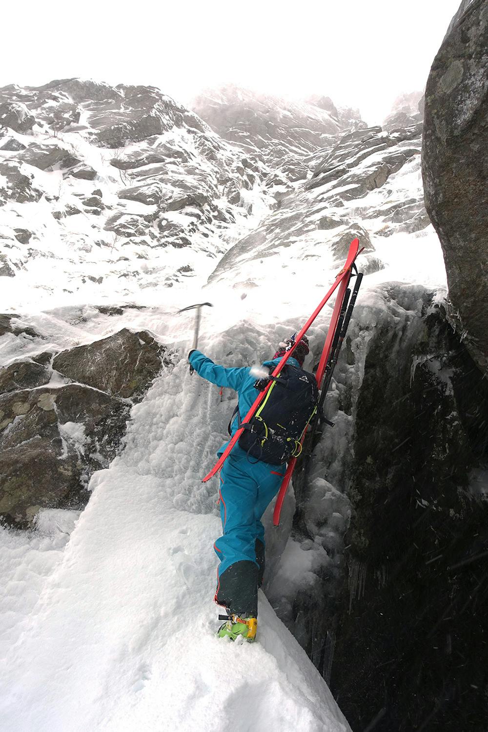
The route finding is straightforward. If not perfectly filled in there is often a small rock or ice step roughly half way up that can require a few meters of mixed climbing on the ascent and consequently a down climb or rappel on the descent. There is no fixed anchor here but ice screws can come handy alongside a small rack of gear. In the top of the couloir, instead of following the natural line straight up, you want to climb out right to reach a top ridge with nice views over towards Henningsvær. You’ve been climbing in the shade and if the weather is right you may get a few sunrays straight in your face as you take off the crampons! The skiing starts from the ridge. The top ridge can often be windy and doesn’t offer a lot of space but is surely a nice spot.
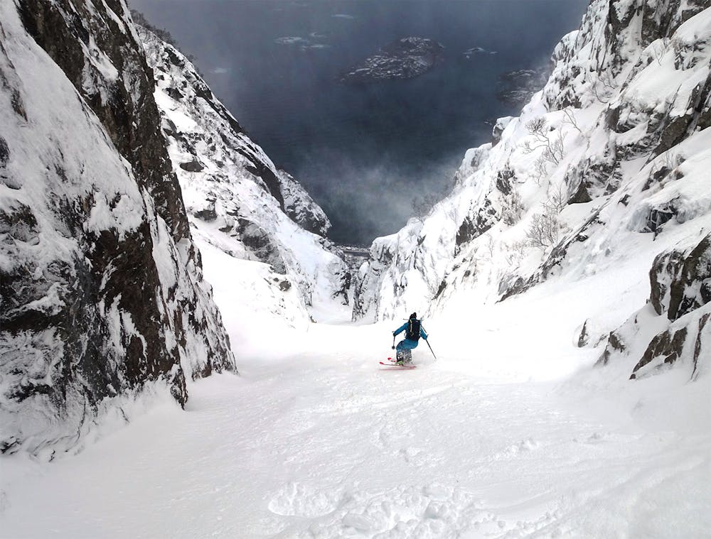
The descent follows the same way as you climbed up. It is <45°steep and you often get to work on the jump turns as you face down with the ocean straight below you. The couloir gets narrower towards the ice/rock step. Watch out for hidden rocks on its banks and any ice and snow that may fall into the couloir from its sidewalls. The skiing feels quite spectacular and proper sluff management is mandatory on deep days! If you are a team skiing together, it can be worth on the ascent to scout out good places to stop for the way down to avoid getting sluffed by your friends! After passing the potential cruxy step mid ways that you climbed across on the ascent, the couloir opens up a bit. In deep snow you can enjoy bigger turns towards the end. Keep in mind the rocks at the bottom! In hard snow conditions, a fall anywhere in the couloir can have very severe consequences. Once down, grasp the views of the sea just a few meters away. It’s a wild spot
Severe
Steep skiing at 38-45 degrees. This requires very good technique and the risk of falling has serious consequences.

As well as the slope itself, there are some obstacles (such as rock outcrops) which could aggravate injury.

Close to help in case of emergency.
4.9 km away
A hidden gem on an impressive rocky peak.
Severe Ski Touring
9.9 km away
Two classic ski touring peaks which make for an awesome quick hit.
Difficult Ski Touring

20 routes · Freeride Skiing · Ski Touring
5 routes · Ski Touring