6 km away
Rondeslottet
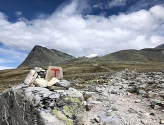
The majesty of Rondane, the highest peak in Norway's oldest natural resort offers great view in all directions
Severe Hiking
- Distance
- 13 km
- Ascent
- 1.3 km
- Descent
- 1.3 km
Approach to Rondvassbu, the best base for adventures in Rondane
Hiking Easy

This is the approach Rondvassbu which is located in the heart of Rondane.


From the parking lot at Spranget, just follow the road on the other side of the barrier, approximately 6 km to Rondvassbu. Alternatively you can either follow marked trails going parallel with the road. You can also rent a bike for 125 NOK at the parking lot to speed up the approach.
Easy
Walking along a well-kept trail that’s mostly flat. No obstacles are present.

The path is on completely flat land and potential injury is limited to falling over.
Close to help in case of emergency.
6 km away
The majesty of Rondane, the highest peak in Norway's oldest natural resort offers great view in all directions
Severe Hiking