Lyngsdalen and Pollfjellet
Lyngen
Hiking Lyngsdalen and summiting the southern peak of Pollfjellet
Hiking Severe
- Distance
- 28 km
- Ascent
- 1.5 km
- Descent
- 1.5 km
- Duration
- 1 day +
- Low Point
- 15 m
- High Point
- 1.1 km
- Gradient
- 18˚

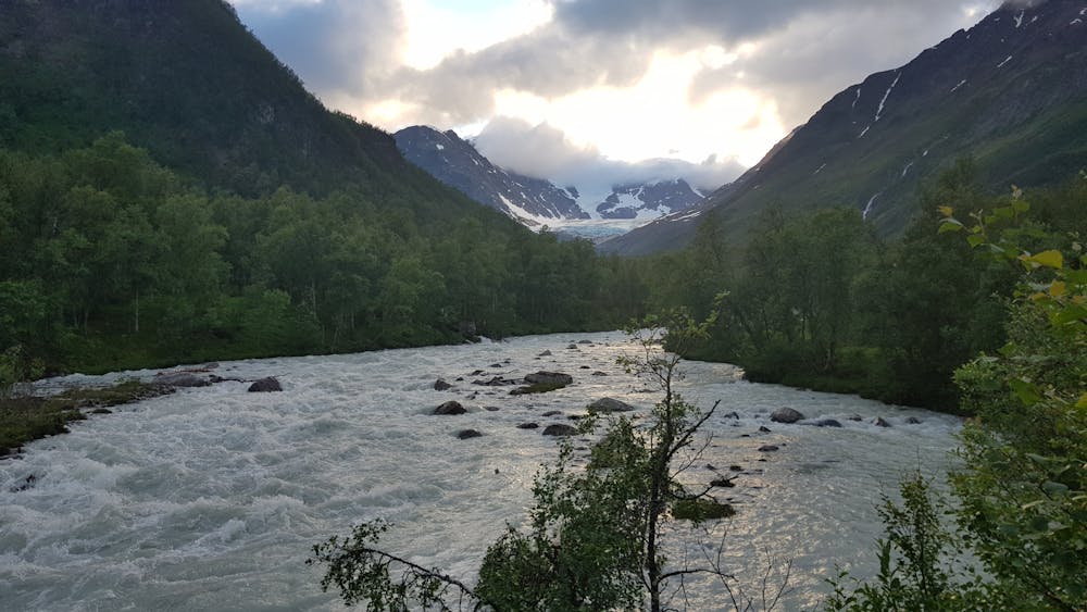
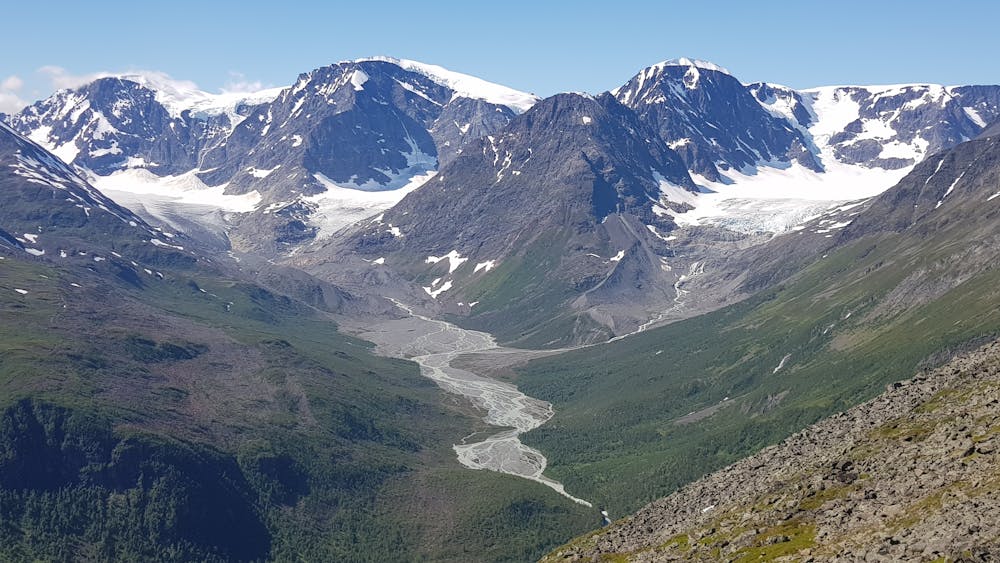
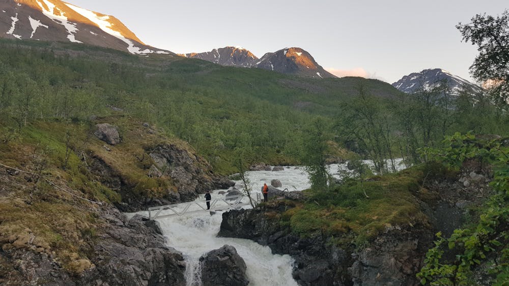
Lyngsdalen is a well marked and moderate trail starting and ending at Furuflaten. A lot of sheeps in the area. Track follows the Lyngsdalselva which is a fast-flowing proglacial river. Many impressive rapids on the way to the hut Lyngsdalshytta. When you reach the hut, stunning views on the glacier terminus opens up.
- •
- •
- •
- •
- •
Description
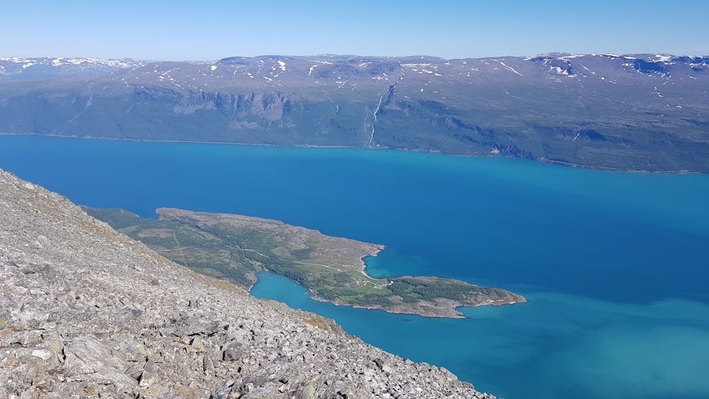
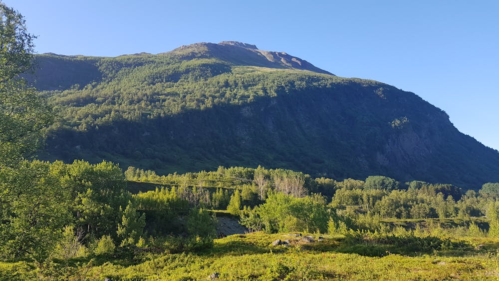
The way up to Pollfjellet is way more challenging and exposed than the track in the valley. There is an almost hidden track up towards Pollfjellet until the treeline. It is steep and used by the local sheeps (be aware of the rather slippery 'minefield' left by the sheeps). Above the treeline, navigate towards the ridge. A lot of steep parts where scrambling is necessary and plenty of loose rocks. It gets easier when you reach the flatter summit area. On the summit, there are magnificent views on fjord, glaciers and river valley.
Difficulty
Severe
Hiking challenging trails where simple scrambling, with the occasional use of the hands, is a distinct possibility. The trails are often filled with all manner of obstacles both small and large, and the hills are very steep. Obstacles and challenges are often unexpected and can be unpredictable.
High Exposure

Some trail sections have exposed ledges or steep ascents/descents where falling could cause serious injury.
Remoteness
Little chance of being seen or helped in case of an accident.
Best time to visit
Features
- Alpine
- Wildlife
- Picturesque
- Summit Hike
- Wild flowers
- Water features