76 m away
Tafeltinden (1395m)
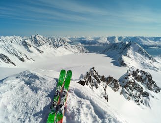
A great ski touring classic in the Lyngen Alps
Moderate Ski Touring
- Distance
- 16 km
- Ascent
- 1.6 km
- Descent
- 1.6 km
A big glacier trip to the heart of Lyngen
Ski Touring Moderate
This route is a spring classic, and takes you right to one of the more stunning areas of Lyngen, with less risk involved than some of the other objectives in the area. Beware that the initial valley is a terrain trap though and has big avalanches every year, so don't go if you're at all unsure about the stability of the snow. Check varsom.no for the current avalanche bulletin, and bring a guide unless you're trained in avalanche assesment.
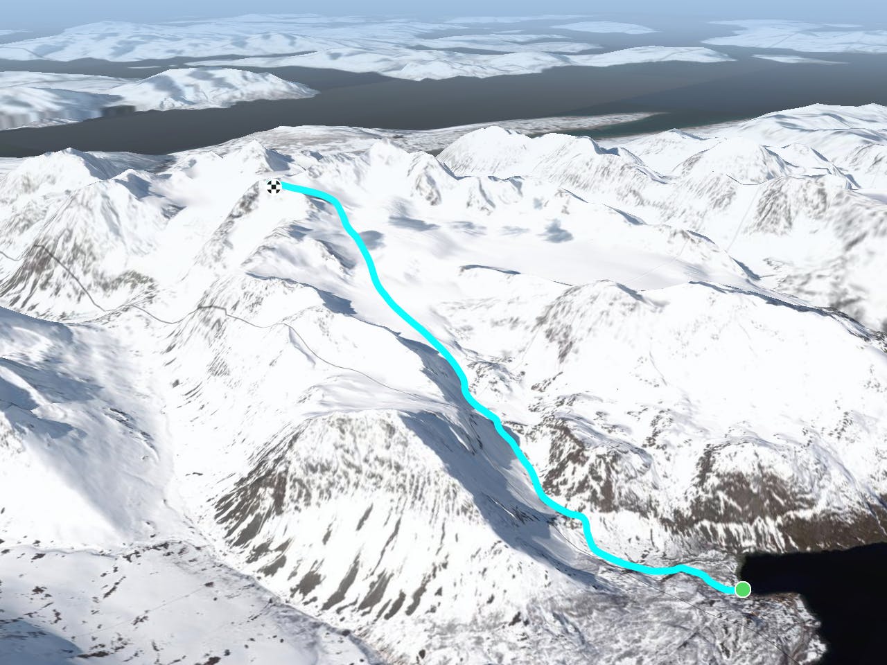
Take the clearing in the woods from the parking lot and cross the stream. The first steep slope is best taken on the right of the waterfall, and then follow the valley up towards the glaciers. Here you're concerned about overhead hazard on your left.
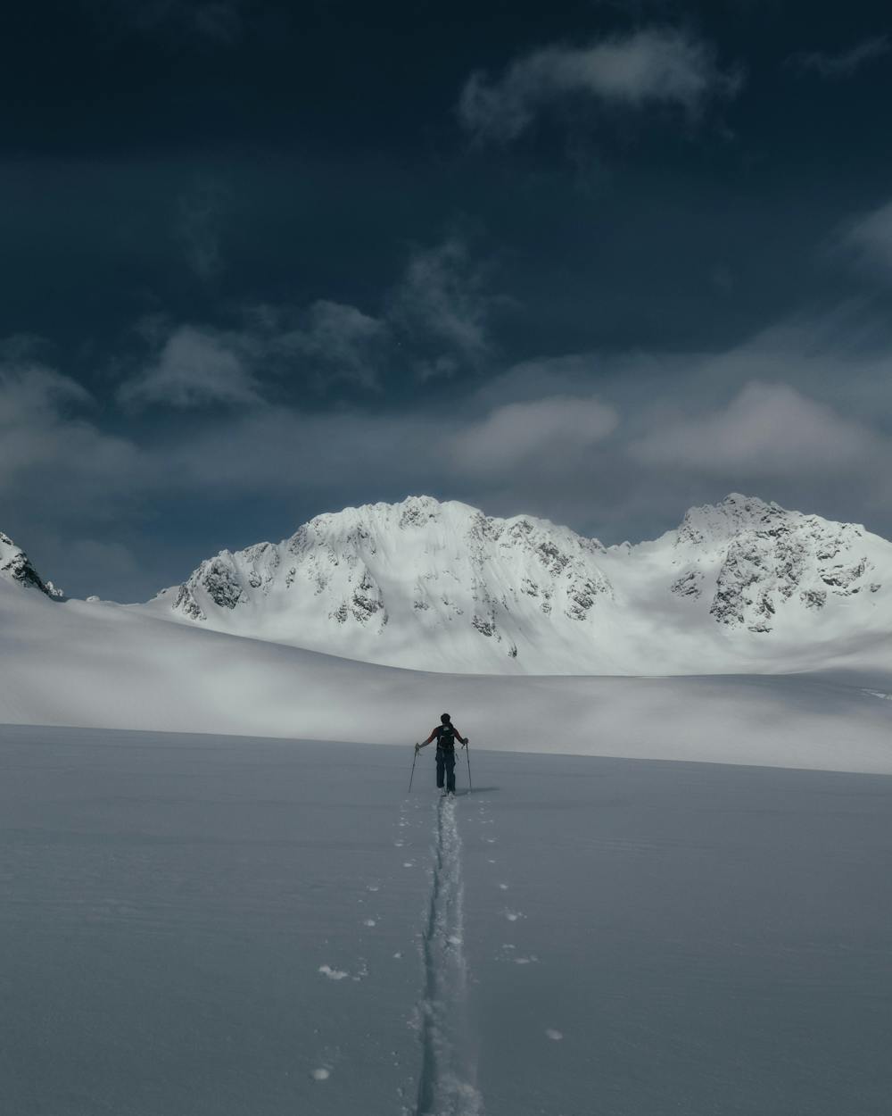
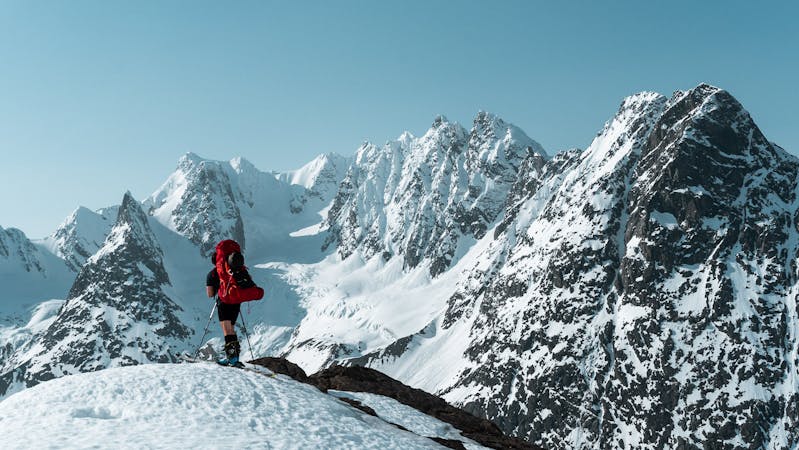
Once you're on the glaciers it's all about enjoying the amazing view and strolling your way up from Koppangsbreen to Strupbreen, where you'll have the mighty Lenangstindan right in front of you. Take a left there switch back up to Tafeltind. The last slope to the peak is also avalanche terrain. From there on you have one of the longest sustained powder runs in Lyngen, so enjoy!
A must do if you only visit Lyngen once.
Moderate
Slopes become slightly steeper at around 25-30 degrees.

Exposure is limited to that of the slope itself. Getting hurt is still likely if the slope is steep and/or the snow is hard.

Away from help but easily accessed.
76 m away
A great ski touring classic in the Lyngen Alps
Moderate Ski Touring
10 routes · Ski Touring