19 m away
Sol i Aire Point-to-Point
A flowy, intermediate-friendly descent.
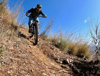
Difficult Mountain Biking
- Distance
- 11 km
- Ascent
- 186 m
- Descent
- 418 m
An intermediate/advanced descent at the north end of Collserola.
Mountain Biking Difficult

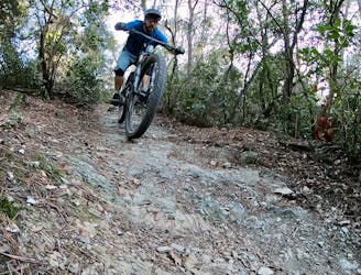
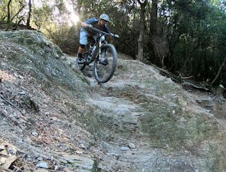
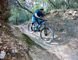
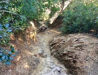
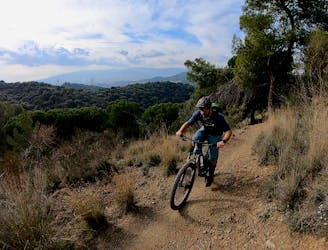
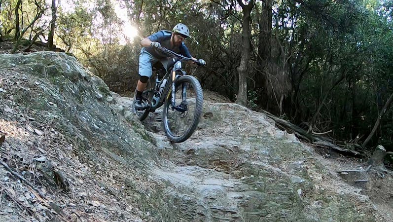
The Trialera Bonita loop is an upper intermediate ride in the northern end of Parc de Collserola. The main descent down the Trialera is on the easier end of the singletrack trails in Collserola, but don’t expect it to be easy. Anticipate unmarked challenges, rock gardens, and exposed slabs of bedrock.
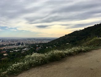
As with all rides in this region of Collserola, you can choose to either pedal up the pavement or ride to the top in the funicular. The route as mapped here runs from the top of the funicular, near el Tibidabo, to the top of the main singletrack descent, down the trail, back up the mountain, and then returns to the top of the funicular. Alternatively, you could begin this route form Cerdanyola del Valles.
If you complete the route as mapped, you can also opt to descend down the frontside of the mountain back to Barcelona. Popular descents include La Secreta and Raizes -> Cosmo Caixa.
Difficult
Mostly stable trail tread with some variability featuring larger and more unavoidable obstacles that may include, but not be limited to: bigger stones, roots, steps, and narrow curves. Compared to lower intermediate, technical difficulty is more advanced and grades of slopes are steeper. Ideal for upper intermediate riders.

The trail contains some obstacles such as outcroppings and rock which could cause injury.
Away from help but easily accessed.
19 m away
A flowy, intermediate-friendly descent.
Difficult Mountain Biking
19 m away
An incredible enduro ride down three of the best descents in Collserola.
Extreme Mountain Biking
22 m away
A delightful enduro ride deep in Collserola.
Severe Mountain Biking
1.6 km away
A quick singletrack loop located right on the outskirts of Barcelona.
Severe Mountain Biking
1.9 km away
A technical test piece popular with the locals.
Extreme Mountain Biking
2.9 km away

A demanding double black diamond descent down the nose of the mountain.
Extreme Mountain Biking
3.2 km away
A flowy gem of cross country singletrack.
Moderate Mountain Biking
3.2 km away
Pedal along a smooth gravel road with gorgeous views of Barcelona and the Mediterranean.
Easy Mountain Biking
8 routes · Mountain Biking