434 m away
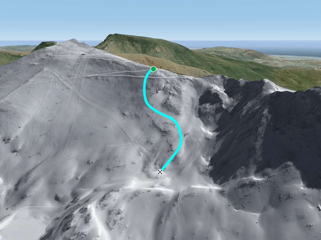
Steepest gully

This is the steepest line in the Sierra Nevada and the most technical. Expert skiers only.
Extreme Freeride Skiing
- Distance
- 204 m
- Ascent
- 5 m
- Descent
- 33 m
A high altitude freeride line before going into better freeride in the "Tajo de la virgin"
Freeride Skiing Severe
Take the Olimpica red slope and follow it for about 50 metres beyond the Lagunillos red slope, then turn off right. This run will always be a bit rocky and occasionally you will need a later entrance to the run to avoid them. You will then find a nice section that can be straight lined for about 150 metres, but remember the bottom is more rocky again. The mid section of this run can hold plenty of snow so pay attention to the snowpack. The exact line will vary, just follow your nose to avoid the worst of the rocks. As soon as the lower rocky section is passed you will join the red slope “Lagunillos” to get back to the bottom of the chairlift.
Severe
Steep skiing at 38-45 degrees. This requires very good technique and the risk of falling has serious consequences.

As well as the slope itself, there are some obstacles (such as rock outcrops) which could aggravate injury.
Away from help but easily accessed.
434 m away
This is the steepest line in the Sierra Nevada and the most technical. Expert skiers only.
Extreme Freeride Skiing
452 m away

A long descent at a good angle for freeriding with a flat section in the middle
Difficult Freeride Skiing
456 m away

Very steep slopes, some of them very narrow; this is not a long route but a good one.
Severe Freeride Skiing
522 m away

A line based on the same route than the laguna as all these line are very well linked together as the "Tajo de la virgin" black slopes is the only way to access to this. The best is the to take as much possible speed to do not have to push too much with the ski poles.
Severe Freeride Skiing
541 m away

Another classic of the laguna's chairlift west side line with some really nice fast riding.
Severe Freeride Skiing
586 m away

A steep gully with a tricky, committing entrance.
Severe Freeride Skiing
630 m away

A steep line where hike is needed into a steep gully, only autonomous skiers in this part.
Extreme Freeride Skiing
632 m away

Probable the most complicated line of the ski resort only for experts into a really steep gully.
Extreme Freeride Skiing
690 m away

A short line without much difficulty.
Difficult Freeride Skiing
725 m away

One the classic steep lines of Laguna chairlift's west side, this is an exciting line mixing cliff drops and speed.
Extreme Freeride Skiing