6.6 km away
Cigalera
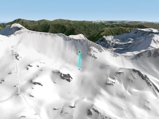
Choose your line in an easily accessible snow field
Moderate Freeride Skiing
- Distance
- 174 m
- Ascent
- 0 m
- Descent
- 54 m
Short but beautiful couloir facing East.
Freeride Skiing Moderate

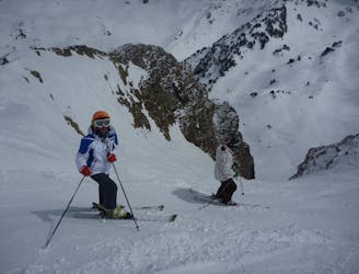
This is a popular freeride skiing route which is generally considered to be moderate. It's remote, it features medium exposure (e2) and is typically done between February and April. From a low point of 2.5 km to the maximum altitude of 2.7 km, the route covers 285 m, 0 vertical metres of ascent and 170 vertical metres of descent. You'll need skins, ice axe and crampons to complete it safely.
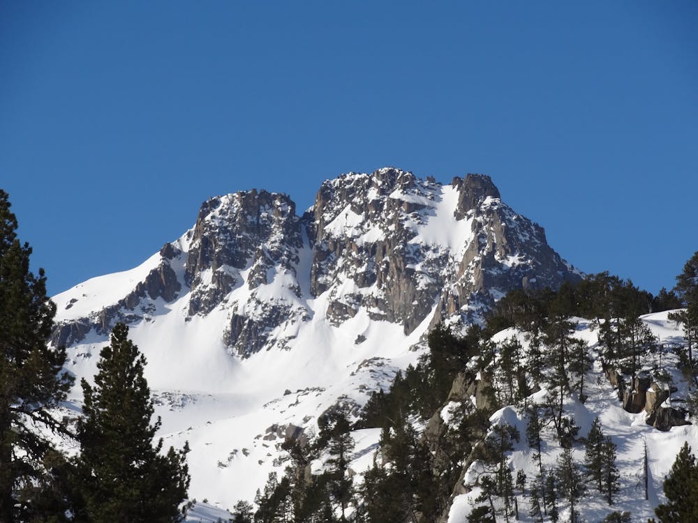
A classic line on this valley. You can find a small cliff on the top but easy to downclimb without rope.
Moderate
Slopes become slightly steeper at around 25-30 degrees.

As well as the slope itself, there are some obstacles (such as rock outcrops) which could aggravate injury.
Away from help but easily accessed.
6.6 km away
Choose your line in an easily accessible snow field
Moderate Freeride Skiing
6.7 km away

A short, steep run
Severe Freeride Skiing
6.7 km away

A short steep run for adventurers.
Severe Freeride Skiing
6.9 km away

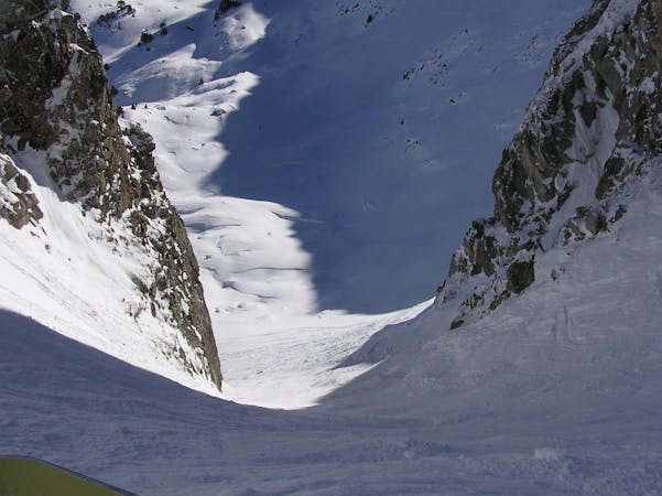
A wild couloir!
Difficult Freeride Skiing
7 km away

A short steep run.
Severe Freeride Skiing
7.8 km away

A long run to finish the day.
Severe Freeride Skiing
8.2 km away

A beautiful, steep run between the pistes
Difficult Freeride Skiing
8.3 km away
One of the classic Baqueira off piste runs for experienced skiers.
Severe Freeride Skiing
8.3 km away

An open snow field.
Moderate Freeride Skiing
8.6 km away

A natural kicker to show off on!
Easy Freeride Skiing
10 routes · Freeride Skiing