8.7 km away
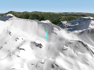
Teso dera Mina I

A short, steep run
Severe Freeride Skiing
- Distance
- 514 m
- Ascent
- 6 m
- Descent
- 186 m
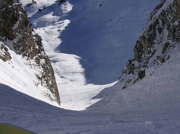
A classic and alpine couloir.
Freeride Skiing Difficult

This is a popular freeride skiing route which is generally considered to be difficult. It's remote, it features medium exposure (e2) and is typically done between February and April. From a low point of 2.5 km to the maximum altitude of 2.9 km, the route covers 503 m, 0 vertical metres of ascent and 360 vertical metres of descent. You'll need rope, skins, ice axe and crampons to complete it safely.
With a less steep top section, when you achive the mid zone you will find a cliff where you can (if the snow conditions allows it) traversse to the riders right or rappel (20mts). Then its all easy and wider.
Difficult
Serious gradient of 30-38 degrees where a real risk of slipping exists.

As well as the slope itself, there are some obstacles (such as rock outcrops) which could aggravate injury.
Away from help but easily accessed.
8.7 km away
A short, steep run
Severe Freeride Skiing
8.7 km away

A short steep run for adventurers.
Severe Freeride Skiing
8.8 km away

A short steep run.
Severe Freeride Skiing
9 km away
Choose your line in an easily accessible snow field
Moderate Freeride Skiing
9.3 km away

A wild couloir!
Difficult Freeride Skiing
9.5 km away

A long run to finish the day.
Severe Freeride Skiing
10 routes · Freeride Skiing