3.1 km away
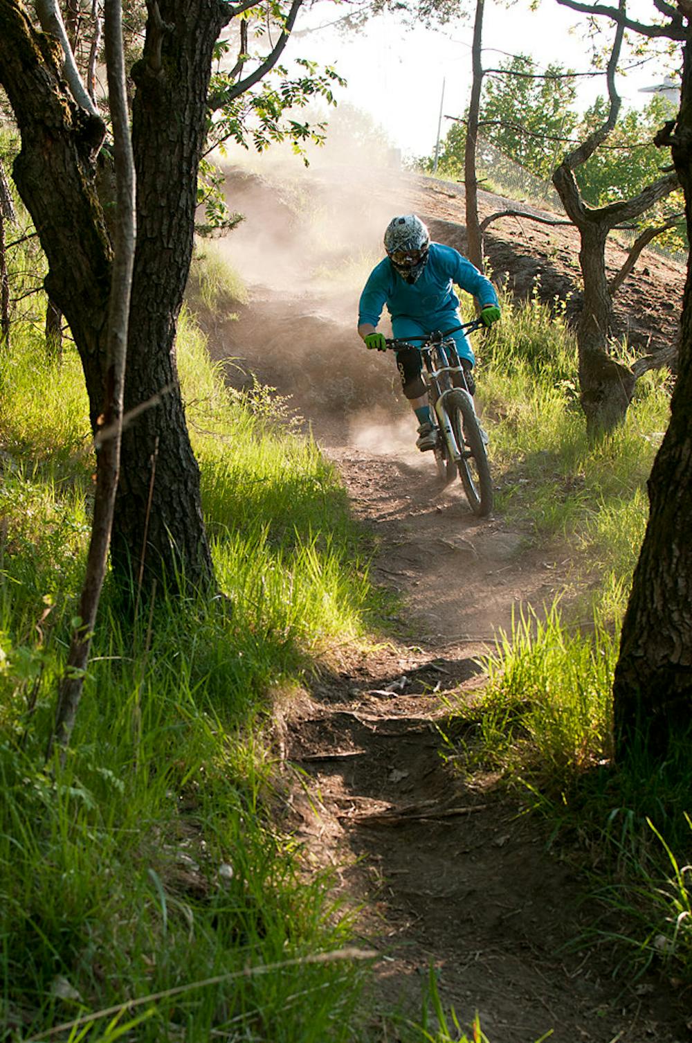
Hellas Loop
An 18km blue loop around Stockholm's MTB paradise.
Moderate Mountain Biking
- Distance
- 18 km
- Ascent
- 268 m
- Descent
- 267 m
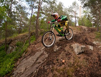
A downhill rider's dream in the heart of the city.
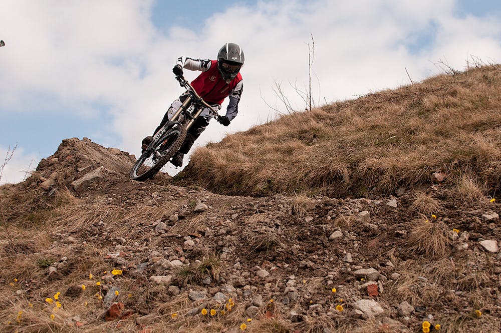
Mountain Biking Difficult

Hammarbybacken is a lift-operated ski slope on the outskirts of Stockholm, which transforms into a mountain bikers playground in the summertime. A T-bar lift takes bikers to the top of the 90-metre mound, where they can choose between a few fun reds and one challenging black line, which was the route for the Swedish World Championships a few years ago.
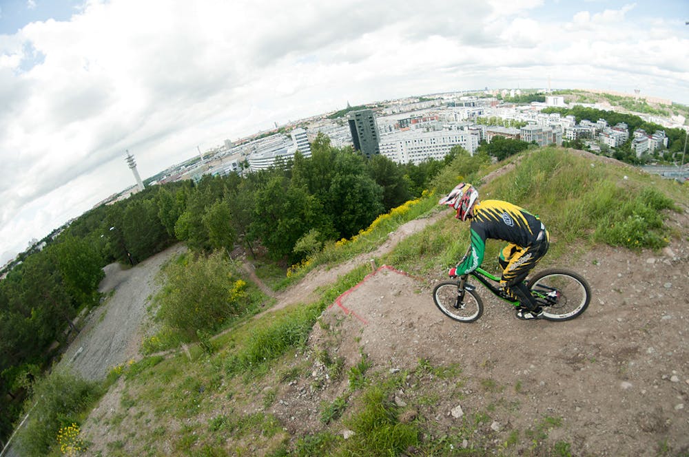
It doesn’t have the biggest vertical drop in the world, nor the most diverse range of runs, so if you want to extend your adventure, the hill is conveniently located on the edge of Hella, a mountain biking paradise which you can ride to in about 15 minutes.
This adventure takes you down one of the reds on Hammarbybacken. If you want even more of a challenge you can incorporate this adventure into the much much longer HammarbyHill XC racecourse, a 40km marathon featuring Stockholms’s favourite recreational mound. Find out more here: https://www.youtube.com/watch?v=tVXd1sRf6aE
Sources https://www.redbull.com/se-en/stockholms-best-inner-city-escape-trails https://www.trailforks.com/region/hammarbybacken/
Difficult
Mostly stable trail tread with some variability featuring larger and more unavoidable obstacles that may include, but not be limited to: bigger stones, roots, steps, and narrow curves. Compared to lower intermediate, technical difficulty is more advanced and grades of slopes are steeper. Ideal for upper intermediate riders.

The trail contains some obstacles such as outcroppings and rock which could cause injury.
3.1 km away
An 18km blue loop around Stockholm's MTB paradise.
Moderate Mountain Biking