995 m away
Grieschumme 32

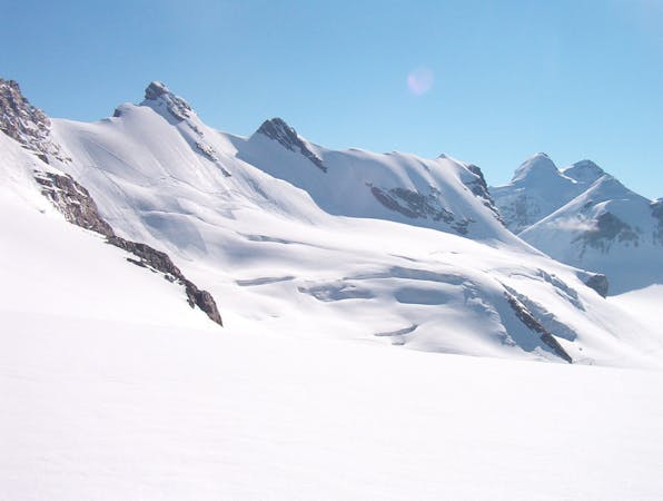
The varied bottom section to the Triftji ski area. Boasts some great short pitches and some traverses to take you back to the main ski area.
Moderate Freeride Skiing
- Distance
- 3.2 km
- Ascent
- 4 m
- Descent
- 757 m
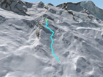
Alternative route after Triftji which requires a hike at the end
Freeride Skiing Difficult

This is a popular freeride skiing route which is generally considered to be difficult. It's very remote, it features medium exposure (e2) and is typically done in an unknown time of year. From a low point of 2.3 km to the maximum altitude of 2.7 km, the route covers 1.7 km, 7 vertical metres of ascent and 411 vertical metres of descent. It's graded 2.2 and Labande grade 3.
From the bottom of the Triftji t-bar continue on directly along the fall line to roll down the glacial moraine and then traverse left near the bottom (higher if the snow cover is poor) back to Grünsee.
Difficult
Serious gradient of 30-38 degrees where a real risk of slipping exists.

As well as the slope itself, there are some obstacles (such as rock outcrops) which could aggravate injury.

Little chance of being seen or helped in case of an accident.
995 m away
The varied bottom section to the Triftji ski area. Boasts some great short pitches and some traverses to take you back to the main ski area.
Moderate Freeride Skiing
1.2 km away
Steep terrrain linking the Hohtalli station to the 'Platte 31' off-piste run.
Difficult Freeride Skiing
1.3 km away

A run for mogul-lovers with pitch after pitch of bumps to get your legs burning!
Moderate Freeride Skiing
1.3 km away

A long variation to the Mittelritze 30 that is fun and flowy.
Difficult Freeride Skiing
1.4 km away

A classic off-piste route in Zermatt. Powder dreams after fresh snow, or an excellent bump run
Moderate Freeride Skiing
1.7 km away

A famous off piste route which is prone to avalanches (so check conditions first).
Severe Freeride Skiing
1.8 km away

A great, medium length off-piste route. With a choice of bumps on the right, more powdery snow the to left, open at the top and running under the cliff face to the left towards the bottom.
Difficult Freeride Skiing
2.6 km away

A steeper and more powdery alternative to the Paradise bump run
Moderate Freeride Skiing
2.7 km away

A short traverse through rolling terrain which leads to great skiing on a long and sustained slope.
Difficult Freeride Skiing
2.7 km away

A great bump run, with a variety of pitches and small transitions
Moderate Freeride Skiing
20 routes · Freeride Skiing