23 m away
Chalet neuf crossing line.

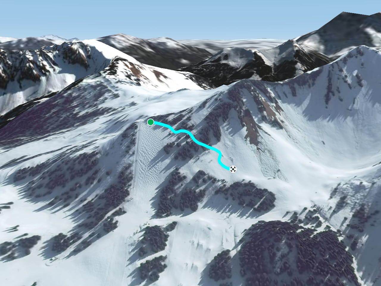
A really nice short line over an often untouched area, which is reached via a little hike from the top of the Corbeau's chairlift.
Severe Freeride Skiing
- Distance
- 839 m
- Ascent
- 81 m
- Descent
- 109 m
Short line with some important steepness in the middle into a forest area.
Freeride Skiing Extreme
This is an easily accessed line as yo turn left from the top of black slope "Le Corbeau" . The entrance of the line can feel like a piste into a an area clear of trees, but there are trees all along the line guiding the navigation. The line gets some good amount of snow in this altitude, however West aspect can bring some problems of wet avalanches, weather check is needed before heading in. Avalanche risk is pretty high around here and the middle section really steep makes the risk higher. The line finishes on the blue piste " Maxime" after a last part of trees which leads back to "Coq's" ski lifts and the bottom of the ski resort.
Extreme
Extreme skiing terrain above 45 degrees. These routes are reserved for experienced experts.

As well as the slope itself, there are some obstacles (such as rock outcrops) which could aggravate injury.

In the high mountains or remote conditions, all individuals must be completely autonomous in every situation.
23 m away
A really nice short line over an often untouched area, which is reached via a little hike from the top of the Corbeau's chairlift.
Severe Freeride Skiing
24 m away

A traverse line in the middle of the "Corbeau" black slope, with two little part of steepness close the
Severe Freeride Skiing
35 m away

Really nice line close the "Corbeau's ski lift". Steepness and trees will be here for you.
Severe Freeride Skiing
48 m away

An easily accessed tree line where the entrance will be the most difficult part with some steepness.
Severe Freeride Skiing
66 m away

A long traverse line where all conditions can be found, as well as trees, technical traverse and wild terrain.
Difficult Freeride Skiing
115 m away

From the black slope "Corbeau" you can find this really nice tree filled area, leading into a nice and not-too-steep section.
Severe Freeride Skiing
287 m away

A nice shortcut without too much steepness close to the blue slope "Maxime", joining back to this slope.
Difficult Freeride Skiing
298 m away

A really nice tree line which joins the blue piste "Maxime"
Moderate Freeride Skiing
315 m away

An easy access line between trees and alongside a snow park and ski lift.
Moderate Freeride Skiing
396 m away

An easy accessed line from the blue slope "Chalet neuf"
Difficult Freeride Skiing