25 m away
Chalet neuf crossing line.

A really nice short line over an often untouched area, which is reached via a little hike from the top of the Corbeau's chairlift.
Severe Freeride Skiing
- Distance
- 839 m
- Ascent
- 81 m
- Descent
- 109 m
An easily accessed tree line where the entrance will be the most difficult part with some steepness.
Freeride Skiing Severe
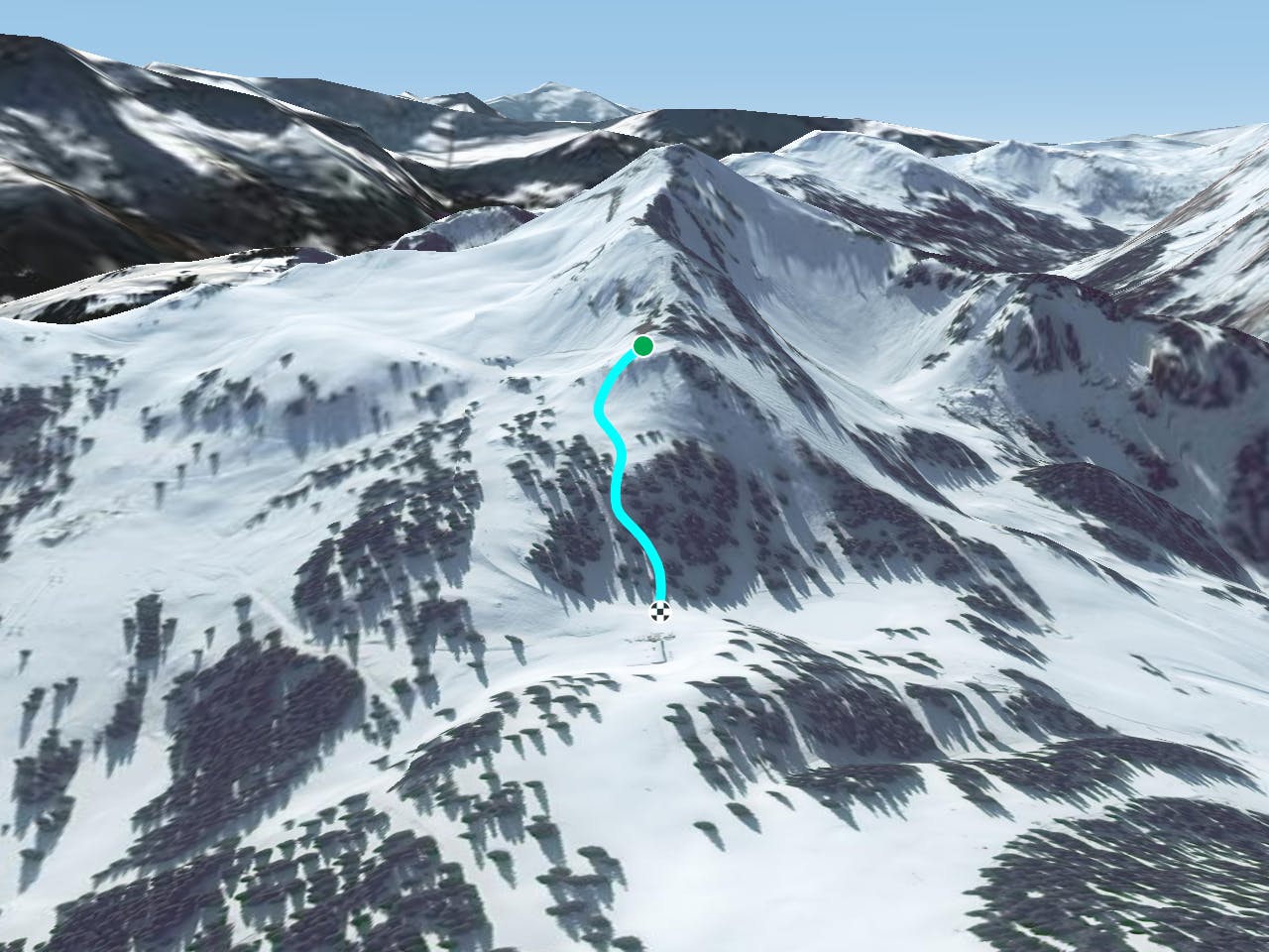
There is one way to access to this line by the top of the Corbeau's ski lift, or in case of the slope is closed you can get there by the blue slope "Le Lac". From the top of the Corbeau's ski lift turn to the L, 50 meters from the blue slope "Le Lac". The entrance is steep and the most complicated part of the line. This is where the avalanche risk will be the highest, but as the line goes into a tree section this will help to stabilize the snow. However in case of big snowfall prudence is needed. Once the cliff is passed the line is less steep and trees are the only hazard. The line finishes back on the blue "Le Lac"piste , giving access to the same Corbeau's ski lift and to the plateau of Super Chatel, giving access to the main lift or bringing you back to the village area.
Severe
Steep skiing at 38-45 degrees. This requires very good technique and the risk of falling has serious consequences.

As well as the slope itself, there are some obstacles (such as rock outcrops) which could aggravate injury.
Away from help but easily accessed.
25 m away
A really nice short line over an often untouched area, which is reached via a little hike from the top of the Corbeau's chairlift.
Severe Freeride Skiing
25 m away

Really nice line close the "Corbeau's ski lift". Steepness and trees will be here for you.
Severe Freeride Skiing
48 m away

Short line with some important steepness in the middle into a forest area.
Extreme Freeride Skiing
71 m away

A traverse line in the middle of the "Corbeau" black slope, with two little part of steepness close the
Severe Freeride Skiing
112 m away

A long traverse line where all conditions can be found, as well as trees, technical traverse and wild terrain.
Difficult Freeride Skiing
158 m away

From the black slope "Corbeau" you can find this really nice tree filled area, leading into a nice and not-too-steep section.
Severe Freeride Skiing
327 m away

A nice shortcut without too much steepness close to the blue slope "Maxime", joining back to this slope.
Difficult Freeride Skiing
338 m away

A really nice tree line which joins the blue piste "Maxime"
Moderate Freeride Skiing
361 m away

An easy accessed line from the blue slope "Chalet neuf"
Difficult Freeride Skiing
363 m away

An easy access line between trees and alongside a snow park and ski lift.
Moderate Freeride Skiing