6.6 km away
Approach to the Rothorn Hut
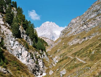
A tough climb from a classic alpine village to a classic alpine hut.
Difficult Hiking
- Distance
- 7.4 km
- Ascent
- 1.6 km
- Descent
- 18 m
Gandeghütte - Breithorn - Trockener Stegg
Hiking Extreme

This is a popular hiking route which is generally considered to be extreme. It's extremely remote, it features extreme exposure and is typically done between July and September. From a low point of 2.9 km to the maximum altitude of 4.2 km, the route covers 17 km, 1167 vertical metres of ascent and 1272 vertical metres of descent.
Gandeghütte - Breithorn - Trockener Stegg
Extreme
Scrambling up mountains and along technical trails with moderate fall exposure. Handholds are necessary to navigate the trail in its entirety, although they are not necessary at all times. Some obstacles can be very large and difficult to navigate, and the grades can often be near-vertical. The challenge of the trail and the steepness of the grade results in very strenuous hiking. Hikes of this difficulty blur the lines between "hiking" and "climbing".

Some trail sections are extremely exposed where falling will almost certainly result in serious injury or death.
In the high mountains or remote conditions, all individuals must be completely autonomous in every situation.
6.6 km away
A tough climb from a classic alpine village to a classic alpine hut.
Difficult Hiking
8.6 km away
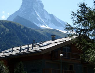
A downhill stroll into Zermatt past some epic scenery.
Moderate Hiking

9 routes · Alpine Climbing · Hiking

20 routes · Alpine Climbing · Hiking