
9 routes · Alpine Climbing · Hiking
A lovely walk past the Lac de Mauvoisin up to a well-positioned hut.
Hiking Difficult

This is a beautiful hike but a tough one, too. Start at the Mauvoisin Dam parking area and climb quickly up to the Dam itself, which is truly spectacular. The drop off to the north of the dam is stomach-churning but the panorama to the south is wonderful, and allows to you see some of the terrain you'll cover on the trip to the Cabane de Chanrion.
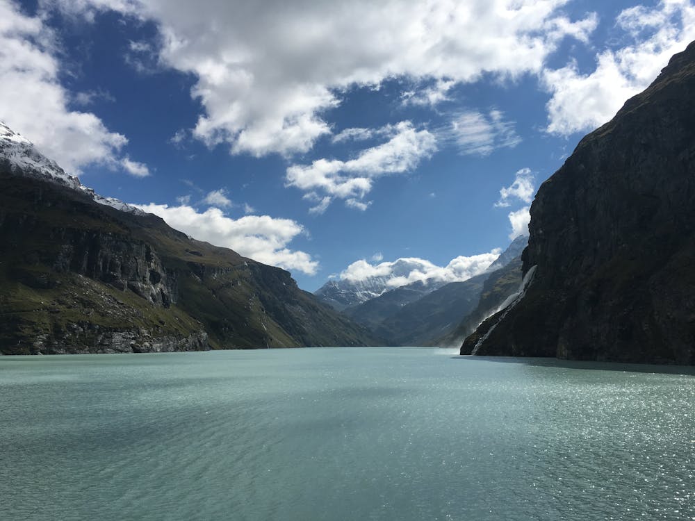
Cross the dam and traverse along the hiker's left side of the Lac de Mauvoisin on a beautiful path. The path begins to drift away from the lake and then climbs more steeply up zig zags to reach a very long, gradual climb southwards to the moraine of the Glacier du Brenay.
The long section of path which takes you to the moraine is utterly stunning but it takes a long time so try to switch off your brain and enjoy the surroundings without dwelling too much on how long you've been walking for!
When you finally find yourself at a col (the Col de Tsofeiret) looking down on the Glacier du Brenay's moraine, follow the path as it leads you down and onto the moraine. Cross over the toe of the moraine and go across the glacial river which runs along the foot of it. No matter how hot the air may be, the water in the river is bone-chillingly cold so make sure you don't slip over in the process of crossing it!
Traverse out of the moraine valley and then walk easily across to the Cabane de Chanrion. The hut is one of the wildest on the whole Haute Route and is incredibly peaceful. Settle in for a well earned rest.
Difficult
Hiking trails where obstacles such as rocks or roots are prevalent. Some obstacles can require care to step over or around. At times, the trail can be worn and eroded. The grade of the trail is generally quite steep, and can often lead to strenuous hiking.

The trail contains some obstacles such as outcroppings and rock which could cause injury.
Away from help but easily accessed.
9 routes · Alpine Climbing · Hiking