22 m away
Tête du Portail Enduro
An absolutely epic 2000m descent from summit to valley floor
Difficult Mountain Biking
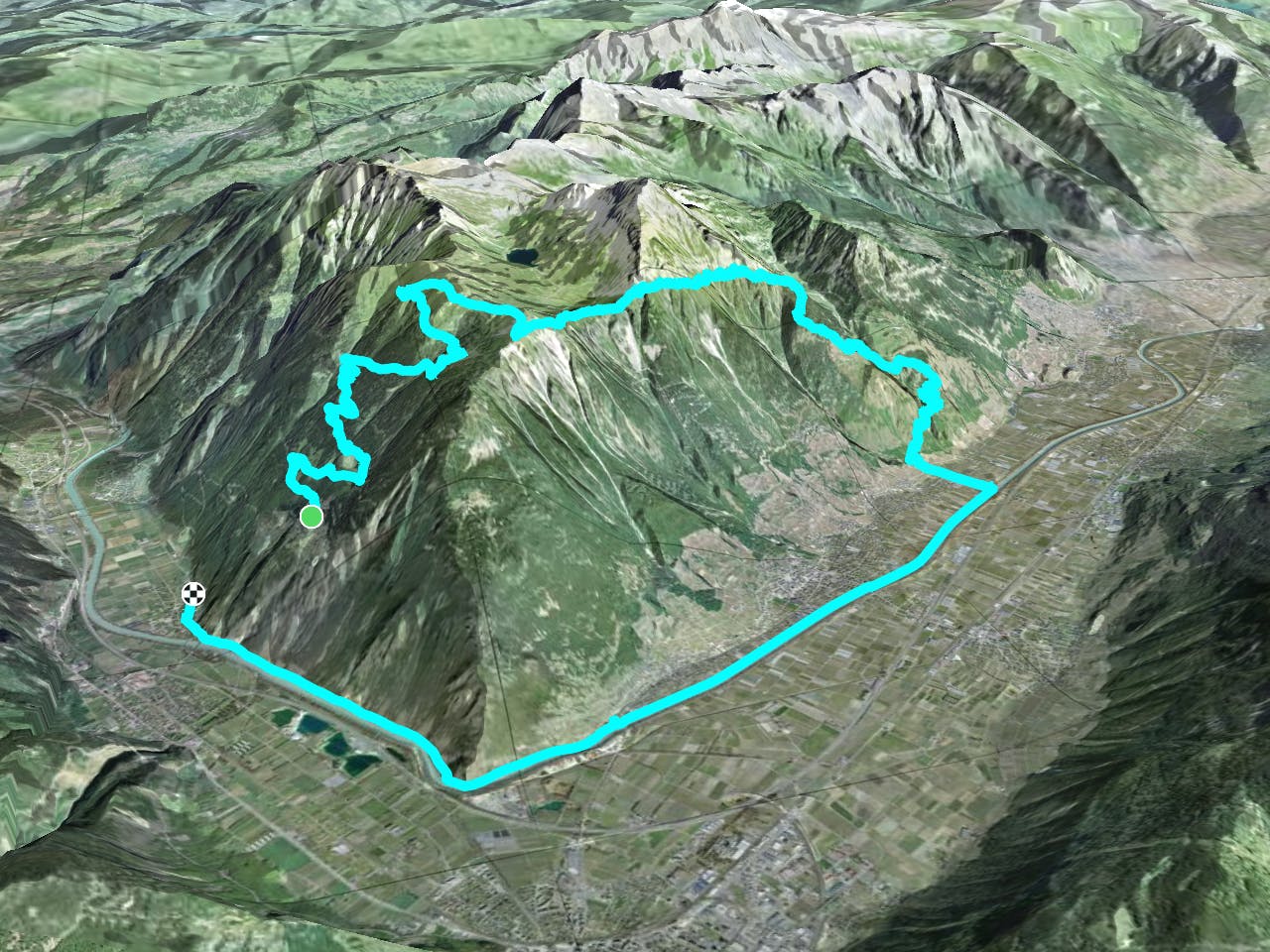
- Distance
- 25 km
- Ascent
- 1.4 km
- Descent
- 2 km
A mind blowing 2000+ descent, featuring the Chavalard Traverse
Mountain Biking Severe
So this is a truly epic day out for experienced riders who don't mind a bit of exposure.
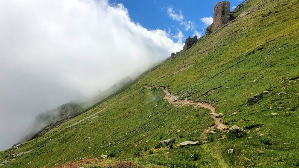
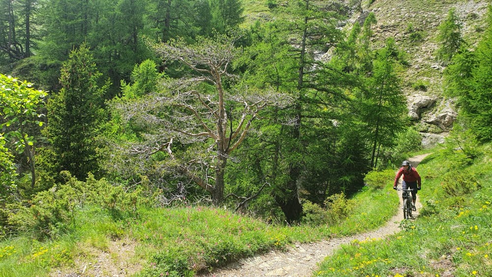
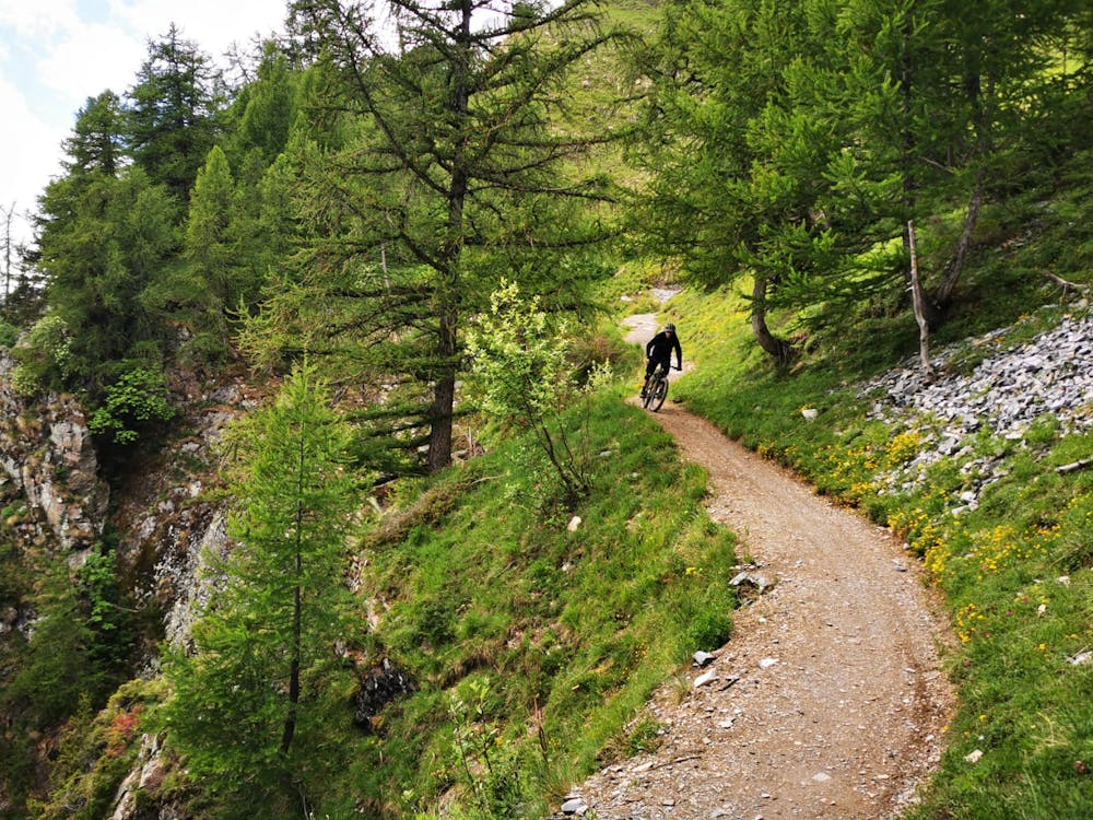
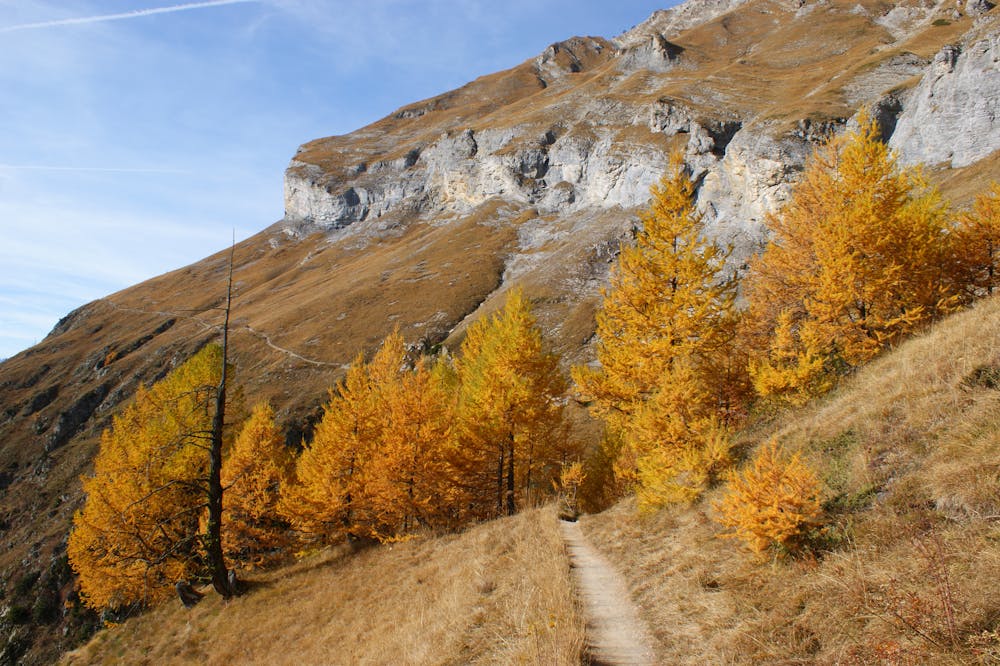
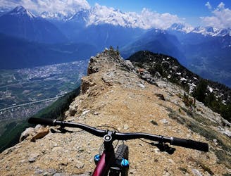
The highlight of this ride is the notorious super flow traverse trail that cuts beneath the monstrous walls of the Grand Chavalard. It's a real mix of technical and flow riding, that's what makes this a perfect enduro epic.
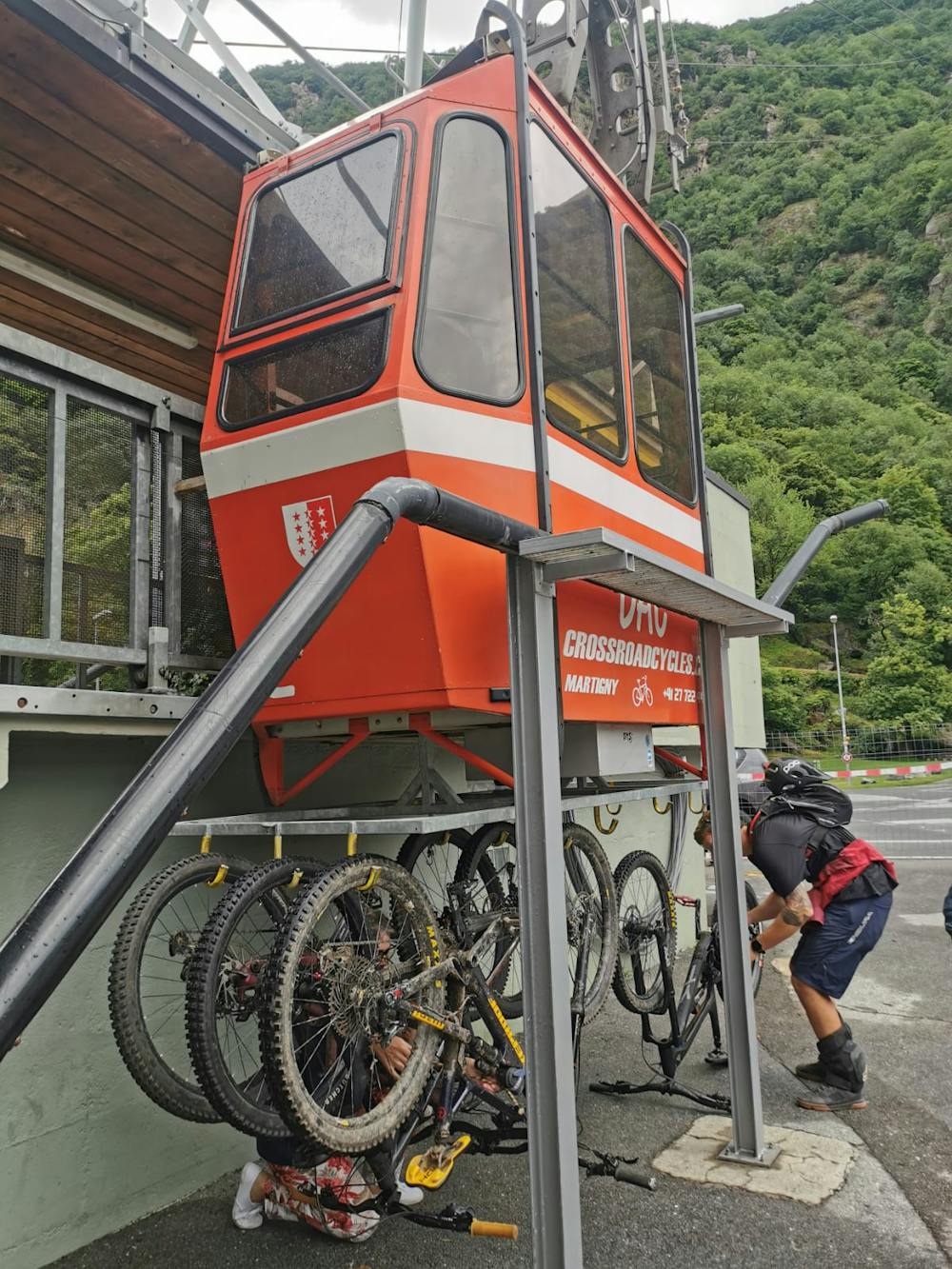
Start from the Dorenaz Lift. This will cost you 12CHF cash. The car park is free.
Pedal your way up the road/4x4 track to the the Cabane du Sex Carro where you'll probably be ready for a break and you can top up water at the fountain.
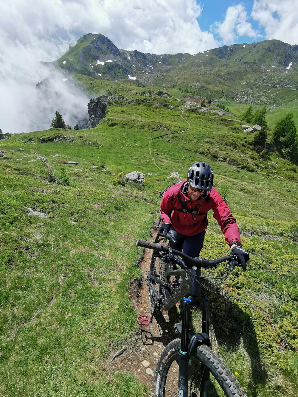
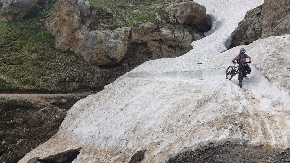
From the cabane to to Portail de Fully it will be a mix of carrying, pushing and peddling.
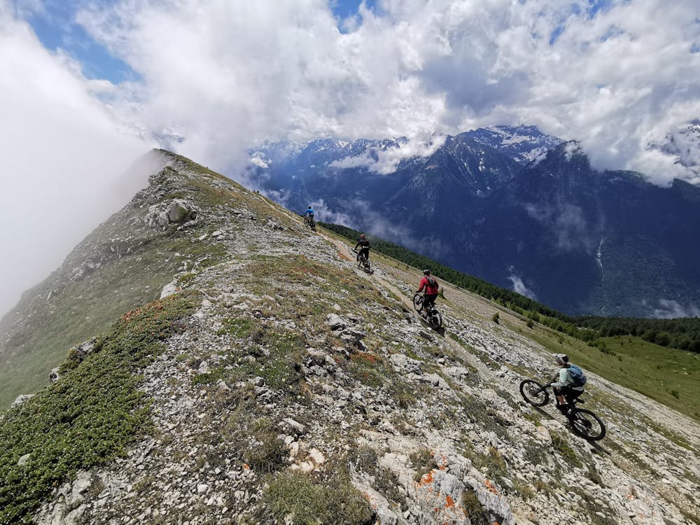
Here you drop in to fairly exposed trail traversing down towards the lakes. Mostly rideable but a couple of sections are not worth taking the risk. You can either stay right ( as i did ) on the ridge or go around the lake on an easier 4x4 track passing the Cabane de Sorniot.
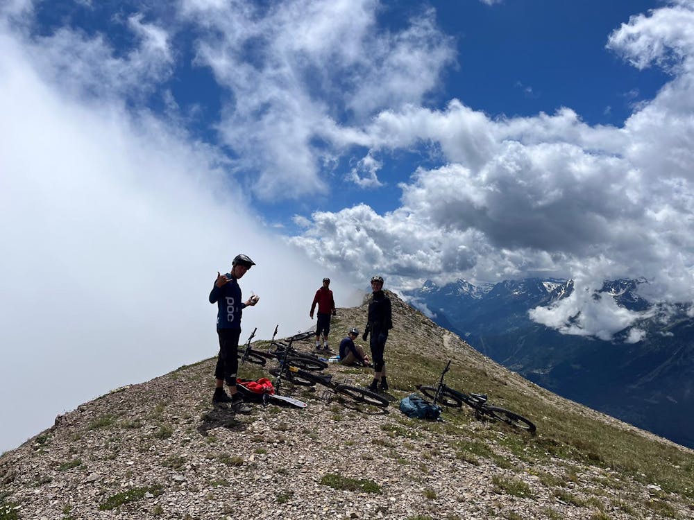
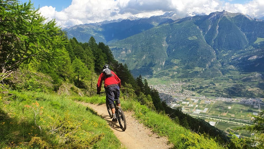
Now a short push up to the high point of the epic flow traverse which you came for... you'll be buzzing with excitement when you finish this section and might need to calm yourself down before dropping into the more vertical descent down to the valley floor.
From the village of Chiboz we decided to head down to Beudon was a perfect mix of flow and tech.
But this last section from Beudon down to the valley was adventurous to say the least, you might want to consider an alternative way down from Chiboz.
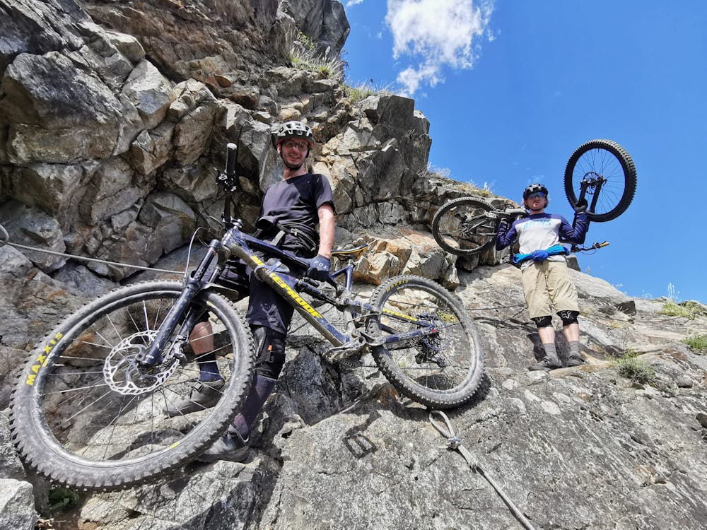
The trail turns almost into Via ferrate... You'll be carrying your bike with the left hand and right hand on the cable ! After a hundred or so meters of this it turned back into ridable tech trail with challenging switchbacks.
To top it off, before popping out onto the road, there was a small bike park, probably made by local kids :P
Severe
Widely variable, narrow trail tread with steeper grades and unavoidable obstacles of 15in/38cm tall or less. Obstacles may include unavoidable bridges 24in/61cm wide or less, large rocks, gravel, difficult root sections, and more. Ideal for advanced-level riders.

Some trail sections have exposed ledges or steep ascents/descents where falling could cause serious injury.

Away from help but easily accessed.
22 m away
An absolutely epic 2000m descent from summit to valley floor
Difficult Mountain Biking