22 m away
Chavalard Epic
A mind blowing 2000+ descent, featuring the Chavalard Traverse
Severe Mountain Biking
- Distance
- 35 km
- Ascent
- 1.4 km
- Descent
- 2.1 km
An absolutely epic 2000m descent from summit to valley floor
Mountain Biking Difficult

An epic 2000m descent from summit to valley floor !

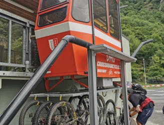
So you'll start from the Dorenaz lift, a small Téléphérique that runs every 45 mins, costs 11CHF cash, and can hold about 4 bikes.
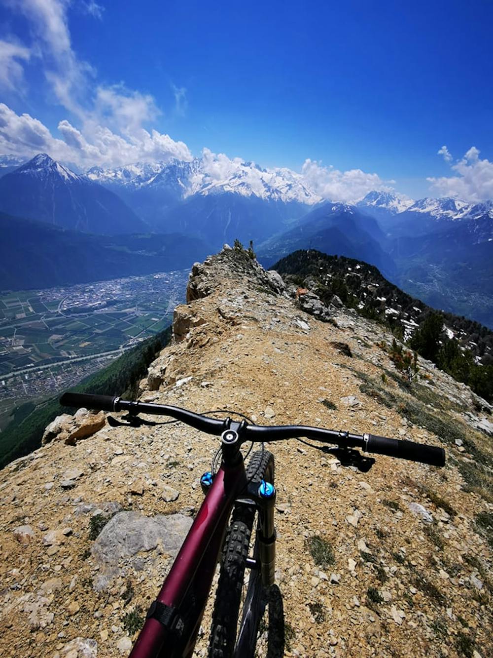
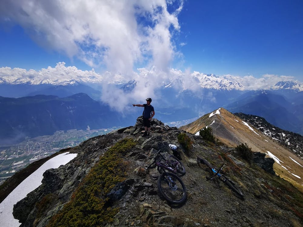
Now get ready for a long road/4x4 climb to Cabane du Sex Carro (there's water here), and from there it's a mix of pedalling, pushing and carrying on single track. Once you make it onto the ridge at 'Portail de Fully' you can either drop in from here or push/carry and extra 5-10 minutes to the summit of Tête du Portail (it would be rude not to ).
DROP IN!
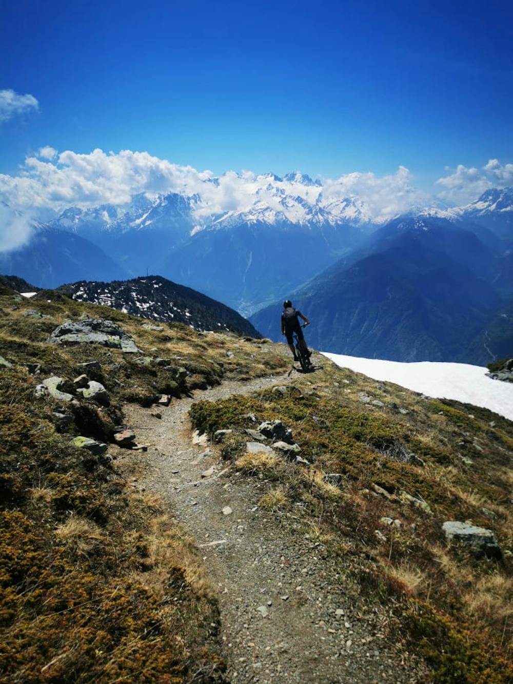
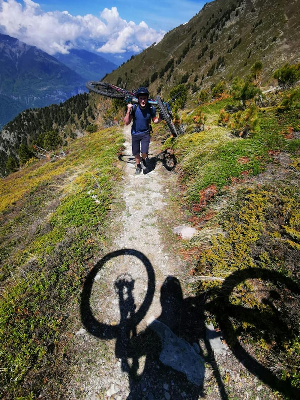
The higher section on the ridge above the tree line is all fairly easy single track with insane views to die for and you'll probably die if you can't keep your eyes off MtBlanc and fall off the ridge... When you get to the Antenna at Sex Carro it gets super steep and technical as you dive into the dense trees. You'll probably be off your bike a few times unless you're Danny Mcaskill... However we were delighted to find out most of it is rideable for experienced enduro riders.. so it's definitely worth the few down climbs.
Once you hit the first village of Jeur Brûlée you'll hit a double track, a few meters on your right you can top up water at the fountain before dropping in to a more fast and flowy section !
To finish there's a traverse trail (up and down, up and down) with some fun little fast sections that will eventually spit you out onto the main road bringing you back to the car at the Dorenaz lift.
This side of the mountain is notoriously dry and very hot in the summer months; unless its rained A LOT, get ready for a dusty, drifty ride.
Difficult
Mostly stable trail tread with some variability featuring larger and more unavoidable obstacles that may include, but not be limited to: bigger stones, roots, steps, and narrow curves. Compared to lower intermediate, technical difficulty is more advanced and grades of slopes are steeper. Ideal for upper intermediate riders.

Some trail sections have exposed ledges or steep ascents/descents where falling could cause serious injury.

Close to help in case of emergency.
22 m away
A mind blowing 2000+ descent, featuring the Chavalard Traverse
Severe Mountain Biking