2 km away
Verbier Crest Loop
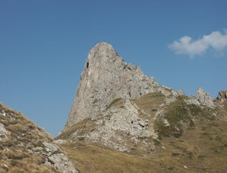
A gorgeous loop following the crest of the mountains above Verbier
Difficult Trail Running
- Distance
- 23 km
- Ascent
- 1.6 km
- Descent
- 1.6 km
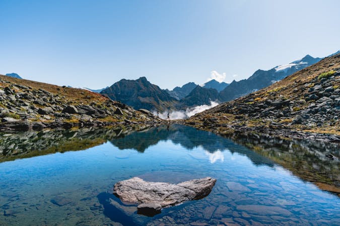
The Via Valais is the running version of what skiers and hikers have long had, a Haute Route. But, this tour is designed by runners, for runners. The route moves beneath numerous 4000-meter peaks, alongside glaciers, and over high, alpine passes. It’s the trail runner’s dream tour.
Trail Running Difficult

The Via Valais is a mountain runner’s tour. It’s a challenge, but not unattainable. Breaking the route into nine stages, you’ll arrive to Zermatt with 225 km and around 14000 meters of vertical in your legs. And bonus peaks if you chose!

Each stage isn’t too long and the vertical is inside the range of an average/challenging day out for runners in the Alps, but the days get stacked one on top of another. Thankfully, the overnights are comfortable, with hotel nights, hot showers, and grocery restocks in Zinal and Randa, to balance out hut nights.
FATMAP Guidebook: /discover/guidebook/50
Full online guide from ALPSinsight: https://elevation.alpsinsight.com/via-valais/
Difficult

Some trail sections have exposed ledges or steep ascents/descents where falling could cause serious injury.

Away from help but easily accessed.
2 km away
A gorgeous loop following the crest of the mountains above Verbier
Difficult Trail Running
3 routes · Trail Running