Le Folly - Couloir N
A steep line on the N Face of Le Folly, offering an interesting alternative to the classic descent
Ski Touring Severe
- Distance
- 7 km
- Ascent
- 572 m
- Descent
- 566 m
- Duration
- 3-4 hrs
- Low Point
- 1.2 km
- High Point
- 1.7 km
- Gradient
- 41˚

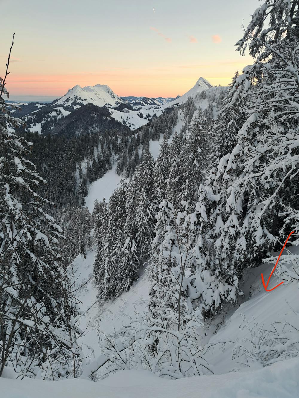
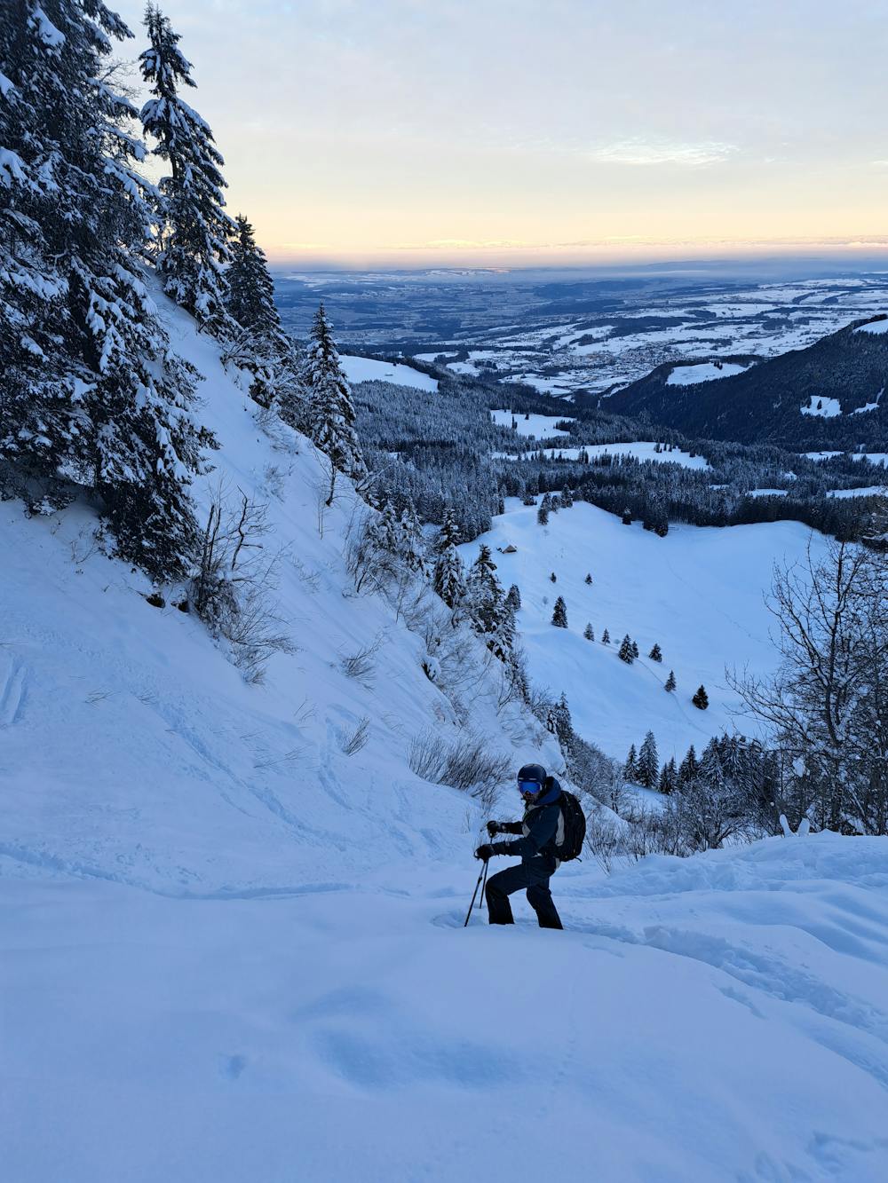
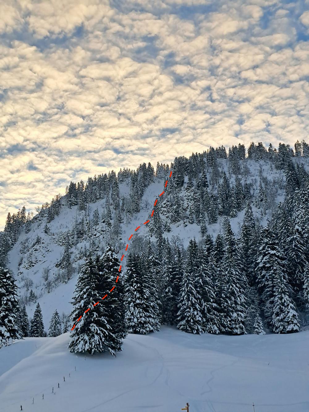
From the parking des Pautets, start climbing on the wide route towards the mountain pasture. After passing tit, head east towards the W ridge of Le Folly. The slope begins to slowly rise, and you walk along the hillside towards Le Molard. Then climb through the last foresty part, and exit it at the summit where a beautiful 360° view on the neighbouring summits welcomes you. Continue on the ridge towards Le Molard, and on your left, you will see the entrance of the N couloir (approx. 10min after you reach the summit of Le Folly). The first meters of the couloir are quite impressive and definitely the most steep (40-43°); they can be icy. Then the slope becomes gentler and gentler (35°) and widens up to reach back the mountain pasture, where you find the ascent path.
- •
- •
- •
- •
- •
Difficulty
Severe
Steep skiing at 38-45 degrees. This requires very good technique and the risk of falling has serious consequences.
Medium Exposure (E2)

As well as the slope itself, there are some obstacles (such as rock outcrops) which could aggravate injury.
Remoteness

Close to help in case of emergency.
Best time to visit
Features
- Couloir
- Tree Skiing
- Single Descent
Equipment required
- Skins