6 m away
Western Oberland Traverse: Diablerets to the Gelten Hut
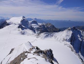
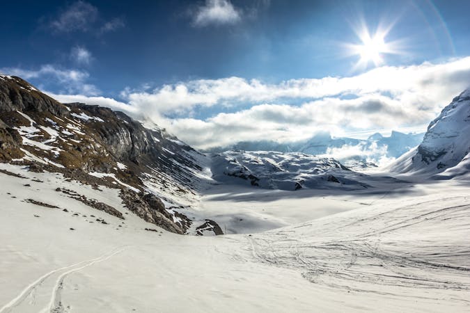
Day 1 of the Western Oberland Traverse, running from Diablerets to the Gelten Hut via the Arpelistock.
Difficult Ski Touring
- Distance
- 19 km
- Ascent
- 1.3 km
- Descent
- 2.3 km
Summit the mighty Diablerets Glacier.
Ski Touring Difficult

At 3210m the Sommet des Diablerets is the highest peak in the Vaud Alps and the jewel in the glaciated Diablerets’ crown. From the summit, you can enjoy a 360-degree panoramic view that includes some of the most beautiful alpine peaks - from the Eiger, Mönch and Jungfrau to the Matterhorn - and views of more than 24 peaks that are over 4000 metres high.
Beginning at the top of the Scex Rouge Cabin, head over to the Dome des Diablerets (2996m) and on to Les Diablerets (3210m). After you’ve taken in the views, head back part of the way you came before descending down by the Glacier de Prapio, and further on into the valley to the town of Les Diablerets.
Sources https://www.alpintouren.com/de/touren/ski/tourbeschreibung/tourdaten25840.html https://www.outdooractive.com/
Difficult
Serious gradient of 30-38 degrees where a real risk of slipping exists.

In case of a fall, death is highly likely.

Away from help but easily accessed.
6 m away
Day 1 of the Western Oberland Traverse, running from Diablerets to the Gelten Hut via the Arpelistock.
Difficult Ski Touring
5 routes · Ski Touring